| Cawkwell | |
|---|---|
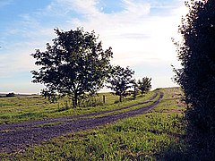
 Cawkwell bridleway | |
Location within
Lincolnshire | |
| OS grid reference | TF281797 |
| • London | 125 mi (201 km) S |
| Civil parish | |
| District | |
| Shire county | |
| Region | |
| Country | England |
| Sovereign state | United Kingdom |
| Post town | Louth |
| Postcode district | LN11 |
| Police | Lincolnshire |
| Fire | Lincolnshire |
| Ambulance | East Midlands |
| UK Parliament | |
Cawkwell is a hamlet and former civil parish, now in the parish of Scamblesby, in the East Lindsey district of Lincolnshire, England. It is situated approximately 6 miles (10 km) south-west from the town of Louth, and in the Lincolnshire Wolds, a designated Area of Outstanding Natural Beauty. In 1961 the parish had a population of 35. [1] On 1 April 1987 the parish was abolished and merged with Scamblesby. [2]
Cawkwell is a deserted medieval village first mentioned in 1354. [3] [4] Cawkwell parish church was dedicated to Saint Peter. It was still standing in 1872 but had disappeared by 1924, with parts of it used to restore the church at Scamblesby. [3] [4] Cawkwell House is a Grade II listed building dating from 1825 and built of brick with a slate roof. [5]
- ^ "Population statistics Cawkwell CP/AP through time". A Vision of Britain through Time. Retrieved 3 September 2023.
- ^ "Horncastle Registration District". UKBMD. Retrieved 3 September 2023.
- ^ a b "Cawkwell". Lincs to the Past. Lincolnshire Archives. Retrieved 30 June 2011.
- ^ a b Historic England. "Cawkwell (352878)". Research records (formerly PastScape). Retrieved 30 June 2011.
- ^ Historic England. "Cawkwell House, Louth Road (1063687)". National Heritage List for England. Retrieved 21 July 2013.
- "Cawkwell (Calkwell)", Genuki.org.uk. Retrieved 9 April 2013
| Cawkwell | |
|---|---|
 Cawkwell bridleway | |
Location within
Lincolnshire | |
| OS grid reference | TF281797 |
| • London | 125 mi (201 km) S |
| Civil parish | |
| District | |
| Shire county | |
| Region | |
| Country | England |
| Sovereign state | United Kingdom |
| Post town | Louth |
| Postcode district | LN11 |
| Police | Lincolnshire |
| Fire | Lincolnshire |
| Ambulance | East Midlands |
| UK Parliament | |
Cawkwell is a hamlet and former civil parish, now in the parish of Scamblesby, in the East Lindsey district of Lincolnshire, England. It is situated approximately 6 miles (10 km) south-west from the town of Louth, and in the Lincolnshire Wolds, a designated Area of Outstanding Natural Beauty. In 1961 the parish had a population of 35. [1] On 1 April 1987 the parish was abolished and merged with Scamblesby. [2]
Cawkwell is a deserted medieval village first mentioned in 1354. [3] [4] Cawkwell parish church was dedicated to Saint Peter. It was still standing in 1872 but had disappeared by 1924, with parts of it used to restore the church at Scamblesby. [3] [4] Cawkwell House is a Grade II listed building dating from 1825 and built of brick with a slate roof. [5]
- ^ "Population statistics Cawkwell CP/AP through time". A Vision of Britain through Time. Retrieved 3 September 2023.
- ^ "Horncastle Registration District". UKBMD. Retrieved 3 September 2023.
- ^ a b "Cawkwell". Lincs to the Past. Lincolnshire Archives. Retrieved 30 June 2011.
- ^ a b Historic England. "Cawkwell (352878)". Research records (formerly PastScape). Retrieved 30 June 2011.
- ^ Historic England. "Cawkwell House, Louth Road (1063687)". National Heritage List for England. Retrieved 21 July 2013.
- "Cawkwell (Calkwell)", Genuki.org.uk. Retrieved 9 April 2013
