Photos • Location


| Caripi River | |
|---|---|
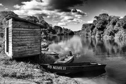 Caripi River near Santa Isabel | |
| Location | |
| Country | Brazil |
| Physical characteristics | |
| Source | |
| • location | Amapá state |
| Mouth | Uaçá River |
• coordinates | 3°56′N 51°27′W / 3.933°N 51.450°W |
Caripi River (also Curupi) is a river of Amapá state in north-eastern Brazil. The Karipuna do Amapá Amerindians are located on along the river. [1] Manga is the main settlement on the river. [2]
- ^ "Karipuna do Amapá". Socio Ambiental. Retrieved 28 March 2021.
- ^ Gonçalves Fonseca, Mary (2019). Currículo e construção da identidade Karipuna na Aldeia Manga, Amapá (Thesis). São Paulo: Pontifical Catholic University of São Paulo. p. 81.
Wikimedia Commons has media related to
Caripi River.
| Caripi River | |
|---|---|
|
Caripi River near Santa Isabel | |
| Location | |
| Country | Brazil |
| Physical characteristics | |
| Source | |
| • location | Amapá state |
| Mouth | Uaçá River |
• coordinates | 3°56′N 51°27′W / 3.933°N 51.450°W |
Caripi River (also Curupi) is a river of Amapá state in north-eastern Brazil. The Karipuna do Amapá Amerindians are located on along the river. [1] Manga is the main settlement on the river. [2]
- ^ "Karipuna do Amapá". Socio Ambiental. Retrieved 28 March 2021.
- ^ Gonçalves Fonseca, Mary (2019). Currículo e construção da identidade Karipuna na Aldeia Manga, Amapá (Thesis). São Paulo: Pontifical Catholic University of São Paulo. p. 81.
Wikimedia Commons has media related to
Caripi River.