Photos • Location

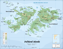
Map of the Falkland Islands

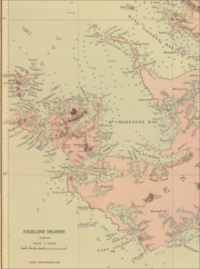
1901 detailed nap of the Weddell Island area featuring Carew Harbour


Carew Harbour [1] (former name Barnards Harbour [2]) is a 3 km (1.6 nmi) wide bay indenting for 8 km (4.3 nmi) the southwest coast of West Falkland in the Falkland Islands, South Atlantic. It is part of Queen Charlotte Bay, centered at 51°49′40″S 60°42′37″W / 51.8277°S 60.7104°W
References
- ^ Carew Harbour. Falkloand Islands. GeoNames Geographical Database[ dead link]
- ^ C. Barnard, J. Nicol, J. Knights, W. Mariner and J. Bartlett. The sea, the ship and the sailor. Tales of adventure from log books and original narratives. Salem, Massachusetts: Marine Research Society, 1925 (map following p. 14)