Photos • Location
Chingizgala

Jar | |
|---|---|
Municipality | |
| Azerbaijani: Car | |
 Jar | |
| Coordinates: 41°40′19″N 46°41′14″E / 41.67194°N 46.68722°E | |
| Country | |
| District | Zagatala |
| Population | |
| • Total | 4,633 |
| Time zone | UTC+4 ( AZT) |
| • Summer ( DST) | UTC+5 ( AZT) |

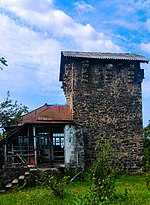
Car (Jar) is a village and municipality in the Zagatala District of Azerbaijan. It has a population of 4,633. The municipality consists of the villages of Jar, Kebeloba, Akhakhdere, and Siliban. [1]
References
- ^ "Belediyye Informasiya Sistemi" (in Azerbaijani). Archived from the original on September 24, 2008.
External links

|
| This Zagatala District location article is a stub. You can help Wikipedia by expanding it. |
Jar | |
|---|---|
Municipality | |
| Azerbaijani: Car | |
Jar | |
| Coordinates: 41°40′19″N 46°41′14″E / 41.67194°N 46.68722°E | |
| Country | |
| District | Zagatala |
| Population | |
| • Total | 4,633 |
| Time zone | UTC+4 ( AZT) |
| • Summer ( DST) | UTC+5 ( AZT) |
Car (Jar) is a village and municipality in the Zagatala District of Azerbaijan. It has a population of 4,633. The municipality consists of the villages of Jar, Kebeloba, Akhakhdere, and Siliban. [1]
References
- ^ "Belediyye Informasiya Sistemi" (in Azerbaijani). Archived from the original on September 24, 2008.
External links
|
| This Zagatala District location article is a stub. You can help Wikipedia by expanding it. |