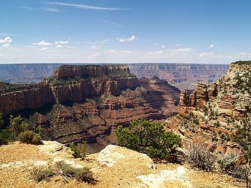
Cape Royal is a 7,880+-cliff-elevation summit located in the eastern
Grand Canyon,
Coconino County of northern
Arizona,
United States. It is the southernmost viewpoint of the North Rim, viewing from north-northeast, south, west, southwest. Its next viewpoint northwest is Honan Point, with
Thor Temple directly below. Directly east-northeast is the major viewing point of Cape Final, which gives views almost directly north. The 1/2 mile
Cape Royal Trail starts at the parking lot and ends at the overlook at Cape Royal.
From Cape Royal, directly southeast can be seen the massif and highpoint of
Freya Castle, and southeasterly is massive
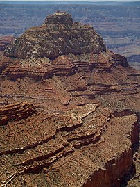
Wotans Throne, which is a surviving section of the North Rim, with a
Ponderosa Pine, forested, flat prominence. The cliffs of Cape Royal are composed of
Kaibab Limestone, on erodible
Toroweap Formation, upon white cliffs of
Coconino Sandstone. The watershed drainage from Cape Royal, overlooks the Unkar Creek and Canyon to the south into the
Colorado River, about 6 miles distant.
Angels Window overlook, 1/3 mile north-northeast of Cape Royal point
Gallery
Cape Final &
Jupiter Temple; views ~east-northeast, to Cape Final.
Cape Royal is a 7,880+-cliff-elevation summit located in the eastern
Grand Canyon,
Coconino County of northern
Arizona,
United States. It is the southernmost viewpoint of the North Rim, viewing from north-northeast, south, west, southwest. Its next viewpoint northwest is Honan Point, with
Thor Temple directly below. Directly east-northeast is the major viewing point of Cape Final, which gives views almost directly north. The 1/2 mile
Cape Royal Trail starts at the parking lot and ends at the overlook at Cape Royal.
From Cape Royal, directly southeast can be seen the massif and highpoint of
Freya Castle, and southeasterly is massive
Wotans Throne, which is a surviving section of the North Rim, with a
Ponderosa Pine, forested, flat prominence. The cliffs of Cape Royal are composed of
Kaibab Limestone, on erodible
Toroweap Formation, upon white cliffs of
Coconino Sandstone. The watershed drainage from Cape Royal, overlooks the Unkar Creek and Canyon to the south into the
Colorado River, about 6 miles distant.
Angels Window overlook, 1/3 mile north-northeast of Cape Royal point
Gallery
Cape Final &
Jupiter Temple; views ~east-northeast, to Cape Final.

 Closeup


.jpg)


 Vishnu Temple
 Freya Castle & Vishnu Temple

 Wotans Throne & Angels Gate
 Wotans Throne
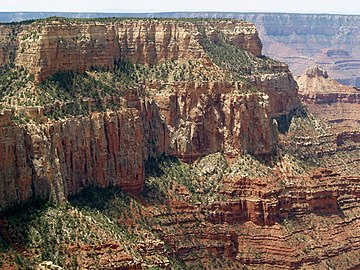 Wotans Throne & Angels Gate - prominence

