Canning is an unincorporated community in Hughes County, in the U.S. state of South Dakota. [1]
History
Canning was platted in 1884. [2] The community was named for George Canning, a British statesman who served as Prime Minister of the United Kingdom. [3] A post office was established as Canning in 1883, and remained in operation until it was discontinued in 1972. [4]
References
- ^ U.S. Geological Survey Geographic Names Information System: Canning, South Dakota
- ^ Federal Writers' Project (1940). South Dakota place-names, v.1-3. University of South Dakota. p. 29.
- ^ Chicago and North Western Railway Company (1908). A History of the Origin of the Place Names Connected with the Chicago & North Western and Chicago, St. Paul, Minneapolis & Omaha Railways. p. 51.
- ^ "Hughes County". Jim Forte Postal History. Retrieved February 28, 2015.
Municipalities and communities of
Hughes County, South Dakota, United States | ||
|---|---|---|
| Cities | 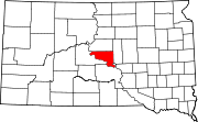 | |
| Town | ||
| Township | ||
| Indian reservation | ||
| CDP | ||
| Other communities | ||
| Footnotes | ‡This populated place also has portions in an adjacent county or counties | |
44°23′47″N 100°01′55″W / 44.39639°N 100.03194°W
|
| This South Dakota state location article is a stub. You can help Wikipedia by expanding it. |
Canning is an unincorporated community in Hughes County, in the U.S. state of South Dakota. [1]
History
Canning was platted in 1884. [2] The community was named for George Canning, a British statesman who served as Prime Minister of the United Kingdom. [3] A post office was established as Canning in 1883, and remained in operation until it was discontinued in 1972. [4]
References
- ^ U.S. Geological Survey Geographic Names Information System: Canning, South Dakota
- ^ Federal Writers' Project (1940). South Dakota place-names, v.1-3. University of South Dakota. p. 29.
- ^ Chicago and North Western Railway Company (1908). A History of the Origin of the Place Names Connected with the Chicago & North Western and Chicago, St. Paul, Minneapolis & Omaha Railways. p. 51.
- ^ "Hughes County". Jim Forte Postal History. Retrieved February 28, 2015.
Municipalities and communities of
Hughes County, South Dakota, United States | ||
|---|---|---|
| Cities | | |
| Town | ||
| Township | ||
| Indian reservation | ||
| CDP | ||
| Other communities | ||
| Footnotes | ‡This populated place also has portions in an adjacent county or counties | |
44°23′47″N 100°01′55″W / 44.39639°N 100.03194°W
|
| This South Dakota state location article is a stub. You can help Wikipedia by expanding it. |