Brudenell, Lyndoch and Raglan | |
|---|---|
| Township of Brudenell, Lyndoch and Raglan | |
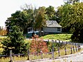
 Near Latchford Bridge | |
 Brudenell, Lyndoch and Raglan  Brudenell, Lyndoch and Raglan | |
| Coordinates: 45°19′N 77°24′W / 45.317°N 77.400°W | |
| Country | Canada |
| Province | Ontario |
| County | Renfrew |
| Established | January 1, 2000 |
| Government | |
| • Mayor | Valerie Jahn |
| • Federal riding | Renfrew—Nipissing—Pembroke |
| • Prov. riding | Renfrew—Nipissing—Pembroke |
| Area | |
| • Land | 701.29 km2 (270.77 sq mi) |
| Population (2021)
[1] | |
| • Total | 1,552 |
| • Density | 2.2/km2 (6/sq mi) |
| Time zone | UTC-5 ( EST) |
| • Summer ( DST) | UTC-4 ( EDT) |
| Postal Code FSA | K0J |
| Area code(s) | 613, 343 |
| Website |
www |
Brudenell, Lyndoch and Raglan is a township in Renfrew County, Ontario, Canada. It was formed on January 1, 1999, through the merger of Brudenell and Lyndoch Township with Raglan Township.
The township comprises the smaller communities of Bruceton, Brudenell, Copp, Hardwood Lake, Harriets Corners, Jewellville, Latchford Bridge, Letterkenny, Lost Nation, Palmer Rapids, Quadeville, Rockingham, Schutt, Wingle and Wolfe.
-
 Brudenell
 -
 The Madawaska River at Palmer Rapids.
 -
 Schutt


In the 2021 Census of Population conducted by Statistics Canada, Brudenell, Lyndoch and Raglan had a population of 1,552 living in 694 of its 998 total private dwellings, a change of 3.3% from its 2016 population of 1,503. With a land area of 701.29 km2 (270.77 sq mi), it had a population density of 2.2/km2 (5.7/sq mi) in 2021. [1]
| 2021 | 2016 | 2011 | |
|---|---|---|---|
| Population | 1,552 (+3.3% from 2016) | 1,503 (-9.3% from 2011) | 1,658 (10.8% from 2006) |
| Land area | 701.29 km2 (270.77 sq mi) | 706.24 km2 (272.68 sq mi) | 705.83 km2 (272.52 sq mi) |
| Population density | 2.2/km2 (5.7/sq mi) | 2.1/km2 (5.4/sq mi) | 2.3/km2 (6.0/sq mi) |
| Median age | 55.6 (M: 56.0, F: 55.6) | 53.5 (M: 54.0, F: 52.8) | |
| Private dwellings | 998 (total) 694 (occupied) | 963 (total) | 1031 (total) |
| Median household income | $62,000 | $51,072 |
Mother tongue (2021): [1]
- English as first language: 92.3%
- French as first language: 1.6%
- English and French as first language: 0%
- Other as first language: 5.2%
| Year | Pop. | ±% |
|---|---|---|
| 2001 | 1,565 | — |
| 2006 | 1,497 | −4.3% |
| 2011 | 1,658 | +10.8% |
| 2016 | 1,502 | −9.4% |
| 2021 | 1,552 | +3.3% |
| Source: Statistics Canada [1] [7] | ||
|
| ||||||||||||||||||||||||||||||||||||||||||||||||||||||||||||||||||||||||||||||||||||||||||||||||||
" Al Capone's Hideout", an Upper Madawaska Theatre Group production, is a musical comedy based on the story of Al Capone's stay in the area in 1942, when he and his gang allegedly hid out near Quadeville, Ontario. [9]
- ^ a b c d e "Brudenell, Lyndoch and Raglan (Code 3547020) Census Profile". 2021 census. Government of Canada - Statistics Canada. Retrieved 2024-07-22.
- ^ "2021 Community Profiles". 2021 Canadian Census. Statistics Canada. February 4, 2022. Retrieved 2023-10-19.
- ^ "2016 Community Profiles". 2016 Canadian Census. Statistics Canada. August 12, 2021. Retrieved 2018-02-19.
- ^ "2011 Community Profiles". 2011 Canadian Census. Statistics Canada. March 21, 2019. Retrieved 2012-02-13.
- ^ "2006 Community Profiles". 2006 Canadian Census. Statistics Canada. August 20, 2019.
- ^ "2001 Community Profiles". 2001 Canadian Census. Statistics Canada. July 18, 2021.
- ^ 1996, 2001, 2006, 2011, 2016 census
- ^ a b "1971 Census of Canada - Population Census Subdivisions (Historical)". Catalogue 92-702 Vol I, part 1 (Bulletin 1.1-2). Statistics Canada: 76, 139. July 1973.
- ^ "The Pembroke Library History Project". www.pembrokelibrary.ca. Archived from the original on 2011-07-06.
Places adjacent to Brudenell, Lyndoch and Raglan | ||||||||||||||||
|---|---|---|---|---|---|---|---|---|---|---|---|---|---|---|---|---|
| ||||||||||||||||
| Cities |  | |
|---|---|---|
| Towns | ||
| Townships | ||
| First Nations | ||
| Indian reserves | ||
| ||
| International | |
|---|---|
| National | |
Brudenell, Lyndoch and Raglan | |
|---|---|
| Township of Brudenell, Lyndoch and Raglan | |
|
Near Latchford Bridge | |
Brudenell, Lyndoch and Raglan Brudenell, Lyndoch and Raglan | |
| Coordinates: 45°19′N 77°24′W / 45.317°N 77.400°W | |
| Country | Canada |
| Province | Ontario |
| County | Renfrew |
| Established | January 1, 2000 |
| Government | |
| • Mayor | Valerie Jahn |
| • Federal riding | Renfrew—Nipissing—Pembroke |
| • Prov. riding | Renfrew—Nipissing—Pembroke |
| Area | |
| • Land | 701.29 km2 (270.77 sq mi) |
| Population (2021)
[1] | |
| • Total | 1,552 |
| • Density | 2.2/km2 (6/sq mi) |
| Time zone | UTC-5 ( EST) |
| • Summer ( DST) | UTC-4 ( EDT) |
| Postal Code FSA | K0J |
| Area code(s) | 613, 343 |
| Website |
www |
Brudenell, Lyndoch and Raglan is a township in Renfrew County, Ontario, Canada. It was formed on January 1, 1999, through the merger of Brudenell and Lyndoch Township with Raglan Township.
The township comprises the smaller communities of Bruceton, Brudenell, Copp, Hardwood Lake, Harriets Corners, Jewellville, Latchford Bridge, Letterkenny, Lost Nation, Palmer Rapids, Quadeville, Rockingham, Schutt, Wingle and Wolfe.
-
Brudenell
-
The Madawaska River at Palmer Rapids.
-
Schutt
In the 2021 Census of Population conducted by Statistics Canada, Brudenell, Lyndoch and Raglan had a population of 1,552 living in 694 of its 998 total private dwellings, a change of 3.3% from its 2016 population of 1,503. With a land area of 701.29 km2 (270.77 sq mi), it had a population density of 2.2/km2 (5.7/sq mi) in 2021. [1]
| 2021 | 2016 | 2011 | |
|---|---|---|---|
| Population | 1,552 (+3.3% from 2016) | 1,503 (-9.3% from 2011) | 1,658 (10.8% from 2006) |
| Land area | 701.29 km2 (270.77 sq mi) | 706.24 km2 (272.68 sq mi) | 705.83 km2 (272.52 sq mi) |
| Population density | 2.2/km2 (5.7/sq mi) | 2.1/km2 (5.4/sq mi) | 2.3/km2 (6.0/sq mi) |
| Median age | 55.6 (M: 56.0, F: 55.6) | 53.5 (M: 54.0, F: 52.8) | |
| Private dwellings | 998 (total) 694 (occupied) | 963 (total) | 1031 (total) |
| Median household income | $62,000 | $51,072 |
Mother tongue (2021): [1]
- English as first language: 92.3%
- French as first language: 1.6%
- English and French as first language: 0%
- Other as first language: 5.2%
| Year | Pop. | ±% |
|---|---|---|
| 2001 | 1,565 | — |
| 2006 | 1,497 | −4.3% |
| 2011 | 1,658 | +10.8% |
| 2016 | 1,502 | −9.4% |
| 2021 | 1,552 | +3.3% |
| Source: Statistics Canada [1] [7] | ||
|
| ||||||||||||||||||||||||||||||||||||||||||||||||||||||||||||||||||||||||||||||||||||||||||||||||||
" Al Capone's Hideout", an Upper Madawaska Theatre Group production, is a musical comedy based on the story of Al Capone's stay in the area in 1942, when he and his gang allegedly hid out near Quadeville, Ontario. [9]
- ^ a b c d e "Brudenell, Lyndoch and Raglan (Code 3547020) Census Profile". 2021 census. Government of Canada - Statistics Canada. Retrieved 2024-07-22.
- ^ "2021 Community Profiles". 2021 Canadian Census. Statistics Canada. February 4, 2022. Retrieved 2023-10-19.
- ^ "2016 Community Profiles". 2016 Canadian Census. Statistics Canada. August 12, 2021. Retrieved 2018-02-19.
- ^ "2011 Community Profiles". 2011 Canadian Census. Statistics Canada. March 21, 2019. Retrieved 2012-02-13.
- ^ "2006 Community Profiles". 2006 Canadian Census. Statistics Canada. August 20, 2019.
- ^ "2001 Community Profiles". 2001 Canadian Census. Statistics Canada. July 18, 2021.
- ^ 1996, 2001, 2006, 2011, 2016 census
- ^ a b "1971 Census of Canada - Population Census Subdivisions (Historical)". Catalogue 92-702 Vol I, part 1 (Bulletin 1.1-2). Statistics Canada: 76, 139. July 1973.
- ^ "The Pembroke Library History Project". www.pembrokelibrary.ca. Archived from the original on 2011-07-06.
Places adjacent to Brudenell, Lyndoch and Raglan | ||||||||||||||||
|---|---|---|---|---|---|---|---|---|---|---|---|---|---|---|---|---|
| ||||||||||||||||
| Cities | | |
|---|---|---|
| Towns | ||
| Townships | ||
| First Nations | ||
| Indian reserves | ||
| ||
| International | |
|---|---|
| National | |