Bruce Crossing, Michigan | |
|---|---|
 | |
 Bruce Crossing Location within the state of Michigan  Bruce Crossing Bruce Crossing (the United States) | |
| Coordinates: 46°32′06″N 89°10′44″W / 46.53500°N 89.17889°W [1] | |
| Country | United States |
| State | Michigan |
| County | Ontonagon |
| Township | Stannard |
| Settled | 1888 |
| Area | |
| • Total | 4.51 sq mi (11.69 km2) |
| • Land | 4.51 sq mi (11.69 km2) |
| • Water | 0.00 sq mi (0.00 km2) |
| Elevation | 1,138 ft (347 m) |
| Population (
2020) | |
| • Total | 184 |
| • Density | 40.78/sq mi (15.74/km2) |
| Time zone | UTC-5 ( Eastern (EST)) |
| • Summer ( DST) | UTC-4 (EDT) |
| ZIP Code(s) | 49912 |
| Area code | 906 |
| GNIS feature ID | 622123 [1] |
Bruce Crossing is an unincorporated community in Ontonagon County in the U.S. state of Michigan. Bruce Crossing is located in Stannard Township at the junction of U.S. Highway 45 and M-28, 24.5 miles (39.4 km) south-southeast of the village of Ontonagon. [3] The community has a post office with the 49912 ZIP Code. [4]
History
Bruce Crossing was first settled by August Neuman, who built a sawmill at the location. The community was originally named Bruce's Crossing when its post office opened on March 5, 1888. The name came from the first postmaster, Donald M. Bruce, who owned a store at the crossing of the Duluth, South Shore and Atlantic Railway and the old Military Road. It was shortened to Bruce Crossing on August 13, 1891. [5]
Climate
July is typically the warmest month in Bruce Crossing, when highs average 77 °F (25 °C) and lows average 53 °F (12 °C). January is coldest, when the high temperatures average 19 °F (-7 °C) and the lows average -1 °F (-18 °C). [6] The highest recorded temperature was 97 °F (36 °C) in 1975, and the lowest was -43 °F (−42 °C) in 1951.
Demographics
| Census | Pop. | Note | %± |
|---|---|---|---|
| 2020 | 184 | — | |
| U.S. Decennial Census [7] | |||
Gallery
-
 Bruce Crossing post office
 -
 Bruce Crossing sign on US 45
 -
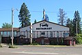 Tulppo's Restaurant in Bruce Crossing


References
- ^ a b c U.S. Geological Survey Geographic Names Information System: Bruce Crossing, Michigan
- ^ "2020 U.S. Gazetteer Files". United States Census Bureau. Retrieved May 21, 2022.
- ^ Ontonagon County (pdf) (Map). Michigan Department of Technology, Management and Budget. 2010. Retrieved May 9, 2011.
- ^ ZIP Code Lookup, United States Post Office
- ^ Romig, Walter (1986) [1973]. Michigan Place Names. Detroit, Michigan: Wayne State University Press. ISBN 0-8143-1838-X.
- ^ "Intellicast - Bruce Crossing Historic Weather Averages in Michigan (49912)". www.intellicast.com. Retrieved November 1, 2017.
- ^ "Census of Population and Housing". Census.gov. Retrieved June 4, 2016.
Municipalities and communities of
Ontonagon County, Michigan, United States | ||
|---|---|---|
| Village |  | |
| Civil townships | ||
| CDPs | ||
|
Other communities | ||
| Ghost town | ||
| Indian reservation | ||
| International | |
|---|---|
| National | |
|
| This Ontonagon County, Michigan location article is a stub. You can help Wikipedia by expanding it. |
Bruce Crossing, Michigan | |
|---|---|
|
| |
Bruce Crossing Location within the state of Michigan Bruce Crossing Bruce Crossing (the United States) | |
| Coordinates: 46°32′06″N 89°10′44″W / 46.53500°N 89.17889°W [1] | |
| Country | United States |
| State | Michigan |
| County | Ontonagon |
| Township | Stannard |
| Settled | 1888 |
| Area | |
| • Total | 4.51 sq mi (11.69 km2) |
| • Land | 4.51 sq mi (11.69 km2) |
| • Water | 0.00 sq mi (0.00 km2) |
| Elevation | 1,138 ft (347 m) |
| Population (
2020) | |
| • Total | 184 |
| • Density | 40.78/sq mi (15.74/km2) |
| Time zone | UTC-5 ( Eastern (EST)) |
| • Summer ( DST) | UTC-4 (EDT) |
| ZIP Code(s) | 49912 |
| Area code | 906 |
| GNIS feature ID | 622123 [1] |
Bruce Crossing is an unincorporated community in Ontonagon County in the U.S. state of Michigan. Bruce Crossing is located in Stannard Township at the junction of U.S. Highway 45 and M-28, 24.5 miles (39.4 km) south-southeast of the village of Ontonagon. [3] The community has a post office with the 49912 ZIP Code. [4]
History
Bruce Crossing was first settled by August Neuman, who built a sawmill at the location. The community was originally named Bruce's Crossing when its post office opened on March 5, 1888. The name came from the first postmaster, Donald M. Bruce, who owned a store at the crossing of the Duluth, South Shore and Atlantic Railway and the old Military Road. It was shortened to Bruce Crossing on August 13, 1891. [5]
Climate
July is typically the warmest month in Bruce Crossing, when highs average 77 °F (25 °C) and lows average 53 °F (12 °C). January is coldest, when the high temperatures average 19 °F (-7 °C) and the lows average -1 °F (-18 °C). [6] The highest recorded temperature was 97 °F (36 °C) in 1975, and the lowest was -43 °F (−42 °C) in 1951.
Demographics
| Census | Pop. | Note | %± |
|---|---|---|---|
| 2020 | 184 | — | |
| U.S. Decennial Census [7] | |||
Gallery
-
Bruce Crossing post office
-
Bruce Crossing sign on US 45
-
Tulppo's Restaurant in Bruce Crossing
References
- ^ a b c U.S. Geological Survey Geographic Names Information System: Bruce Crossing, Michigan
- ^ "2020 U.S. Gazetteer Files". United States Census Bureau. Retrieved May 21, 2022.
- ^ Ontonagon County (pdf) (Map). Michigan Department of Technology, Management and Budget. 2010. Retrieved May 9, 2011.
- ^ ZIP Code Lookup, United States Post Office
- ^ Romig, Walter (1986) [1973]. Michigan Place Names. Detroit, Michigan: Wayne State University Press. ISBN 0-8143-1838-X.
- ^ "Intellicast - Bruce Crossing Historic Weather Averages in Michigan (49912)". www.intellicast.com. Retrieved November 1, 2017.
- ^ "Census of Population and Housing". Census.gov. Retrieved June 4, 2016.
Municipalities and communities of
Ontonagon County, Michigan, United States | ||
|---|---|---|
| Village | | |
| Civil townships | ||
| CDPs | ||
|
Other communities | ||
| Ghost town | ||
| Indian reservation | ||
| International | |
|---|---|
| National | |
|
| This Ontonagon County, Michigan location article is a stub. You can help Wikipedia by expanding it. |