Brookesmith, Texas | |
|---|---|
 Brookesmith  Brookesmith | |
| Coordinates: 31°33′02″N 99°07′07″W / 31.55056°N 99.11861°W | |
| Country | United States |
| State | Texas |
| County | Brown |
| Elevation | 1,348 ft (411 m) |
| Time zone | UTC-6 ( Central (CST)) |
| • Summer ( DST) | UTC-5 (CDT) |
| ZIP Code | 76827 |
| Area code | 325 |
| GNIS feature ID | 1352935 [1] |
Brookesmith is an unincorporated community in Brown County, Texas, United States. [1] According to the Handbook of Texas, the community had a population of 61 in 2000. It is located within the Brownwood, Texas micropolitan area.
History
Brookesmith was named in honor of local banker Brooke Smith in 1902. A post office was established there that next year. Besides Smith, other early settlers of the community included David Smith and Aaron Lee. There were three cotton gins and other businesses in the community until cotton farming ended in the 1950s. The post office continued to operate into the 1980s, alongside a store and a gas station. Its population was recorded as 61 from 1980 through 2000. [2] Smith Cemetery is shown on maps of the community today. [3]
Geography
Brookesmith is located two miles off U.S. Highway 377 and Farm to Market Road 586, 19 mi (31 km) south of Brownwood and 39 mi (63 km) west of Goldthwaite [3] between Clear Creek and Spring Branch in southwestern Brown County. [2]
Climate
The climate in this area is characterized by hot, humid summers and generally mild to cool winters. According to the Köppen Climate Classification system, Brookesmith has a humid subtropical climate, abbreviated "Cfa" on climate maps. [4]
Education
In the 1980s, Brookesmith had a school that hosted 12 grade levels. [2] The Brookesmith Independent School District serves area students.
References
- ^ a b U.S. Geological Survey Geographic Names Information System: Brookesmith, Texas
- ^ a b c Hunt, William R. "Brookesmith, TX". tshaonline.org. Retrieved December 5, 2022.
- ^ a b "Brookesmith, Texas". Texas Escapes Online Magazine. Retrieved December 5, 2022.
- ^ Climate Summary for Brookesmith, Texas
Municipalities and communities of
Brown County, Texas, United States | ||
|---|---|---|
| Cities | 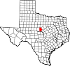 | |
| Town | ||
| CDPs | ||
|
Other communities | ||
| Ghost towns | ||
| International | |
|---|---|
| National | |
 | This article about a location in Brown County, Texas is a stub. You can help Wikipedia by expanding it. |
Brookesmith, Texas | |
|---|---|
Brookesmith Brookesmith | |
| Coordinates: 31°33′02″N 99°07′07″W / 31.55056°N 99.11861°W | |
| Country | United States |
| State | Texas |
| County | Brown |
| Elevation | 1,348 ft (411 m) |
| Time zone | UTC-6 ( Central (CST)) |
| • Summer ( DST) | UTC-5 (CDT) |
| ZIP Code | 76827 |
| Area code | 325 |
| GNIS feature ID | 1352935 [1] |
Brookesmith is an unincorporated community in Brown County, Texas, United States. [1] According to the Handbook of Texas, the community had a population of 61 in 2000. It is located within the Brownwood, Texas micropolitan area.
History
Brookesmith was named in honor of local banker Brooke Smith in 1902. A post office was established there that next year. Besides Smith, other early settlers of the community included David Smith and Aaron Lee. There were three cotton gins and other businesses in the community until cotton farming ended in the 1950s. The post office continued to operate into the 1980s, alongside a store and a gas station. Its population was recorded as 61 from 1980 through 2000. [2] Smith Cemetery is shown on maps of the community today. [3]
Geography
Brookesmith is located two miles off U.S. Highway 377 and Farm to Market Road 586, 19 mi (31 km) south of Brownwood and 39 mi (63 km) west of Goldthwaite [3] between Clear Creek and Spring Branch in southwestern Brown County. [2]
Climate
The climate in this area is characterized by hot, humid summers and generally mild to cool winters. According to the Köppen Climate Classification system, Brookesmith has a humid subtropical climate, abbreviated "Cfa" on climate maps. [4]
Education
In the 1980s, Brookesmith had a school that hosted 12 grade levels. [2] The Brookesmith Independent School District serves area students.
References
- ^ a b U.S. Geological Survey Geographic Names Information System: Brookesmith, Texas
- ^ a b c Hunt, William R. "Brookesmith, TX". tshaonline.org. Retrieved December 5, 2022.
- ^ a b "Brookesmith, Texas". Texas Escapes Online Magazine. Retrieved December 5, 2022.
- ^ Climate Summary for Brookesmith, Texas
Municipalities and communities of
Brown County, Texas, United States | ||
|---|---|---|
| Cities | | |
| Town | ||
| CDPs | ||
|
Other communities | ||
| Ghost towns | ||
| International | |
|---|---|
| National | |
|
| This article about a location in Brown County, Texas is a stub. You can help Wikipedia by expanding it. |