| Bothnian Bay National Park | |
|---|---|
IUCN category II (
national park) | |
 | |
| Location | Lapland, Finland |
| Coordinates | 65°37′N 024°19′E / 65.617°N 24.317°E |
| Area | 157 km2 (61 sq mi) |
| Established | 1991 |
| Visitors | 9000 (in 2009 [1]) |
| Governing body | Metsähallitus |
| Website |
www |
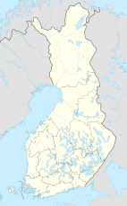
Bothnian Bay National Park ( Finnish: Perämeren kansallispuisto, Swedish: Bottenvikens nationalpark) is a national park in Lapland, Finland. The park which was established in 1991, covers 157 square kilometres (61 sq mi) of which 2.5 square kilometres (0.97 sq mi) is on land. It is maintained by Metsähallitus.
The islands in the area have been formed by post-glacial rebound, and the scenery is still in a constant state of change. There are also numerous traditional fishing bases.
The national park is reachable by boat although visiting is only recommended for experienced boaters.
- ^ "Käyntimäärät kansallispuistoittain 2009" (in Finnish). Metsähallitus. Archived from the original on March 8, 2012. Retrieved September 29, 2010.
| Bothnian Bay National Park | |
|---|---|
IUCN category II (
national park) | |
 | |
| Location | Lapland, Finland |
| Coordinates | 65°37′N 024°19′E / 65.617°N 24.317°E |
| Area | 157 km2 (61 sq mi) |
| Established | 1991 |
| Visitors | 9000 (in 2009 [1]) |
| Governing body | Metsähallitus |
| Website |
www |
Bothnian Bay National Park ( Finnish: Perämeren kansallispuisto, Swedish: Bottenvikens nationalpark) is a national park in Lapland, Finland. The park which was established in 1991, covers 157 square kilometres (61 sq mi) of which 2.5 square kilometres (0.97 sq mi) is on land. It is maintained by Metsähallitus.
The islands in the area have been formed by post-glacial rebound, and the scenery is still in a constant state of change. There are also numerous traditional fishing bases.
The national park is reachable by boat although visiting is only recommended for experienced boaters.
- ^ "Käyntimäärät kansallispuistoittain 2009" (in Finnish). Metsähallitus. Archived from the original on March 8, 2012. Retrieved September 29, 2010.
