Bormes-les-Mimosas | |
|---|---|
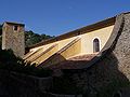
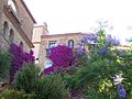
 Street in Bormes-les-Mimosas | |
.svg) Coat of arms | |
 Bormes-les-Mimosas  Bormes-les-Mimosas | |
| Coordinates: 43°09′09″N 6°20′38″E / 43.152500°N 6.3439°E | |
| Country | France |
| Region | Provence-Alpes-Côte d'Azur |
| Department | Var |
| Arrondissement | Toulon |
| Canton | La Crau |
| Government | |
| • Mayor (2020–2026) | François Arizzi [1] |
| Area 1 | 97.32 km2 (37.58 sq mi) |
| Population (2021)
[2] | 8,173 |
| • Density | 84/km2 (220/sq mi) |
| Time zone | UTC+01:00 ( CET) |
| • Summer ( DST) | UTC+02:00 ( CEST) |
| INSEE/Postal code |
83019 /83230 |
| 1 French Land Register data, which excludes lakes, ponds, glaciers > 1 km2 (0.386 sq mi or 247 acres) and river estuaries. | |
Bormes-les-Mimosas (French pronunciation: [bɔʁm le mimoza]; Occitan: Bòrmas dei Mimòsas) is a commune in the Var department, Provence-Alpes-Côte d'Azur Region, southeastern France.
It has a Mediterranean climate.
Bormes-les-Mimosas is a city in bloom and won the 2003 Gold Medal awarded by the Entente Florale. The Fort de Brégançon, located in the commune, is the official retreat for the President of the French Republic.
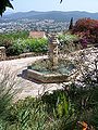
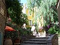
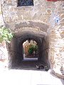
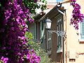
The historic village is situated on the hills. Medieval houses are overgrown with bougainvillea flowers. Significant buildings include the church and the town hall.
Other parts of town include the seaside district of La Faviere with its marina.
Bormes-les-Mimosas has a hot-summer Mediterranean climate ( Köppen climate classification Csa). The average annual temperature in Bormes-les-Mimosas is 14.3 °C (57.7 °F). The average annual rainfall is 917.9 mm (36.14 in) with October as the wettest month. The temperatures are highest on average in August, at around 22.7 °C (72.9 °F), and lowest in January, at around 7.2 °C (45.0 °F). The highest temperature ever recorded in Bormes-les-Mimosas was 41.9 °C (107.4 °F) on 7 July 1982; the coldest temperature ever recorded was −12.6 °C (9.3 °F) on 8 January 1985.
| Climate data for Bormes-les-Mimosas (1981−2010 normals, extremes 1971−present) | |||||||||||||
|---|---|---|---|---|---|---|---|---|---|---|---|---|---|
| Month | Jan | Feb | Mar | Apr | May | Jun | Jul | Aug | Sep | Oct | Nov | Dec | Year |
| Record high °C (°F) | 23.6 (74.5) |
25.8 (78.4) |
28.9 (84.0) |
28.0 (82.4) |
35.3 (95.5) |
38.9 (102.0) |
41.9 (107.4) |
39.9 (103.8) |
36.4 (97.5) |
30.9 (87.6) |
26.3 (79.3) |
22.5 (72.5) |
41.9 (107.4) |
| Mean daily maximum °C (°F) | 12.8 (55.0) |
13.4 (56.1) |
16.1 (61.0) |
18.2 (64.8) |
22.5 (72.5) |
26.6 (79.9) |
30.1 (86.2) |
30.1 (86.2) |
25.9 (78.6) |
21.1 (70.0) |
16.2 (61.2) |
13.4 (56.1) |
20.6 (69.1) |
| Daily mean °C (°F) | 7.2 (45.0) |
7.5 (45.5) |
9.9 (49.8) |
12.1 (53.8) |
15.9 (60.6) |
19.7 (67.5) |
22.6 (72.7) |
22.7 (72.9) |
19.1 (66.4) |
15.5 (59.9) |
10.8 (51.4) |
8.1 (46.6) |
14.3 (57.7) |
| Mean daily minimum °C (°F) | 1.5 (34.7) |
1.5 (34.7) |
3.7 (38.7) |
6.0 (42.8) |
9.3 (48.7) |
12.7 (54.9) |
15.1 (59.2) |
15.3 (59.5) |
12.4 (54.3) |
9.9 (49.8) |
5.4 (41.7) |
2.7 (36.9) |
8.0 (46.4) |
| Record low °C (°F) | −12.6 (9.3) |
−10.6 (12.9) |
−11.8 (10.8) |
−4.0 (24.8) |
−1.0 (30.2) |
2.2 (36.0) |
6.2 (43.2) |
4.9 (40.8) |
1.0 (33.8) |
−4.1 (24.6) |
−7.6 (18.3) |
−9.5 (14.9) |
−12.6 (9.3) |
| Average precipitation mm (inches) | 113.4 (4.46) |
68.3 (2.69) |
59.0 (2.32) |
91.1 (3.59) |
57.4 (2.26) |
42.6 (1.68) |
13.7 (0.54) |
27.5 (1.08) |
76.9 (3.03) |
133.5 (5.26) |
116.8 (4.60) |
117.7 (4.63) |
917.9 (36.14) |
| Average precipitation days (≥ 1.0 mm) | 6.4 | 5.5 | 5.3 | 7.3 | 5.3 | 3.7 | 1.5 | 2.4 | 4.9 | 7.5 | 7.6 | 7.7 | 65.2 |
| Source: Météo-France [3] | |||||||||||||
| Year | Pop. | ±% p.a. |
|---|---|---|
| 1968 | 2,965 | — |
| 1975 | 3,093 | +0.61% |
| 1982 | 3,839 | +3.13% |
| 1990 | 5,083 | +3.57% |
| 1999 | 6,324 | +2.46% |
| 2007 | 7,153 | +1.55% |
| 2012 | 7,698 | +1.48% |
| 2017 | 8,102 | +1.03% |
| Source: INSEE [4] | ||
Notable people related to Bormes-les-Mimosas include:
- Alfred Courmes, born in Bormes-les-Mimosas on 21 May 1898, painter
- Hermann Sabran, lawyer and philanthropist from Lyon, General Councillor of Var, owner of the Fort de Brégançon, married in Bormes-les-Mimosas on 22 June 1869
- Grand Duke Henri of Luxembourg (and the Grand Ducal Family), who owns a holiday villa, La Tour sarrasine, in nearby Cabasson village, purchased by his grandmother, the Grand Duchess Charlotte, in 1949.
- Hippolyte de Bouchard was born in Bormes-les-Mimosas on 15 January 1780. He was a sailor and corsair who fought for the independence of Argentina, Chile and Peru.

- Place St-Francois
- La chapelle Notre-Dame-de-Constance
- Église St-Trophyme
- La chapelle Notre-Dame-de-Constance
- Château des Seigneurs de Foz
- Musee "Arts et Histoire"
- Arboretum de Gratteloup
- Arboretum du Ruscas
-
 Église St-Trophyme
 -
 Place l'Isclou d'Amour
 -
 Rue de l'Horloge
 -
 Fort des Seigneurs de Fos
 -
 La fameuse pierre des Bormes
 -
 Rue des Contours
 -
 Montée des Écureuils
 -
 Rue typique de Bormes


- ^ "Répertoire national des élus: les maires". data.gouv.fr, Plateforme ouverte des données publiques françaises (in French). 2 December 2020.
- ^ "Populations légales 2021" (in French). The National Institute of Statistics and Economic Studies. 28 December 2023.
- ^ "Fiche Climatologique Statistiques 1981-2010 et records" (PDF) (in French). Météo-France. Retrieved September 8, 2022.
- ^ Population en historique depuis 1968, INSEE
- City of Bormes-les-Mimosas official web site (in French)
- Pictures of the city, the annual flower parade, and of the surrounding landscapes
- More pictures of the city[ permanent dead link]
- Aerial map of the city
- Information : Bormes les Mimosas and le Lavandou Archived 2021-01-16 at the Wayback Machine
| International | |
|---|---|
| National | |
|
| This Var geographical article is a stub. You can help Wikipedia by expanding it. |
Bormes-les-Mimosas | |
|---|---|
|
Street in Bormes-les-Mimosas | |
|
Coat of arms | |
Bormes-les-Mimosas Bormes-les-Mimosas | |
| Coordinates: 43°09′09″N 6°20′38″E / 43.152500°N 6.3439°E | |
| Country | France |
| Region | Provence-Alpes-Côte d'Azur |
| Department | Var |
| Arrondissement | Toulon |
| Canton | La Crau |
| Government | |
| • Mayor (2020–2026) | François Arizzi [1] |
| Area 1 | 97.32 km2 (37.58 sq mi) |
| Population (2021)
[2] | 8,173 |
| • Density | 84/km2 (220/sq mi) |
| Time zone | UTC+01:00 ( CET) |
| • Summer ( DST) | UTC+02:00 ( CEST) |
| INSEE/Postal code |
83019 /83230 |
| 1 French Land Register data, which excludes lakes, ponds, glaciers > 1 km2 (0.386 sq mi or 247 acres) and river estuaries. | |
Bormes-les-Mimosas (French pronunciation: [bɔʁm le mimoza]; Occitan: Bòrmas dei Mimòsas) is a commune in the Var department, Provence-Alpes-Côte d'Azur Region, southeastern France.
It has a Mediterranean climate.
Bormes-les-Mimosas is a city in bloom and won the 2003 Gold Medal awarded by the Entente Florale. The Fort de Brégançon, located in the commune, is the official retreat for the President of the French Republic.
The historic village is situated on the hills. Medieval houses are overgrown with bougainvillea flowers. Significant buildings include the church and the town hall.
Other parts of town include the seaside district of La Faviere with its marina.
Bormes-les-Mimosas has a hot-summer Mediterranean climate ( Köppen climate classification Csa). The average annual temperature in Bormes-les-Mimosas is 14.3 °C (57.7 °F). The average annual rainfall is 917.9 mm (36.14 in) with October as the wettest month. The temperatures are highest on average in August, at around 22.7 °C (72.9 °F), and lowest in January, at around 7.2 °C (45.0 °F). The highest temperature ever recorded in Bormes-les-Mimosas was 41.9 °C (107.4 °F) on 7 July 1982; the coldest temperature ever recorded was −12.6 °C (9.3 °F) on 8 January 1985.
| Climate data for Bormes-les-Mimosas (1981−2010 normals, extremes 1971−present) | |||||||||||||
|---|---|---|---|---|---|---|---|---|---|---|---|---|---|
| Month | Jan | Feb | Mar | Apr | May | Jun | Jul | Aug | Sep | Oct | Nov | Dec | Year |
| Record high °C (°F) | 23.6 (74.5) |
25.8 (78.4) |
28.9 (84.0) |
28.0 (82.4) |
35.3 (95.5) |
38.9 (102.0) |
41.9 (107.4) |
39.9 (103.8) |
36.4 (97.5) |
30.9 (87.6) |
26.3 (79.3) |
22.5 (72.5) |
41.9 (107.4) |
| Mean daily maximum °C (°F) | 12.8 (55.0) |
13.4 (56.1) |
16.1 (61.0) |
18.2 (64.8) |
22.5 (72.5) |
26.6 (79.9) |
30.1 (86.2) |
30.1 (86.2) |
25.9 (78.6) |
21.1 (70.0) |
16.2 (61.2) |
13.4 (56.1) |
20.6 (69.1) |
| Daily mean °C (°F) | 7.2 (45.0) |
7.5 (45.5) |
9.9 (49.8) |
12.1 (53.8) |
15.9 (60.6) |
19.7 (67.5) |
22.6 (72.7) |
22.7 (72.9) |
19.1 (66.4) |
15.5 (59.9) |
10.8 (51.4) |
8.1 (46.6) |
14.3 (57.7) |
| Mean daily minimum °C (°F) | 1.5 (34.7) |
1.5 (34.7) |
3.7 (38.7) |
6.0 (42.8) |
9.3 (48.7) |
12.7 (54.9) |
15.1 (59.2) |
15.3 (59.5) |
12.4 (54.3) |
9.9 (49.8) |
5.4 (41.7) |
2.7 (36.9) |
8.0 (46.4) |
| Record low °C (°F) | −12.6 (9.3) |
−10.6 (12.9) |
−11.8 (10.8) |
−4.0 (24.8) |
−1.0 (30.2) |
2.2 (36.0) |
6.2 (43.2) |
4.9 (40.8) |
1.0 (33.8) |
−4.1 (24.6) |
−7.6 (18.3) |
−9.5 (14.9) |
−12.6 (9.3) |
| Average precipitation mm (inches) | 113.4 (4.46) |
68.3 (2.69) |
59.0 (2.32) |
91.1 (3.59) |
57.4 (2.26) |
42.6 (1.68) |
13.7 (0.54) |
27.5 (1.08) |
76.9 (3.03) |
133.5 (5.26) |
116.8 (4.60) |
117.7 (4.63) |
917.9 (36.14) |
| Average precipitation days (≥ 1.0 mm) | 6.4 | 5.5 | 5.3 | 7.3 | 5.3 | 3.7 | 1.5 | 2.4 | 4.9 | 7.5 | 7.6 | 7.7 | 65.2 |
| Source: Météo-France [3] | |||||||||||||
| Year | Pop. | ±% p.a. |
|---|---|---|
| 1968 | 2,965 | — |
| 1975 | 3,093 | +0.61% |
| 1982 | 3,839 | +3.13% |
| 1990 | 5,083 | +3.57% |
| 1999 | 6,324 | +2.46% |
| 2007 | 7,153 | +1.55% |
| 2012 | 7,698 | +1.48% |
| 2017 | 8,102 | +1.03% |
| Source: INSEE [4] | ||
Notable people related to Bormes-les-Mimosas include:
- Alfred Courmes, born in Bormes-les-Mimosas on 21 May 1898, painter
- Hermann Sabran, lawyer and philanthropist from Lyon, General Councillor of Var, owner of the Fort de Brégançon, married in Bormes-les-Mimosas on 22 June 1869
- Grand Duke Henri of Luxembourg (and the Grand Ducal Family), who owns a holiday villa, La Tour sarrasine, in nearby Cabasson village, purchased by his grandmother, the Grand Duchess Charlotte, in 1949.
- Hippolyte de Bouchard was born in Bormes-les-Mimosas on 15 January 1780. He was a sailor and corsair who fought for the independence of Argentina, Chile and Peru.
- Place St-Francois
- La chapelle Notre-Dame-de-Constance
- Église St-Trophyme
- La chapelle Notre-Dame-de-Constance
- Château des Seigneurs de Foz
- Musee "Arts et Histoire"
- Arboretum de Gratteloup
- Arboretum du Ruscas
-
Église St-Trophyme
-
Place l'Isclou d'Amour
-
Rue de l'Horloge
-
Fort des Seigneurs de Fos
-
La fameuse pierre des Bormes
-
Rue des Contours
-
Montée des Écureuils
-
Rue typique de Bormes
- ^ "Répertoire national des élus: les maires". data.gouv.fr, Plateforme ouverte des données publiques françaises (in French). 2 December 2020.
- ^ "Populations légales 2021" (in French). The National Institute of Statistics and Economic Studies. 28 December 2023.
- ^ "Fiche Climatologique Statistiques 1981-2010 et records" (PDF) (in French). Météo-France. Retrieved September 8, 2022.
- ^ Population en historique depuis 1968, INSEE
- City of Bormes-les-Mimosas official web site (in French)
- Pictures of the city, the annual flower parade, and of the surrounding landscapes
- More pictures of the city[ permanent dead link]
- Aerial map of the city
- Information : Bormes les Mimosas and le Lavandou Archived 2021-01-16 at the Wayback Machine
| International | |
|---|---|
| National | |
|
| This Var geographical article is a stub. You can help Wikipedia by expanding it. |