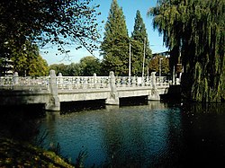
The Boezembrug is a bridge in
Rotterdam, part of the Gouda Roadway. The Bosom bridge connects both banks of the Boezem. The bridge is a
Rijksmonument designed by
S. J. Rutgers in 1903.
The Boezembrug is a bridge in
Rotterdam, part of the Gouda Roadway. The Bosom bridge connects both banks of the Boezem. The bridge is a
Rijksmonument designed by
S. J. Rutgers in 1903.