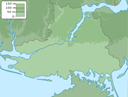
Blahodatne
Благодатне | |
|---|---|
 Technical Vocational School No. 6 | |
| Coordinates: 46°47′23″N 32°20′44″E / 46.789722°N 32.345556°E | |
| Country | Ukraine |
| Province | Kherson Oblast |
| District | Kherson Raion |
| Hromada | Chornobaivka rural hromada |
| Founded | 1920 |
| Area | |
| • Total | 1.054 km2 (0.407 sq mi) |
| Elevation | 42 m (138 ft) |
| Population (
2001 census) | |
| • Total | 1,008 |
| • Density | 960/km2 (2,500/sq mi) |
| Time zone | UTC+2 (EET) |
| • Summer ( DST) | UTC+3 (EEST) |
| Postal code | 75011
[1] |
| Area code | +380 5547 |
|
| |
Blahodatne ( Ukrainian: Благодатне; Russian: Благодатное), known as Petrivske ( Ukrainian: Петрівське; Russian: Петровское) until 2016, is a village in Kherson Raion, Kherson Oblast, southern Ukraine, about 32 kilometres (20 mi) north-west from the centre of Kherson city.
History
The village came under attack by Russian forces in May 2022, during the Russian invasion of Ukraine. The Russian troops were driven back by Ukrainian forces on 8 June 2022. [2]
On 5 September the Russian Armed Forces recaptured the village. [3][ needs independent confirmation] On 10 November, Ukrainian troops regained full control over the village. [4]
Demographics
The settlement had 1008 inhabitants in 2001. The native language distribution according to the 2001 Ukrainian Census was: [5]
- Ukrainian: 91.89%
- Russian: 7.43%
- Moldovan ( Romanian): 0.20%
- Belarusian: 0.10%
- Other languages: 0.38%
References
- ^ Довідник поштових індексів України. Херсонська область. Білозерський район
- ^ "Russian Offensive Campaign Assessment, June 8". Institute for the Study of War. Retrieved 23 August 2022.
- ^ Плотников, Дмитрий Александрович (5 September 2022). "Секретный тоннель и тысяча катакомб: когда ВС РФ будут брать Николаев". Правда.Ру (in Russian). Retrieved 6 September 2022.
- ^ "Ukrainian military in Blahodatne of Kherson region Kherson - Ukraine Interactive map - Ukraine Latest news on live map - liveuamap.com". Ukraine Interactive map - Ukraine Latest news on live map - liveuamap.com. Retrieved 3 February 2023.
- ^ "Офіційна сторінка Всеукраїнського перепису населення | Банк даних" [All-Ukrainian population census | Database]. ukrcensus.gov.ua (in Ukrainian). Retrieved 4 February 2023.
External links
![]() Media related to
Blahodatne at Wikimedia Commons
Media related to
Blahodatne at Wikimedia Commons
Blahodatne
Благодатне | |
|---|---|
 Technical Vocational School No. 6 | |
| Coordinates: 46°47′23″N 32°20′44″E / 46.789722°N 32.345556°E | |
| Country | Ukraine |
| Province | Kherson Oblast |
| District | Kherson Raion |
| Hromada | Chornobaivka rural hromada |
| Founded | 1920 |
| Area | |
| • Total | 1.054 km2 (0.407 sq mi) |
| Elevation | 42 m (138 ft) |
| Population (
2001 census) | |
| • Total | 1,008 |
| • Density | 960/km2 (2,500/sq mi) |
| Time zone | UTC+2 (EET) |
| • Summer ( DST) | UTC+3 (EEST) |
| Postal code | 75011
[1] |
| Area code | +380 5547 |
|
| |
Blahodatne ( Ukrainian: Благодатне; Russian: Благодатное), known as Petrivske ( Ukrainian: Петрівське; Russian: Петровское) until 2016, is a village in Kherson Raion, Kherson Oblast, southern Ukraine, about 32 kilometres (20 mi) north-west from the centre of Kherson city.
History
The village came under attack by Russian forces in May 2022, during the Russian invasion of Ukraine. The Russian troops were driven back by Ukrainian forces on 8 June 2022. [2]
On 5 September the Russian Armed Forces recaptured the village. [3][ needs independent confirmation] On 10 November, Ukrainian troops regained full control over the village. [4]
Demographics
The settlement had 1008 inhabitants in 2001. The native language distribution according to the 2001 Ukrainian Census was: [5]
- Ukrainian: 91.89%
- Russian: 7.43%
- Moldovan ( Romanian): 0.20%
- Belarusian: 0.10%
- Other languages: 0.38%
References
- ^ Довідник поштових індексів України. Херсонська область. Білозерський район
- ^ "Russian Offensive Campaign Assessment, June 8". Institute for the Study of War. Retrieved 23 August 2022.
- ^ Плотников, Дмитрий Александрович (5 September 2022). "Секретный тоннель и тысяча катакомб: когда ВС РФ будут брать Николаев". Правда.Ру (in Russian). Retrieved 6 September 2022.
- ^ "Ukrainian military in Blahodatne of Kherson region Kherson - Ukraine Interactive map - Ukraine Latest news on live map - liveuamap.com". Ukraine Interactive map - Ukraine Latest news on live map - liveuamap.com. Retrieved 3 February 2023.
- ^ "Офіційна сторінка Всеукраїнського перепису населення | Банк даних" [All-Ukrainian population census | Database]. ukrcensus.gov.ua (in Ukrainian). Retrieved 4 February 2023.
External links
![]() Media related to
Blahodatne at Wikimedia Commons
Media related to
Blahodatne at Wikimedia Commons

