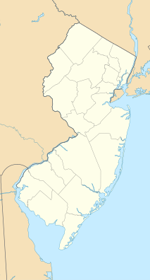
| Black River Wildlife Management Area | |
|---|---|
 | |
| Location | Chester Township, Morris County, New Jersey |
| Coordinates | 40°49′00″N 74°40′29″W / 40.81667°N 74.67472°W [1] |
| Area | 3,078 acres (1,246 ha) |
| Governing body | New Jersey Division of Fish and Wildlife |
The Black River Wildlife Management Area is located along the Black River (also known as the Lamington River) in Chester Township of Morris County, New Jersey. [2] This WMA is 3,078 acres (12.46 km2) and includes diverse landscape with plentiful flora and fauna. The Patriots' Path follows an abandoned branch of the Delaware, Lackawanna and Western Railroad along the river. [3]
Other parks in the Black River valley are the Black River County Park and the Hacklebarney State Park.
- ^ "Black River Wildlife Management Area". Geographic Names Information System. United States Geological Survey, United States Department of the Interior.
- ^ "Wildlife Management Areas". New Jersey Division of Fish and Wildlife.
- ^ "Black River Wildlife Management Area". New York–New Jersey Trail Conference.
-
 Media related to
Black River Wildlife Management Area at Wikimedia Commons
 - https://web.archive.org/web/20080513143014/http://www.outdoorphotographer.com/content/2007/may/fp_jersey.shtml
- http://www.nynjctbotany.org/njhigh/blkriver.html
| Black River Wildlife Management Area | |
|---|---|
 | |
| Location | Chester Township, Morris County, New Jersey |
| Coordinates | 40°49′00″N 74°40′29″W / 40.81667°N 74.67472°W [1] |
| Area | 3,078 acres (1,246 ha) |
| Governing body | New Jersey Division of Fish and Wildlife |
The Black River Wildlife Management Area is located along the Black River (also known as the Lamington River) in Chester Township of Morris County, New Jersey. [2] This WMA is 3,078 acres (12.46 km2) and includes diverse landscape with plentiful flora and fauna. The Patriots' Path follows an abandoned branch of the Delaware, Lackawanna and Western Railroad along the river. [3]
Other parks in the Black River valley are the Black River County Park and the Hacklebarney State Park.
- ^ "Black River Wildlife Management Area". Geographic Names Information System. United States Geological Survey, United States Department of the Interior.
- ^ "Wildlife Management Areas". New Jersey Division of Fish and Wildlife.
- ^ "Black River Wildlife Management Area". New York–New Jersey Trail Conference.
-
 Media related to
Black River Wildlife Management Area at Wikimedia Commons
 - https://web.archive.org/web/20080513143014/http://www.outdoorphotographer.com/content/2007/may/fp_jersey.shtml
- http://www.nynjctbotany.org/njhigh/blkriver.html


