Bittou | |
|---|---|
 | |
| Coordinates: 11°15′27″N 0°18′14″W / 11.25750°N 0.30389°W | |
| Country | |
| Region | Centre-Est Region |
| Province | Boulgou Province |
| Department | Bittou Department |
| Population (2019 census)
[1] | |
| • Total | 31,210 |
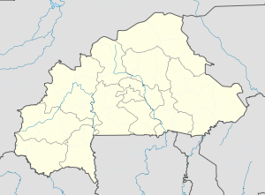
Bittou is a town and seat of the Bittou Department of Boulgou Province in south-eastern Burkina Faso. The town is a stop on the caravan trading route. [2] Today the town is located along the N16 Road which links Burkina Faso with Northern Togo and Ghana (via Togo). In 1898 the French Colonial Army built a fort here to keep the British Colonial Army from capturing the area. [3] As of 2019, the town has a population of 31,210. [1]
Climate
Köppen-Geiger climate classification system classifies its climate as tropical wet and dry (Aw) that closely borders with hot semi-arid (BSh).
| Climate data for Bittou | |||||||||||||
|---|---|---|---|---|---|---|---|---|---|---|---|---|---|
| Month | Jan | Feb | Mar | Apr | May | Jun | Jul | Aug | Sep | Oct | Nov | Dec | Year |
| Mean daily maximum °C (°F) | 35.1 (95.2) |
36.6 (97.9) |
38.4 (101.1) |
37.9 (100.2) |
35.6 (96.1) |
32.9 (91.2) |
30.8 (87.4) |
30 (86) |
30.9 (87.6) |
34 (93) |
36.1 (97.0) |
34.7 (94.5) |
34.4 (93.9) |
| Daily mean °C (°F) | 27.1 (80.8) |
29 (84) |
31.2 (88.2) |
31.4 (88.5) |
29.9 (85.8) |
27.8 (82.0) |
26.2 (79.2) |
25.8 (78.4) |
26.1 (79.0) |
27.8 (82.0) |
28.1 (82.6) |
26.7 (80.1) |
28.1 (82.6) |
| Mean daily minimum °C (°F) | 19.1 (66.4) |
21.4 (70.5) |
24.1 (75.4) |
25 (77) |
24.3 (75.7) |
22.7 (72.9) |
21.7 (71.1) |
21.6 (70.9) |
21.4 (70.5) |
21.7 (71.1) |
20.2 (68.4) |
18.8 (65.8) |
21.8 (71.3) |
| Average precipitation mm (inches) | 0 (0) |
1 (0.0) |
11 (0.4) |
36 (1.4) |
87 (3.4) |
116 (4.6) |
180 (7.1) |
239 (9.4) |
155 (6.1) |
47 (1.9) |
4 (0.2) |
3 (0.1) |
879 (34.6) |
| Source: Climate-Data.org, altitude: 247m [4] | |||||||||||||
See also
References
- ^ a b Citypopulation.de Population of cities & localities in Burkina Faso
- ^ Historical Dictionary of Burkina Faso, by Lawrence Rupley, Lamissa Bangali, Boureima Diamitani, 2013, Third edition, Scarecrow Press, Inc. ISBN 978-0-8108-6770-3
- ^ Historical Dictionary of Burkina Faso, by Lawrence Rupley, Lamissa Bangali, Boureima Diamitani, 2013, Third edition, Scarecrow Press, Inc. ISBN 978-0-8108-6770-3
- ^ "Climate: Bittou - Climate graph, Temperature graph, Climate table". Climate-Data.org. Retrieved 19 October 2013.
Bittou | |
|---|---|
 | |
| Coordinates: 11°15′27″N 0°18′14″W / 11.25750°N 0.30389°W | |
| Country | |
| Region | Centre-Est Region |
| Province | Boulgou Province |
| Department | Bittou Department |
| Population (2019 census)
[1] | |
| • Total | 31,210 |
Bittou is a town and seat of the Bittou Department of Boulgou Province in south-eastern Burkina Faso. The town is a stop on the caravan trading route. [2] Today the town is located along the N16 Road which links Burkina Faso with Northern Togo and Ghana (via Togo). In 1898 the French Colonial Army built a fort here to keep the British Colonial Army from capturing the area. [3] As of 2019, the town has a population of 31,210. [1]
Climate
Köppen-Geiger climate classification system classifies its climate as tropical wet and dry (Aw) that closely borders with hot semi-arid (BSh).
| Climate data for Bittou | |||||||||||||
|---|---|---|---|---|---|---|---|---|---|---|---|---|---|
| Month | Jan | Feb | Mar | Apr | May | Jun | Jul | Aug | Sep | Oct | Nov | Dec | Year |
| Mean daily maximum °C (°F) | 35.1 (95.2) |
36.6 (97.9) |
38.4 (101.1) |
37.9 (100.2) |
35.6 (96.1) |
32.9 (91.2) |
30.8 (87.4) |
30 (86) |
30.9 (87.6) |
34 (93) |
36.1 (97.0) |
34.7 (94.5) |
34.4 (93.9) |
| Daily mean °C (°F) | 27.1 (80.8) |
29 (84) |
31.2 (88.2) |
31.4 (88.5) |
29.9 (85.8) |
27.8 (82.0) |
26.2 (79.2) |
25.8 (78.4) |
26.1 (79.0) |
27.8 (82.0) |
28.1 (82.6) |
26.7 (80.1) |
28.1 (82.6) |
| Mean daily minimum °C (°F) | 19.1 (66.4) |
21.4 (70.5) |
24.1 (75.4) |
25 (77) |
24.3 (75.7) |
22.7 (72.9) |
21.7 (71.1) |
21.6 (70.9) |
21.4 (70.5) |
21.7 (71.1) |
20.2 (68.4) |
18.8 (65.8) |
21.8 (71.3) |
| Average precipitation mm (inches) | 0 (0) |
1 (0.0) |
11 (0.4) |
36 (1.4) |
87 (3.4) |
116 (4.6) |
180 (7.1) |
239 (9.4) |
155 (6.1) |
47 (1.9) |
4 (0.2) |
3 (0.1) |
879 (34.6) |
| Source: Climate-Data.org, altitude: 247m [4] | |||||||||||||
See also
References
- ^ a b Citypopulation.de Population of cities & localities in Burkina Faso
- ^ Historical Dictionary of Burkina Faso, by Lawrence Rupley, Lamissa Bangali, Boureima Diamitani, 2013, Third edition, Scarecrow Press, Inc. ISBN 978-0-8108-6770-3
- ^ Historical Dictionary of Burkina Faso, by Lawrence Rupley, Lamissa Bangali, Boureima Diamitani, 2013, Third edition, Scarecrow Press, Inc. ISBN 978-0-8108-6770-3
- ^ "Climate: Bittou - Climate graph, Temperature graph, Climate table". Climate-Data.org. Retrieved 19 October 2013.

