Bilhorod-Dnistrovskyi Raion
Білгород-Дністровський район | |
|---|---|
 | |
 | |
| Coordinates: 46°10′N 30°10′E / 46.167°N 30.167°E | |
| Country | |
| Oblast | |
| Established | 1957 |
| Admin. center | Bilhorod-Dnistrovskyi |
| Subdivisions | 16 hromadas |
| Government | |
| • Governor | Vasyl Chornolutskiy |
| Area - since July 2020 | |
| • Total | 5,154.98 km2 (1,990.35 sq mi) |
| Population (2022)
[1] | |
| • Total | 196,618 |
| • Density | 38/km2 (99/sq mi) |
| Time zone | UTC+2 ( EET) |
| • Summer ( DST) | UTC+3 ( EEST) |
| Postal index | 67720—67798 |
| Area code | +380 4849 |
| Website | https://bd-rda.od.gov.ua/ |
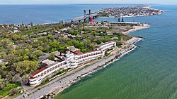
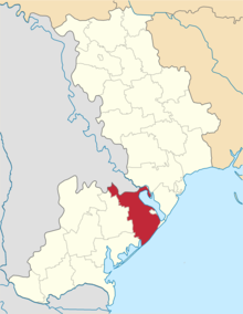
Bilhorod-Dnistrovskyi Raion ( Ukrainian: Білгород-Дністровський район; Romanian: Raionul Cetatea Albă) is a raion (district) in Odesa Oblast of Ukraine. It is part of the historical region of Bessarabia. Its administrative center is the town of Bilhorod-Dnistrovskyi. Population: 196,618 (2022 estimate). [1]
On 18 July 2020, as part of the administrative reform of Ukraine, the number of raions of Odesa Oblast was reduced to seven, and the area of Bilhorod-Dnistrovskyi Raion was significantly expanded. Two abolished raions, Sarata and Tatarbunary Raions, as well as Bilhorod-Dnistrovskyi Municipality and part of Ovidiopol Raion, were merged into Bilhorod-Dnistrovskyi Raion. [2] [3] The January 2020 estimate of the raion population was 59,349 (2020 est.). [4]
Administrative division
Current
After the reform in July 2020, the raion consisted of 16 hromadas: [3]
- Bilhorod-Dnistrovskyi urban hromada with the administration in the city of Bilhorod-Dnistrovskyi, transferred from Bilhorod-Dnistrovskyi Municipality; [5]
- Dyvisiia rural hromada with the administration in the village of Dyvisiia, transferred from Tatarbunary Raion; [6]
- Karolino-Buhaz rural hromada with the administration in the village of Karolino-Buhaz, transferred from Ovidiopol Raion; [7]
- Kulevcha rural hromada with the administration in the village of Kulevcha, transferred from Sarata Raion; [8]
- Lyman rural hromada with the administration in the village of Lyman, transferred from Tatarbunary Raion; [6]
- Marazliivka rural hromada with the administration in the village of Marazliivka, retained from Bilhorod-Dnistrovskyi Raion;
- Moloha rural hromada with the administration in the village of Moloha, retained from Bilhorod-Dnistrovskyi Raion;
- Petropavlivka rural hromada with the administration in the village of Petropavlivka, transferred from Sarata Raion; [8]
- Plakhtiivka rural hromada with the administration in the village of Plakhtiivka, transferred from Sarata Raion; [8]
- Sarata settlement hromada with the administration in the rural settlement of Sarata, transferred from Sarata Raion; [8]
- Serhiivka settlement hromada with the administration in the rural settlement of Serhiivka, retained from Bilhorod-Dnistrovskyi Raion and Bilhorod-Dnistrovskyi Municipality;
- Shabo rural hromada with the administration in the village of Shabo, retained from Bilhorod-Dnistrovskyi Raion;
- Starokozache rural hromada with the administration in the village of Starokozache, retained from Bilhorod-Dnistrovskyi Raion;
- Tatarbunary urban hromada with the administration in the city of Tatarbunary, transferred from Tatarbunary Raion; [6]
- Tuzly rural hromada with the administration in the village of Tuzly, transferred from Tatarbunary Raion; [6]
- Uspenivka rural hromada with the administration in the village of Uspenivka, transferred from Sarata Raion. [8]
Before 2020

Before the 2020 reform, the raion consisted of five hromadas, [9]
- Marazliivka rural hromada with the administration in Marazliivka;
- Moloha rural hromada with the administration in Moloha;
- Serhiivka settlement hromada with the administration in Serhiivka (partially in Bilhorod-Dnistrovskyi Municipality);
- Shabo rural hromada with the administration in Shabo;
- Starokozache rural hromada with the administration in Starokozache.
References
- ^ a b Чисельність наявного населення України на 1 січня 2022 [Number of Present Population of Ukraine, as of January 1, 2022] (PDF) (in Ukrainian and English). Kyiv: State Statistics Service of Ukraine. Archived (PDF) from the original on 4 July 2022.
- ^ "Про утворення та ліквідацію районів. Постанова Верховної Ради України № 807-ІХ". Голос України (in Ukrainian). 2020-07-18. Retrieved 2020-10-03.
- ^ a b "Нові райони: карти + склад" (in Ukrainian). Міністерство розвитку громад та територій України.
- ^ Чисельність наявного населення України на 1 січня 2020 року / Population of Ukraine Number of Existing as of January 1, 2020 (PDF) (in Ukrainian and English). Kyiv: State Statistics Service of Ukraine. Archived (PDF) from the original on 28 September 2023.
- ^ "Белгород-Днестровская городская громада" (in Russian). Портал об'єднаних громад України.
- ^ a b c d "Татарбунарська районна рада (состав до 2020 г.)" (in Russian). Портал об'єднаних громад України.
- ^ "Овідіопольська районна рада (состав до 2020 г.)" (in Russian). Портал об'єднаних громад України.
- ^ a b c d e "Саратська районна рада (состав до 2020 г.)" (in Russian). Портал об'єднаних громад України.
- ^ "Білгород-Дністровська районна рада (состав до 2020 г.)" (in Russian). Портал об'єднаних громад України.
Bilhorod-Dnistrovskyi Raion
Білгород-Дністровський район | |
|---|---|
 | |
 | |
| Coordinates: 46°10′N 30°10′E / 46.167°N 30.167°E | |
| Country | |
| Oblast | |
| Established | 1957 |
| Admin. center | Bilhorod-Dnistrovskyi |
| Subdivisions | 16 hromadas |
| Government | |
| • Governor | Vasyl Chornolutskiy |
| Area - since July 2020 | |
| • Total | 5,154.98 km2 (1,990.35 sq mi) |
| Population (2022)
[1] | |
| • Total | 196,618 |
| • Density | 38/km2 (99/sq mi) |
| Time zone | UTC+2 ( EET) |
| • Summer ( DST) | UTC+3 ( EEST) |
| Postal index | 67720—67798 |
| Area code | +380 4849 |
| Website | https://bd-rda.od.gov.ua/ |
Bilhorod-Dnistrovskyi Raion ( Ukrainian: Білгород-Дністровський район; Romanian: Raionul Cetatea Albă) is a raion (district) in Odesa Oblast of Ukraine. It is part of the historical region of Bessarabia. Its administrative center is the town of Bilhorod-Dnistrovskyi. Population: 196,618 (2022 estimate). [1]
On 18 July 2020, as part of the administrative reform of Ukraine, the number of raions of Odesa Oblast was reduced to seven, and the area of Bilhorod-Dnistrovskyi Raion was significantly expanded. Two abolished raions, Sarata and Tatarbunary Raions, as well as Bilhorod-Dnistrovskyi Municipality and part of Ovidiopol Raion, were merged into Bilhorod-Dnistrovskyi Raion. [2] [3] The January 2020 estimate of the raion population was 59,349 (2020 est.). [4]
Administrative division
Current
After the reform in July 2020, the raion consisted of 16 hromadas: [3]
- Bilhorod-Dnistrovskyi urban hromada with the administration in the city of Bilhorod-Dnistrovskyi, transferred from Bilhorod-Dnistrovskyi Municipality; [5]
- Dyvisiia rural hromada with the administration in the village of Dyvisiia, transferred from Tatarbunary Raion; [6]
- Karolino-Buhaz rural hromada with the administration in the village of Karolino-Buhaz, transferred from Ovidiopol Raion; [7]
- Kulevcha rural hromada with the administration in the village of Kulevcha, transferred from Sarata Raion; [8]
- Lyman rural hromada with the administration in the village of Lyman, transferred from Tatarbunary Raion; [6]
- Marazliivka rural hromada with the administration in the village of Marazliivka, retained from Bilhorod-Dnistrovskyi Raion;
- Moloha rural hromada with the administration in the village of Moloha, retained from Bilhorod-Dnistrovskyi Raion;
- Petropavlivka rural hromada with the administration in the village of Petropavlivka, transferred from Sarata Raion; [8]
- Plakhtiivka rural hromada with the administration in the village of Plakhtiivka, transferred from Sarata Raion; [8]
- Sarata settlement hromada with the administration in the rural settlement of Sarata, transferred from Sarata Raion; [8]
- Serhiivka settlement hromada with the administration in the rural settlement of Serhiivka, retained from Bilhorod-Dnistrovskyi Raion and Bilhorod-Dnistrovskyi Municipality;
- Shabo rural hromada with the administration in the village of Shabo, retained from Bilhorod-Dnistrovskyi Raion;
- Starokozache rural hromada with the administration in the village of Starokozache, retained from Bilhorod-Dnistrovskyi Raion;
- Tatarbunary urban hromada with the administration in the city of Tatarbunary, transferred from Tatarbunary Raion; [6]
- Tuzly rural hromada with the administration in the village of Tuzly, transferred from Tatarbunary Raion; [6]
- Uspenivka rural hromada with the administration in the village of Uspenivka, transferred from Sarata Raion. [8]
Before 2020

Before the 2020 reform, the raion consisted of five hromadas, [9]
- Marazliivka rural hromada with the administration in Marazliivka;
- Moloha rural hromada with the administration in Moloha;
- Serhiivka settlement hromada with the administration in Serhiivka (partially in Bilhorod-Dnistrovskyi Municipality);
- Shabo rural hromada with the administration in Shabo;
- Starokozache rural hromada with the administration in Starokozache.
References
- ^ a b Чисельність наявного населення України на 1 січня 2022 [Number of Present Population of Ukraine, as of January 1, 2022] (PDF) (in Ukrainian and English). Kyiv: State Statistics Service of Ukraine. Archived (PDF) from the original on 4 July 2022.
- ^ "Про утворення та ліквідацію районів. Постанова Верховної Ради України № 807-ІХ". Голос України (in Ukrainian). 2020-07-18. Retrieved 2020-10-03.
- ^ a b "Нові райони: карти + склад" (in Ukrainian). Міністерство розвитку громад та територій України.
- ^ Чисельність наявного населення України на 1 січня 2020 року / Population of Ukraine Number of Existing as of January 1, 2020 (PDF) (in Ukrainian and English). Kyiv: State Statistics Service of Ukraine. Archived (PDF) from the original on 28 September 2023.
- ^ "Белгород-Днестровская городская громада" (in Russian). Портал об'єднаних громад України.
- ^ a b c d "Татарбунарська районна рада (состав до 2020 г.)" (in Russian). Портал об'єднаних громад України.
- ^ "Овідіопольська районна рада (состав до 2020 г.)" (in Russian). Портал об'єднаних громад України.
- ^ a b c d e "Саратська районна рада (состав до 2020 г.)" (in Russian). Портал об'єднаних громад України.
- ^ "Білгород-Дністровська районна рада (состав до 2020 г.)" (in Russian). Портал об'єднаних громад України.

