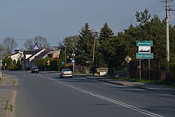
Biała | |
|---|---|
Village | |
 | |
| Coordinates: 51°15′59″N 18°26′21″E / 51.26639°N 18.43917°E | |
| Country | |
| Voivodeship | Łódź |
| County | Wieluń |
| Gmina | Biała |
| Population | 333 |
| Time zone | UTC+1 ( CET) |
| • Summer ( DST) | UTC+2 ( CEST) |
| Vehicle registration | EWI |
| National roads |
|
Biała [ˈbjawa] is a village in Wieluń County, Łódź Voivodeship, in south-central Poland. It is the seat of the gmina (administrative district) called Gmina Biała. [1] It lies approximately 11 kilometres (7 mi) north-west of Wieluń and 92 km (57 mi) south-west of the regional capital Łódź.
History
In 1827, Biała had a population of 781. [2]
During the German occupation of Poland ( World War II), in 1940–1941, the German gendarmerie carried out expulsions of Poles, who were either deported to the General Government in the more eastern part of German-occupied Poland or enslaved as forced labour in the region or in Germany. [3] Houses and farms of expelled Poles were handed over to German colonists as part of the Lebensraum policy. [4]
References
- ^ "Central Statistical Office (GUS) - TERYT (National Register of Territorial Land Apportionment Journal)" (in Polish). 2008-06-01.
-
^ Słownik geograficzny Królestwa Polskiego i innych krajów słowiańskich, Tom I (in Polish). Warsaw. 1880. p. 170.
{{
cite book}}
: CS1 maint: location missing publisher ( link) - ^ Wardzyńska, Maria (2017). Wysiedlenia ludności polskiej z okupowanych ziem polskich włączonych do III Rzeszy w latach 1939-1945 (in Polish). Warsaw: IPN. pp. 254, 306. ISBN 978-83-8098-174-4.
- ^ Wardzyńska, pp. 255, 308
Biała | |
|---|---|
Village | |
 | |
| Coordinates: 51°15′59″N 18°26′21″E / 51.26639°N 18.43917°E | |
| Country | |
| Voivodeship | Łódź |
| County | Wieluń |
| Gmina | Biała |
| Population | 333 |
| Time zone | UTC+1 ( CET) |
| • Summer ( DST) | UTC+2 ( CEST) |
| Vehicle registration | EWI |
| National roads |
|
Biała [ˈbjawa] is a village in Wieluń County, Łódź Voivodeship, in south-central Poland. It is the seat of the gmina (administrative district) called Gmina Biała. [1] It lies approximately 11 kilometres (7 mi) north-west of Wieluń and 92 km (57 mi) south-west of the regional capital Łódź.
History
In 1827, Biała had a population of 781. [2]
During the German occupation of Poland ( World War II), in 1940–1941, the German gendarmerie carried out expulsions of Poles, who were either deported to the General Government in the more eastern part of German-occupied Poland or enslaved as forced labour in the region or in Germany. [3] Houses and farms of expelled Poles were handed over to German colonists as part of the Lebensraum policy. [4]
References
- ^ "Central Statistical Office (GUS) - TERYT (National Register of Territorial Land Apportionment Journal)" (in Polish). 2008-06-01.
-
^ Słownik geograficzny Królestwa Polskiego i innych krajów słowiańskich, Tom I (in Polish). Warsaw. 1880. p. 170.
{{
cite book}}
: CS1 maint: location missing publisher ( link) - ^ Wardzyńska, Maria (2017). Wysiedlenia ludności polskiej z okupowanych ziem polskich włączonych do III Rzeszy w latach 1939-1945 (in Polish). Warsaw: IPN. pp. 254, 306. ISBN 978-83-8098-174-4.
- ^ Wardzyńska, pp. 255, 308

