Photos • Location
Bhilkati | |
|---|---|
Village | |
 | |
| Nickname: Bhilkati | |
| Coordinates: 18°1′10″N 74°22′26″E / 18.01944°N 74.37389°E | |
| Country | India |
| State | Maharashtra |
| District | Satara |
| Founded by | Kalel Family founder of Bhilkati village, |
| Named for | Shivprasad |
| Government | |
| • Type | Elective Gram Panchayat |
| • Body | Gram Panchayat |
| Population | |
| • Total | 841 |
| Marathi | |
| • Official | Marathi |
| Time zone | UTC+5:30 ( IST) |
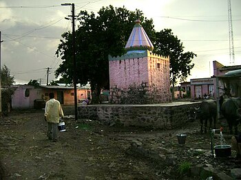
Bhilkati is a village in Phaltan tehsil of Satara district in Maharashtra state of India. The main activity of the community is farming.
Bhilkati | |
|---|---|
Village | |
 | |
| Nickname: Bhilkati | |
| Coordinates: 18°1′10″N 74°22′26″E / 18.01944°N 74.37389°E | |
| Country | India |
| State | Maharashtra |
| District | Satara |
| Founded by | Kalel Family founder of Bhilkati village, |
| Named for | Shivprasad |
| Government | |
| • Type | Elective Gram Panchayat |
| • Body | Gram Panchayat |
| Population | |
| • Total | 841 |
| Marathi | |
| • Official | Marathi |
| Time zone | UTC+5:30 ( IST) |
Bhilkati is a village in Phaltan tehsil of Satara district in Maharashtra state of India. The main activity of the community is farming.
