Photos • Location
| Beinn Leoid | |
|---|---|
 Beinn Leoid | |
| Highest point | |
| Elevation | 792 m (2,598 ft) [1] |
| Prominence | 495 m (1,624 ft) |
| Listing | Corbett, Marilyn |
| Coordinates | 58°13′19″N 4°51′41″W / 58.2220°N 4.8615°W |
| Geography | |
| Location | Sutherland, Scotland |
| Parent range | Northwest Highlands |
| OS grid | NC320294 |
| Topo map | OS Landranger 15 |
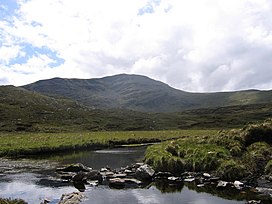
Beinn Leoid (792 m) is a mountain in the Northwest Highlands of Scotland. It lies in Sutherland, east of the village of Kylesku.
A very remote mountain, it provides fine views towards the coast from its summit. [2]
References
- ^ "Beinn Leoid". hill-bagging.co.uk. Retrieved 18 May 2019.
- ^ "walkhighlands Beinn Leoid". walkhighlands.co.uk. Retrieved 18 May 2019.
| Beinn Leoid | |
|---|---|
 Beinn Leoid | |
| Highest point | |
| Elevation | 792 m (2,598 ft) [1] |
| Prominence | 495 m (1,624 ft) |
| Listing | Corbett, Marilyn |
| Coordinates | 58°13′19″N 4°51′41″W / 58.2220°N 4.8615°W |
| Geography | |
| Location | Sutherland, Scotland |
| Parent range | Northwest Highlands |
| OS grid | NC320294 |
| Topo map | OS Landranger 15 |
Beinn Leoid (792 m) is a mountain in the Northwest Highlands of Scotland. It lies in Sutherland, east of the village of Kylesku.
A very remote mountain, it provides fine views towards the coast from its summit. [2]
References
- ^ "Beinn Leoid". hill-bagging.co.uk. Retrieved 18 May 2019.
- ^ "walkhighlands Beinn Leoid". walkhighlands.co.uk. Retrieved 18 May 2019.