Beatrice Municipal Airport | |||||||||||||||
|---|---|---|---|---|---|---|---|---|---|---|---|---|---|---|---|
 | |||||||||||||||
| Summary | |||||||||||||||
| Airport type | Public | ||||||||||||||
| Owner | Beatrice Airport Authority | ||||||||||||||
| Serves | Beatrice, Nebraska | ||||||||||||||
| Elevation AMSL | 1,324 ft / 404 m | ||||||||||||||
| Coordinates | 40°18′04″N 096°45′14″W / 40.30111°N 96.75389°W | ||||||||||||||
| Map | |||||||||||||||
| Runways | |||||||||||||||
| |||||||||||||||
| Statistics | |||||||||||||||
| |||||||||||||||
Source:
Federal Aviation Administration
[1] | |||||||||||||||
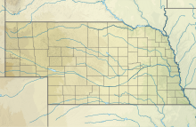
Beatrice Municipal Airport ( IATA: BIE, ICAO: KBIE, FAA LID: BIE) is 3 mi (4.8 km) north of Beatrice, in Gage County, Nebraska. [1]
Frontier DC-3s stopped there from 1959 to 1963.
Facilities
The airport covers 643 acres (260 ha) at an elevation of 1,324 ft (404 m). It has two concrete runways: 18/36 is 5,602 by 100 ft (1,707 by 30 m) and 14/32 is 4,401 by 75 ft (1,341 by 23 m). In the year ending June 21, 2023 the airport had 11,000 aircraft operations, an average of 30 per day: 92% general aviation, 6% air taxi and 2% military. In June 2023, 30 aircraft were based at the airport, all single-engine. [1] The terminal has wireless internet. [2]
Airlines and Destinations
Cargo
Beatrice has scheduled cargo service on Ameriflight [3]
| Airlines | Destinations |
|---|---|
| Ameriflight | Omaha |
See also
References
- ^ a b c FAA Airport Form 5010 for BIE PDF, effective August 10, 2023.
- ^ "beatrice airport". beatriceairport.com. Retrieved 2015-04-30.
- ^ "Route Map".
External links
- FAA Terminal Procedures for BIE, effective July 11, 2024
- Resources for this airport:
- FAA airport information for BIE
- AirNav airport information for KBIE
- ASN accident history for BIE
- FlightAware airport information and live flight tracker
- NOAA/NWS weather observations: current, past three days
- SkyVector aeronautical chart, Terminal Procedures
Beatrice Municipal Airport | |||||||||||||||
|---|---|---|---|---|---|---|---|---|---|---|---|---|---|---|---|
 | |||||||||||||||
| Summary | |||||||||||||||
| Airport type | Public | ||||||||||||||
| Owner | Beatrice Airport Authority | ||||||||||||||
| Serves | Beatrice, Nebraska | ||||||||||||||
| Elevation AMSL | 1,324 ft / 404 m | ||||||||||||||
| Coordinates | 40°18′04″N 096°45′14″W / 40.30111°N 96.75389°W | ||||||||||||||
| Map | |||||||||||||||
| Runways | |||||||||||||||
| |||||||||||||||
| Statistics | |||||||||||||||
| |||||||||||||||
Source:
Federal Aviation Administration
[1] | |||||||||||||||
Beatrice Municipal Airport ( IATA: BIE, ICAO: KBIE, FAA LID: BIE) is 3 mi (4.8 km) north of Beatrice, in Gage County, Nebraska. [1]
Frontier DC-3s stopped there from 1959 to 1963.
Facilities
The airport covers 643 acres (260 ha) at an elevation of 1,324 ft (404 m). It has two concrete runways: 18/36 is 5,602 by 100 ft (1,707 by 30 m) and 14/32 is 4,401 by 75 ft (1,341 by 23 m). In the year ending June 21, 2023 the airport had 11,000 aircraft operations, an average of 30 per day: 92% general aviation, 6% air taxi and 2% military. In June 2023, 30 aircraft were based at the airport, all single-engine. [1] The terminal has wireless internet. [2]
Airlines and Destinations
Cargo
Beatrice has scheduled cargo service on Ameriflight [3]
| Airlines | Destinations |
|---|---|
| Ameriflight | Omaha |
See also
References
- ^ a b c FAA Airport Form 5010 for BIE PDF, effective August 10, 2023.
- ^ "beatrice airport". beatriceairport.com. Retrieved 2015-04-30.
- ^ "Route Map".
External links
- FAA Terminal Procedures for BIE, effective July 11, 2024
- Resources for this airport:
- FAA airport information for BIE
- AirNav airport information for KBIE
- ASN accident history for BIE
- FlightAware airport information and live flight tracker
- NOAA/NWS weather observations: current, past three days
- SkyVector aeronautical chart, Terminal Procedures

