Bawku | |
|---|---|
 | |
Location of Bawku in
Upper East region | |
| Coordinates: 11°3′36″N 0°14′24″W / 11.06000°N 0.24000°W | |
| Country | Ghana |
| Region | Upper East Region |
| District | Bawku Municipal District |
| Population (2012) | |
| • Total | 69,527 [1] |
| Time zone | GMT |
| • Summer ( DST) | GMT |

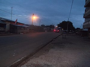
Bawku is a town and is the capital of the Bawku Municipal District, district in the Upper East region of north Ghana, adjacent to the border with Burkina Faso. [2] [3] [4] It is located approximately between latitudes 11o 111 and 100 401 North and longitude 0o 181w and 0o 61 E in the north-eastern corner of the region. The municipality has a total land area of about 257 km2. [5] The Municipality was established by Legislative Instrument (L.I) 2103. [5] The municipality has a total land area of about 257 km2. [5] Bawku has a 2021 settlement population of 119,458 people. [1] [6] Hon. Ayariga Mahama is the Member of Parliament for Bawku Central Constituency. [7]
The "tomb" of, Naa Gbewaa, the founder of the Mamprusi, Dagomba, and Nanumba tribes, is located just a few kilometers from Bawku in Pusiga in the Upper East Region of Ghana. Legend states that Naa Gbewaa never died but simply vanished into the ground. The shrine was thought to have been built in the 14th century in commemoration of Naa Gbewaa, and is today a place of spiritual reverence. [8]
- ^ a b "World Gazetteer online". World-gazetteer.com. Archived from the original on 2012-01-11.
- ^ Bawku Municipal District Archived June 14, 2013, at the Wayback Machine
- ^ "Upper East Region". List of All MMDAs in Ghana. A Public - Private Partnership Programme between Min. of Local Govt., Rural Dev. & Environment & Maks Publications & Media Services. 2006. Archived from the original on 2009-08-05. Retrieved 2008-01-01.
- ^ "4 dead in renewed Bawku chieftaincy violence - MyJoyOnline.com". www.myjoyonline.com. 2022-01-24. Retrieved 2022-01-24.
- ^ a b c "Ghana Districts: A repository of all Local Assemblies in Ghana". ghanadistricts.com. Retrieved 2023-09-20.
- ^ "Ghana Districts: A repository of all Local Assemblies in Ghana". www.ghanadistricts.com. Retrieved 2023-09-16.
- ^ "Parliament of Ghana". www.parliament.gh. Retrieved 2023-09-28.
- ^ "Upper East Region Attractions - Ghana Tourism Homepage". Touringghana.com. Archived from the original on 2014-03-17. Retrieved 2014-04-18.
Bawku | |
|---|---|
 | |
Location of Bawku in
Upper East region | |
| Coordinates: 11°3′36″N 0°14′24″W / 11.06000°N 0.24000°W | |
| Country | Ghana |
| Region | Upper East Region |
| District | Bawku Municipal District |
| Population (2012) | |
| • Total | 69,527 [1] |
| Time zone | GMT |
| • Summer ( DST) | GMT |

Bawku is a town and is the capital of the Bawku Municipal District, district in the Upper East region of north Ghana, adjacent to the border with Burkina Faso. [2] [3] [4] It is located approximately between latitudes 11o 111 and 100 401 North and longitude 0o 181w and 0o 61 E in the north-eastern corner of the region. The municipality has a total land area of about 257 km2. [5] The Municipality was established by Legislative Instrument (L.I) 2103. [5] The municipality has a total land area of about 257 km2. [5] Bawku has a 2021 settlement population of 119,458 people. [1] [6] Hon. Ayariga Mahama is the Member of Parliament for Bawku Central Constituency. [7]
The "tomb" of, Naa Gbewaa, the founder of the Mamprusi, Dagomba, and Nanumba tribes, is located just a few kilometers from Bawku in Pusiga in the Upper East Region of Ghana. Legend states that Naa Gbewaa never died but simply vanished into the ground. The shrine was thought to have been built in the 14th century in commemoration of Naa Gbewaa, and is today a place of spiritual reverence. [8]
- ^ a b "World Gazetteer online". World-gazetteer.com. Archived from the original on 2012-01-11.
- ^ Bawku Municipal District Archived June 14, 2013, at the Wayback Machine
- ^ "Upper East Region". List of All MMDAs in Ghana. A Public - Private Partnership Programme between Min. of Local Govt., Rural Dev. & Environment & Maks Publications & Media Services. 2006. Archived from the original on 2009-08-05. Retrieved 2008-01-01.
- ^ "4 dead in renewed Bawku chieftaincy violence - MyJoyOnline.com". www.myjoyonline.com. 2022-01-24. Retrieved 2022-01-24.
- ^ a b c "Ghana Districts: A repository of all Local Assemblies in Ghana". ghanadistricts.com. Retrieved 2023-09-20.
- ^ "Ghana Districts: A repository of all Local Assemblies in Ghana". www.ghanadistricts.com. Retrieved 2023-09-16.
- ^ "Parliament of Ghana". www.parliament.gh. Retrieved 2023-09-28.
- ^ "Upper East Region Attractions - Ghana Tourism Homepage". Touringghana.com. Archived from the original on 2014-03-17. Retrieved 2014-04-18.

