Banner Township | |
|---|---|
 Banner Township Location in Arkansas  Banner Township Banner Township (the United States) | |
| Coordinates: 33°16′55″N 91°36′25″W / 33.281880°N 91.607009°W [1] | |
| Country | United States |
| State | Arkansas |
| County | Ashley |
| Area | |
| • Total | 16.673 sq mi (43.18 km2) |
| • Land | 16.383 sq mi (42.43 km2) |
| • Water | 0.290 sq mi (0.75 km2) |
| Elevation | 164 ft (50 m) |
| Population | |
| • Total | 158 |
| • Density | 9.5/sq mi (3.7/km2) |
| Time zone | UTC-6 ( CST) |
| • Summer ( DST) | UTC-5 ( CDT) |
| FIPS code [2] [3] | 05-90102 |
| GNIS ID [2] [3] | 63671 |
Banner Township is a township in Ashley County, Arkansas, United States. [4] Its total population was 158 as of the 2010 United States Census, [1] [5] a decrease of 7.6 percent from 171 at the 2000 census. [6] [7]

According to the 2010 Census, Banner Township is located at 33°16′55″N 91°36′25″W / 33.281880°N 91.607009°W (33.281880, -91.607009). [1] It has a total area of 16.673 square miles (43.18 square kilometers), of which 16.383 sq mi (42.43 km2) is land and 0.290 sq mi (0.75 km2) is water (1.74%). [1] As per the USGS National Elevation Dataset, the elevation is 164 feet (50 m). [2]
- ^ a b c d e f "County Subdivisions (2010): Arkansas". 2010 Census Gazetteer Files. United States Census Bureau. Archived from the original ( TXT) on May 31, 2014. Retrieved May 31, 2014.
- ^ a b c d "Feature ID 63671: Township of Banner (Ashley County, Arkansas)". Geographic Names Information System. United States Geological Survey. Retrieved May 31, 2014.
- ^ a b "FIPS55 Data: Arkansas". FIPS55 Data. United States Geological Survey. February 23, 2006. Archived from the original ( TXT) on June 18, 2006. Retrieved May 31, 2014.
- ^ "Summary Population and Housing Characteristics, CPH-1-5, Arkansas" ( PDF). 2010 Census of Population and Housing. United States Census Bureau. September 2012. Retrieved May 31, 2014.
- ^ "2010 Demographic Profile (DP-1): Banner township, Ashley County, Arkansas". American FactFinder. United States Census Bureau. Archived from the original on February 12, 2020. Retrieved May 31, 2014.
- ^ "2000 Demographic Profile (DP-1): Banner township, Ashley County, Arkansas". American FactFinder. United States Census Bureau. Archived from the original on February 12, 2020. Retrieved May 31, 2014.
- ^ "County Subdivisions (2000)". 2000 Census Gazetteer Files. United States Census Bureau. Archived from the original ( Zipped TXT) on May 31, 2014. Retrieved May 31, 2014.
- "2010 Census Block Map: Banner Township, Arkansas" (PDF). Arkansas 2010 Census Block Maps - County Subdivisions. U.S. Census Bureau.
- "2013 Boundary and Annexation Survey (BAS) Map: Ashley County, Arkansas" (PDF). Boundary and Annexation Survey (BAS) Shapefiles and Maps. U.S. Census Bureau. Archived from the original (PDF) on March 4, 2016. Retrieved May 31, 2014.
- "2010 Census County Subdivision Maps: Arkansas" (PDF). County Subdivision Maps. U.S. Census Bureau.
Municipalities and communities of
Ashley County, Arkansas, United States | ||
|---|---|---|
| Cities | 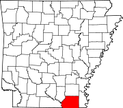 | |
| Town | ||
| CDPs | ||
|
Unincorporated communities | ||
|
| This article about a location in Ashley County, Arkansas is a stub. You can help Wikipedia by expanding it. |
Banner Township | |
|---|---|
Banner Township Location in Arkansas Banner Township Banner Township (the United States) | |
| Coordinates: 33°16′55″N 91°36′25″W / 33.281880°N 91.607009°W [1] | |
| Country | United States |
| State | Arkansas |
| County | Ashley |
| Area | |
| • Total | 16.673 sq mi (43.18 km2) |
| • Land | 16.383 sq mi (42.43 km2) |
| • Water | 0.290 sq mi (0.75 km2) |
| Elevation | 164 ft (50 m) |
| Population | |
| • Total | 158 |
| • Density | 9.5/sq mi (3.7/km2) |
| Time zone | UTC-6 ( CST) |
| • Summer ( DST) | UTC-5 ( CDT) |
| FIPS code [2] [3] | 05-90102 |
| GNIS ID [2] [3] | 63671 |
Banner Township is a township in Ashley County, Arkansas, United States. [4] Its total population was 158 as of the 2010 United States Census, [1] [5] a decrease of 7.6 percent from 171 at the 2000 census. [6] [7]
According to the 2010 Census, Banner Township is located at 33°16′55″N 91°36′25″W / 33.281880°N 91.607009°W (33.281880, -91.607009). [1] It has a total area of 16.673 square miles (43.18 square kilometers), of which 16.383 sq mi (42.43 km2) is land and 0.290 sq mi (0.75 km2) is water (1.74%). [1] As per the USGS National Elevation Dataset, the elevation is 164 feet (50 m). [2]
- ^ a b c d e f "County Subdivisions (2010): Arkansas". 2010 Census Gazetteer Files. United States Census Bureau. Archived from the original ( TXT) on May 31, 2014. Retrieved May 31, 2014.
- ^ a b c d "Feature ID 63671: Township of Banner (Ashley County, Arkansas)". Geographic Names Information System. United States Geological Survey. Retrieved May 31, 2014.
- ^ a b "FIPS55 Data: Arkansas". FIPS55 Data. United States Geological Survey. February 23, 2006. Archived from the original ( TXT) on June 18, 2006. Retrieved May 31, 2014.
- ^ "Summary Population and Housing Characteristics, CPH-1-5, Arkansas" ( PDF). 2010 Census of Population and Housing. United States Census Bureau. September 2012. Retrieved May 31, 2014.
- ^ "2010 Demographic Profile (DP-1): Banner township, Ashley County, Arkansas". American FactFinder. United States Census Bureau. Archived from the original on February 12, 2020. Retrieved May 31, 2014.
- ^ "2000 Demographic Profile (DP-1): Banner township, Ashley County, Arkansas". American FactFinder. United States Census Bureau. Archived from the original on February 12, 2020. Retrieved May 31, 2014.
- ^ "County Subdivisions (2000)". 2000 Census Gazetteer Files. United States Census Bureau. Archived from the original ( Zipped TXT) on May 31, 2014. Retrieved May 31, 2014.
- "2010 Census Block Map: Banner Township, Arkansas" (PDF). Arkansas 2010 Census Block Maps - County Subdivisions. U.S. Census Bureau.
- "2013 Boundary and Annexation Survey (BAS) Map: Ashley County, Arkansas" (PDF). Boundary and Annexation Survey (BAS) Shapefiles and Maps. U.S. Census Bureau. Archived from the original (PDF) on March 4, 2016. Retrieved May 31, 2014.
- "2010 Census County Subdivision Maps: Arkansas" (PDF). County Subdivision Maps. U.S. Census Bureau.
Municipalities and communities of
Ashley County, Arkansas, United States | ||
|---|---|---|
| Cities | | |
| Town | ||
| CDPs | ||
|
Unincorporated communities | ||
|
| This article about a location in Ashley County, Arkansas is a stub. You can help Wikipedia by expanding it. |