Bangi-dong | |
|---|---|
| Korean transcription(s) | |
| • Hangul | 방이동 |
| • Hanja | 芳 荑 洞 |
| • Revised Romanization | Bang(-)i-dong |
| • McCune–Reischauer | Pangi-tong |

Olympic Park, Seoul located in Bangi-dong | |
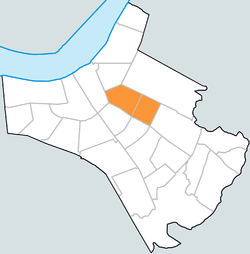
 Bangi-dong within Songpa-gu | |
| Country | South Korea |
| Area | |
| • Total | 1.3 km2 (0.5 sq mi) |
| Population (2013)
[1] | |
| • Total | 42,445 |
| • Density | 33,000/km2 (85,000/sq mi) |
Bangi-dong is a neighbourhood, dong of Songpa-gu, Seoul, South Korea. [2] [3]
Bangidong has a historical origin dating back to 1636 during the Joseon Dynasty, in the 14th year of King Injo. At that time, amidst the Manchu invasions, King Injo sought refuge in Namhansanseong fortress. The village, then known as Bangigol, played a significant role in defending against Qing soldiers attempting to advance towards Namhansanseong. Local defenders repelled the invaders by shooting arrows and hurling stones from the mountain slopes, thus earning the name "Bangigol," which translates to "blocking the barbarians."
Around 1914, scholars at the village's school reinterpreted the characters in the name: changing "bang" (방) from "defense" to "fragrant," and "i" (이) from "barbarian" to "white mugwort." This led to the renaming of the village as Bangigol. The area was also noted for its snug terrain and abundant rhododendron flowers, which contributed to its distinctive name.
Historically, Bangidong belonged to Bangi-ri in Jungdae-myeon, Gwangju-gun, Gyeonggi-do province during the Joseon Dynasty. During the Japanese colonial period, administrative changes in 1914 led to the incorporation of Bangigol and neighboring strongholds like Utmal and Geonneomal into Bangi-ri. In subsequent years, due to the expansion of Seoul's districts, Bangidong was successively annexed to Seongdong-gu in 1963, Gangnam-gu in 1975 following Presidential Decree No. 7816, and later to Gangdong-gu in 1979. With the establishment of Songpa-gu from Gangdong-gu in 1988, Bangidong remains within its current administrative boundaries in Seoul.
Korea National Sport University is located there, next to Olympic Park.
Schools located in Bangi-dong:
- Seoul Bangi Elementary School
- Seoul Bangsan Elementary School
- Bangi Middle School
- Bangsan Middle School
- Bangsan High School
- ^ "상세보기 < 최근인구현황(주민등록인구) < 송파통계 < 행정자료 < 행정정보 < 송파구청". Archived from the original on 2017-09-13. Retrieved 2013-09-17.
- ^ "방이동 (Bangi-dong 芳荑洞)" (in Korean). Doosan Encyclopedia. Retrieved 2008-04-15.[ permanent dead link]
- ^ "The origin of the name and timetable of Bangi-dong (동명 유래/연혁)" (in Korean). Bangi 1-dong resident center. Retrieved 2008-04-15.
- (in Korean) Bangi 1-dong resident center website Archived 2014-10-16 at the Wayback Machine
- Songpa-gu map[ permanent dead link]
37°30′58″N 127°07′19″E / 37.516°N 127.122°E
Bangi-dong | |
|---|---|
| Korean transcription(s) | |
| • Hangul | 방이동 |
| • Hanja | 芳 荑 洞 |
| • Revised Romanization | Bang(-)i-dong |
| • McCune–Reischauer | Pangi-tong |

Olympic Park, Seoul located in Bangi-dong | |
 Bangi-dong within Songpa-gu | |
| Country | South Korea |
| Area | |
| • Total | 1.3 km2 (0.5 sq mi) |
| Population (2013)
[1] | |
| • Total | 42,445 |
| • Density | 33,000/km2 (85,000/sq mi) |
Bangi-dong is a neighbourhood, dong of Songpa-gu, Seoul, South Korea. [2] [3]
Bangidong has a historical origin dating back to 1636 during the Joseon Dynasty, in the 14th year of King Injo. At that time, amidst the Manchu invasions, King Injo sought refuge in Namhansanseong fortress. The village, then known as Bangigol, played a significant role in defending against Qing soldiers attempting to advance towards Namhansanseong. Local defenders repelled the invaders by shooting arrows and hurling stones from the mountain slopes, thus earning the name "Bangigol," which translates to "blocking the barbarians."
Around 1914, scholars at the village's school reinterpreted the characters in the name: changing "bang" (방) from "defense" to "fragrant," and "i" (이) from "barbarian" to "white mugwort." This led to the renaming of the village as Bangigol. The area was also noted for its snug terrain and abundant rhododendron flowers, which contributed to its distinctive name.
Historically, Bangidong belonged to Bangi-ri in Jungdae-myeon, Gwangju-gun, Gyeonggi-do province during the Joseon Dynasty. During the Japanese colonial period, administrative changes in 1914 led to the incorporation of Bangigol and neighboring strongholds like Utmal and Geonneomal into Bangi-ri. In subsequent years, due to the expansion of Seoul's districts, Bangidong was successively annexed to Seongdong-gu in 1963, Gangnam-gu in 1975 following Presidential Decree No. 7816, and later to Gangdong-gu in 1979. With the establishment of Songpa-gu from Gangdong-gu in 1988, Bangidong remains within its current administrative boundaries in Seoul.
Korea National Sport University is located there, next to Olympic Park.
Schools located in Bangi-dong:
- Seoul Bangi Elementary School
- Seoul Bangsan Elementary School
- Bangi Middle School
- Bangsan Middle School
- Bangsan High School
- ^ "상세보기 < 최근인구현황(주민등록인구) < 송파통계 < 행정자료 < 행정정보 < 송파구청". Archived from the original on 2017-09-13. Retrieved 2013-09-17.
- ^ "방이동 (Bangi-dong 芳荑洞)" (in Korean). Doosan Encyclopedia. Retrieved 2008-04-15.[ permanent dead link]
- ^ "The origin of the name and timetable of Bangi-dong (동명 유래/연혁)" (in Korean). Bangi 1-dong resident center. Retrieved 2008-04-15.
- (in Korean) Bangi 1-dong resident center website Archived 2014-10-16 at the Wayback Machine
- Songpa-gu map[ permanent dead link]
37°30′58″N 127°07′19″E / 37.516°N 127.122°E
