Photos • Location
Banghak-dong | |
|---|---|
| Korean transcription(s) | |
| • Hangul | 방학동 |
| • Hanja | 放 鶴 洞 |
| • Revised Romanization | Banghak-dong |
| • McCune–Reischauer | Panghak-tong |
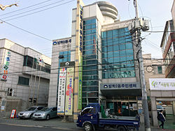
 Banghakjei-dong Community Service Center | |
 | |
| Country | South Korea |
| Area | |
| • Total | 4.07 km2 (1.57 sq mi) |
| Population (2010)
[1] | |
| • Total | 89,855 |
| • Density | 22,000/km2 (57,000/sq mi) |
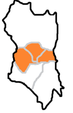
Banghak-dong is a dong, neighbourhood of Dobong-gu in Seoul, South Korea. [1] [2]
References
- ^ a b 동별 인구현황 (in Korean). Dobong-gu official site. Retrieved 2011-02-20.[ permanent dead link]
- ^ Kim Il-woo (2007-10-13). "The origin of the dongs in Dobong-gu" (in Korean). Dobong-gu official site. Retrieved 2008-04-17.[ permanent dead link]
External links
37°40′01″N 127°02′02″E / 37.667°N 127.034°E
Banghak-dong | |
|---|---|
| Korean transcription(s) | |
| • Hangul | 방학동 |
| • Hanja | 放 鶴 洞 |
| • Revised Romanization | Banghak-dong |
| • McCune–Reischauer | Panghak-tong |
 Banghakjei-dong Community Service Center | |
 | |
| Country | South Korea |
| Area | |
| • Total | 4.07 km2 (1.57 sq mi) |
| Population (2010)
[1] | |
| • Total | 89,855 |
| • Density | 22,000/km2 (57,000/sq mi) |
Banghak-dong is a dong, neighbourhood of Dobong-gu in Seoul, South Korea. [1] [2]
References
- ^ a b 동별 인구현황 (in Korean). Dobong-gu official site. Retrieved 2011-02-20.[ permanent dead link]
- ^ Kim Il-woo (2007-10-13). "The origin of the dongs in Dobong-gu" (in Korean). Dobong-gu official site. Retrieved 2008-04-17.[ permanent dead link]
External links
37°40′01″N 127°02′02″E / 37.667°N 127.034°E