Photos • Location

Ballylinney Road

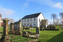
Ballylinney or Ballylinny (from Irish Baile Linne, meaning 'homestead of the pond') [1] is a small village and townland near Ballyclare in County Antrim, Northern Ireland. It is part of Antrim and Newtownabbey Borough Council.
Schools
The closest local school is called Thompson Primary School.
Churches
See also
References
- ^ Placenames NI Archived 2012-03-31 at the Wayback Machine
External links
54°44′13″N 5°59′50″W / 54.73694°N 5.99722°W
