You can help expand this article with text translated from
the corresponding article in Indonesian. (January 2018) Click [show] for important translation instructions.
|
Bajawa | |
|---|---|
 Bajawa | |
Location in
Indonesia | |
| Coordinates: 8°48′29″S 120°57′22″E / 8.80806°S 120.95611°E | |
| Country | Indonesia |
| Region | Lesser Sunda Islands |
| Province | East Nusa Tenggara |
| Regency | Ngada |
| Population (mid 2023 estimate) | |
| • Total | 40,259 |
| [1] | |
| Time zone | UTC+8 ( WITA) |
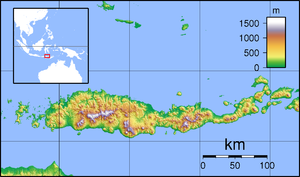
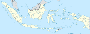
Bajawa is a town of Flores, Indonesia, and the capital of the Ngada Regency. Ngada Regency is part of East Nusa Tenggara province and located to the east of Ruteng.
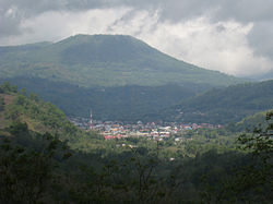
Bajawa features natural hot springs which are used for bathing [2] and volcanic scenery [3] due to the proximity of the Inierie volcano some 10 km to the south. [4] The population is primarily Roman Catholic.
Bajawa district
Bajawa district has 28 villages: [5]
- Bajawa
- Beiwali
- Beja
- Bela
- Bolonga
- Bomari
- Boradho
- Borani
- Bowali
- Faobata
- Jawameze
- Kisanata
- Langagedha
- Langagedha I
- Lebijaga
- Mukuvoka
- Naru (Natu)
- Ngadhamana
- Ngedukelu
- Ngoranale
- Pape
- Susu
- Tanalodu
- Trikora
- Ubedolumolo
- Ubedolumolo II
- Ubedolumolo Satu
- Waowae
Transportation
The town is served by two minor airports:
Climate
Bajawa has a cool tropical savanna climate (Aw) with moderate to little rainfall from May to October and heavy to very heavy rainfall from November to April.
| Climate data for Bajawa | |||||||||||||
|---|---|---|---|---|---|---|---|---|---|---|---|---|---|
| Month | Jan | Feb | Mar | Apr | May | Jun | Jul | Aug | Sep | Oct | Nov | Dec | Year |
| Mean daily maximum °C (°F) | 24.9 (76.8) |
24.6 (76.3) |
24.9 (76.8) |
25.2 (77.4) |
24.6 (76.3) |
23.9 (75.0) |
23.7 (74.7) |
24.1 (75.4) |
25.2 (77.4) |
26.2 (79.2) |
26.1 (79.0) |
25.4 (77.7) |
24.9 (76.8) |
| Daily mean °C (°F) | 20.2 (68.4) |
20.1 (68.2) |
20.2 (68.4) |
20.2 (68.4) |
19.6 (67.3) |
18.8 (65.8) |
18.2 (64.8) |
18.3 (64.9) |
19.3 (66.7) |
20.4 (68.7) |
20.9 (69.6) |
20.6 (69.1) |
19.7 (67.5) |
| Mean daily minimum °C (°F) | 15.6 (60.1) |
15.6 (60.1) |
15.5 (59.9) |
15.2 (59.4) |
14.6 (58.3) |
13.7 (56.7) |
12.7 (54.9) |
12.5 (54.5) |
13.4 (56.1) |
14.7 (58.5) |
15.8 (60.4) |
15.8 (60.4) |
14.6 (58.3) |
| Average rainfall mm (inches) | 376 (14.8) |
308 (12.1) |
257 (10.1) |
130 (5.1) |
86 (3.4) |
33 (1.3) |
49 (1.9) |
26 (1.0) |
20 (0.8) |
80 (3.1) |
170 (6.7) |
300 (11.8) |
1,835 (72.1) |
| Source: Climate-Data.org [6] | |||||||||||||
References
- ^ Badan Pusat Statistik, Jakarta, 28 February 2024, Kabupaten Ngada Dalam Angka 2024 (Katalog-BPS 1102001.5309)
- ^ Kim "kcheepv". "Ruteng to Bajawa by car". GLOBOsapiens.net. Retrieved 2 July 2010.
- ^ Moxon, Mark. "Indonesia: Bajawa". Retrieved 2 July 2010.
- ^ "Bajawa, map". google.com/maps.
- ^ "List of places (villages) in Bajawa district, Ngada regency". m.nomor.net. Retrieved 2024-06-09.
- ^ "Climate: Bajawa". Climate-Data.org. Retrieved 18 November 2020.
External links
You can help expand this article with text translated from
the corresponding article in Indonesian. (January 2018) Click [show] for important translation instructions.
|
Bajawa | |
|---|---|
 Bajawa | |
Location in
Indonesia | |
| Coordinates: 8°48′29″S 120°57′22″E / 8.80806°S 120.95611°E | |
| Country | Indonesia |
| Region | Lesser Sunda Islands |
| Province | East Nusa Tenggara |
| Regency | Ngada |
| Population (mid 2023 estimate) | |
| • Total | 40,259 |
| [1] | |
| Time zone | UTC+8 ( WITA) |
Bajawa is a town of Flores, Indonesia, and the capital of the Ngada Regency. Ngada Regency is part of East Nusa Tenggara province and located to the east of Ruteng.
Bajawa features natural hot springs which are used for bathing [2] and volcanic scenery [3] due to the proximity of the Inierie volcano some 10 km to the south. [4] The population is primarily Roman Catholic.
Bajawa district
Bajawa district has 28 villages: [5]
- Bajawa
- Beiwali
- Beja
- Bela
- Bolonga
- Bomari
- Boradho
- Borani
- Bowali
- Faobata
- Jawameze
- Kisanata
- Langagedha
- Langagedha I
- Lebijaga
- Mukuvoka
- Naru (Natu)
- Ngadhamana
- Ngedukelu
- Ngoranale
- Pape
- Susu
- Tanalodu
- Trikora
- Ubedolumolo
- Ubedolumolo II
- Ubedolumolo Satu
- Waowae
Transportation
The town is served by two minor airports:
Climate
Bajawa has a cool tropical savanna climate (Aw) with moderate to little rainfall from May to October and heavy to very heavy rainfall from November to April.
| Climate data for Bajawa | |||||||||||||
|---|---|---|---|---|---|---|---|---|---|---|---|---|---|
| Month | Jan | Feb | Mar | Apr | May | Jun | Jul | Aug | Sep | Oct | Nov | Dec | Year |
| Mean daily maximum °C (°F) | 24.9 (76.8) |
24.6 (76.3) |
24.9 (76.8) |
25.2 (77.4) |
24.6 (76.3) |
23.9 (75.0) |
23.7 (74.7) |
24.1 (75.4) |
25.2 (77.4) |
26.2 (79.2) |
26.1 (79.0) |
25.4 (77.7) |
24.9 (76.8) |
| Daily mean °C (°F) | 20.2 (68.4) |
20.1 (68.2) |
20.2 (68.4) |
20.2 (68.4) |
19.6 (67.3) |
18.8 (65.8) |
18.2 (64.8) |
18.3 (64.9) |
19.3 (66.7) |
20.4 (68.7) |
20.9 (69.6) |
20.6 (69.1) |
19.7 (67.5) |
| Mean daily minimum °C (°F) | 15.6 (60.1) |
15.6 (60.1) |
15.5 (59.9) |
15.2 (59.4) |
14.6 (58.3) |
13.7 (56.7) |
12.7 (54.9) |
12.5 (54.5) |
13.4 (56.1) |
14.7 (58.5) |
15.8 (60.4) |
15.8 (60.4) |
14.6 (58.3) |
| Average rainfall mm (inches) | 376 (14.8) |
308 (12.1) |
257 (10.1) |
130 (5.1) |
86 (3.4) |
33 (1.3) |
49 (1.9) |
26 (1.0) |
20 (0.8) |
80 (3.1) |
170 (6.7) |
300 (11.8) |
1,835 (72.1) |
| Source: Climate-Data.org [6] | |||||||||||||
References
- ^ Badan Pusat Statistik, Jakarta, 28 February 2024, Kabupaten Ngada Dalam Angka 2024 (Katalog-BPS 1102001.5309)
- ^ Kim "kcheepv". "Ruteng to Bajawa by car". GLOBOsapiens.net. Retrieved 2 July 2010.
- ^ Moxon, Mark. "Indonesia: Bajawa". Retrieved 2 July 2010.
- ^ "Bajawa, map". google.com/maps.
- ^ "List of places (villages) in Bajawa district, Ngada regency". m.nomor.net. Retrieved 2024-06-09.
- ^ "Climate: Bajawa". Climate-Data.org. Retrieved 18 November 2020.

