Bahrenborstel | |
|---|---|
 Coat of arms | |
Location of Bahrenborstel within Diepholz district 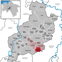 | |
 Bahrenborstel  Bahrenborstel | |
| Coordinates: 52°34′N 08°49′E / 52.567°N 8.817°E | |
| Country | Germany |
| State | Lower Saxony |
| District | Diepholz |
| Municipal assoc. | Kirchdorf |
| Government | |
| • Mayor | Heinz Albers |
| Area | |
| • Total | 31.27 km2 (12.07 sq mi) |
| Elevation | 44 m (144 ft) |
| Population (2022-12-31)
[1] | |
| • Total | 1,105 |
| • Density | 35/km2 (92/sq mi) |
| Time zone | UTC+01:00 ( CET) |
| • Summer ( DST) | UTC+02:00 ( CEST) |
| Postal codes | 27245 |
| Dialling codes | 04273 |
| Vehicle registration | DH |
Bahrenborstel is a municipality in the district of Diepholz, in Lower Saxony, Germany.
It lies between the Dümmer Nature Park and the Steinhuder Nature Park, and roughly between Bremen and Minden. Approximately 7 km south of the community is the Great Moor. A few kilometers northwest runs a section of the Great Aue.
References

| International | |
|---|---|
| National | |
|
| This Diepholz district location article is a stub. You can help Wikipedia by expanding it. |
Bahrenborstel | |
|---|---|
|
Coat of arms | |
Location of Bahrenborstel within Diepholz district | |
Bahrenborstel Bahrenborstel | |
| Coordinates: 52°34′N 08°49′E / 52.567°N 8.817°E | |
| Country | Germany |
| State | Lower Saxony |
| District | Diepholz |
| Municipal assoc. | Kirchdorf |
| Government | |
| • Mayor | Heinz Albers |
| Area | |
| • Total | 31.27 km2 (12.07 sq mi) |
| Elevation | 44 m (144 ft) |
| Population (2022-12-31)
[1] | |
| • Total | 1,105 |
| • Density | 35/km2 (92/sq mi) |
| Time zone | UTC+01:00 ( CET) |
| • Summer ( DST) | UTC+02:00 ( CEST) |
| Postal codes | 27245 |
| Dialling codes | 04273 |
| Vehicle registration | DH |
Bahrenborstel is a municipality in the district of Diepholz, in Lower Saxony, Germany.
It lies between the Dümmer Nature Park and the Steinhuder Nature Park, and roughly between Bremen and Minden. Approximately 7 km south of the community is the Great Moor. A few kilometers northwest runs a section of the Great Aue.
References
| International | |
|---|---|
| National | |
|
| This Diepholz district location article is a stub. You can help Wikipedia by expanding it. |