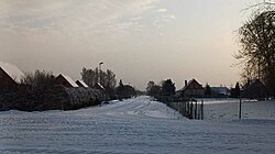
Audrupi | |
|---|---|
Hamlet | |
 | |
| Coordinates: 56°34′27″N 24°14′53″E / 56.57417°N 24.24806°E | |
| Country | Latvia |
| Municipality | Bauska Municipality |
| Parish | Iecava Parish |
| Area | |
| • Land | 0.46 km2 (0.18 sq mi) |
| Elevation | 24 m (79 ft) |
| Population (2021) | |
| • Total | 94 |
| ZIP Code | LV-3913 |
Audrupi (formerly also Sosti) is a hamlet in Bauska municipality.
It is located in the middle part of the Iecava parish, 4.6 km from the parish center Iecava, 23.9 km from the municipality center Bauska and 49 km from Riga.
The settlement was established in the post-war years as a village near a large dairy farm.
Population
Within the existing limits, according to CSB and OSP data.
|
|
References
- ^ "Iedzīvotāji pēc dzimuma un vecuma grupām reģionos, novados, pilsētās, pagastos, ciemos (atbilstoši robežām 2023. gada sākumā), apkaimēs un blīvi apdzīvotās teritorijās (eksperimentālā statistika) 2000 - 2023". Oficiālās statistikas portāls (in Latvian). Retrieved 2023-12-03.
56°34′27″N 24°14′53″E / 56.5742°N 24.2481°E
Audrupi | |
|---|---|
Hamlet | |
 | |
| Coordinates: 56°34′27″N 24°14′53″E / 56.57417°N 24.24806°E | |
| Country | Latvia |
| Municipality | Bauska Municipality |
| Parish | Iecava Parish |
| Area | |
| • Land | 0.46 km2 (0.18 sq mi) |
| Elevation | 24 m (79 ft) |
| Population (2021) | |
| • Total | 94 |
| ZIP Code | LV-3913 |
Audrupi (formerly also Sosti) is a hamlet in Bauska municipality.
It is located in the middle part of the Iecava parish, 4.6 km from the parish center Iecava, 23.9 km from the municipality center Bauska and 49 km from Riga.
The settlement was established in the post-war years as a village near a large dairy farm.
Population
Within the existing limits, according to CSB and OSP data.
|
|
References
- ^ "Iedzīvotāji pēc dzimuma un vecuma grupām reģionos, novados, pilsētās, pagastos, ciemos (atbilstoši robežām 2023. gada sākumā), apkaimēs un blīvi apdzīvotās teritorijās (eksperimentālā statistika) 2000 - 2023". Oficiālās statistikas portāls (in Latvian). Retrieved 2023-12-03.
56°34′27″N 24°14′53″E / 56.5742°N 24.2481°E
