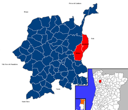
Photos • Location
Atães e Rendufe | |
|---|---|
| Coordinates: 41°28′01″N 8°14′42″W / 41.467°N 8.245°W | |
| Country | |
| Region | Norte |
| Intermunic. comm. | Ave |
| District | Braga |
| Municipality | Guimarães |
| Area | |
| • Total | 12.09 km2 (4.67 sq mi) |
| Population (2021) | |
| • Total | 2,580 |
| • Density | 210/km2 (550/sq mi) |
| Time zone | UTC±00:00 ( WET) |
| • Summer ( DST) | UTC+01:00 ( WEST) |
Atães e Rendufe (officially: União das Freguesias de Atães e Rendufe) is a civil parish in the municipality of Guimarães, Portugal. [1] It was formed in 2013 by the merger of the former parishes Atães and Rendufe. The population in 2021 was 2,580, [2] in an area of 12.09 km2.
-
Atães coat of arms
- ^ "União de Freguesias Atães e Rendufe". freguesia-ataes.pt. Retrieved 3 January 2022.
- ^ "Resultados Provisorios". Censos 2021. Retrieved 30 December 2021.


