Photos • Location

(Redirected from
Arroyo Pando)
| Pando Creek | |
|---|---|
 | |
| Location | |
| Country | Uruguay |
| Physical characteristics | |
| Length | 28 kilometres (17 mi) |
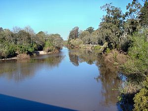
Pando Creek ( Spanish: Arroyo Pando) is a Uruguayan stream, crossing Canelones Department. It flows into the Río de la Plata. Its name derives from the nearby city of Pando.
See also
References
Wikimedia Commons has media related to
Arroyo Pando.
34°48′S 55°52′W / 34.800°S 55.867°W
(Redirected from
Arroyo Pando)
| Pando Creek | |
|---|---|
 | |
| Location | |
| Country | Uruguay |
| Physical characteristics | |
| Length | 28 kilometres (17 mi) |
Pando Creek ( Spanish: Arroyo Pando) is a Uruguayan stream, crossing Canelones Department. It flows into the Río de la Plata. Its name derives from the nearby city of Pando.
See also
References
Wikimedia Commons has media related to
Arroyo Pando.
34°48′S 55°52′W / 34.800°S 55.867°W