Arlington, Alabama | |
|---|---|
 Downtown Arlington, Alabama | |
 Arlington, Alabama Location within the state of Alabama  Arlington, Alabama Arlington, Alabama (the United States) | |
| Coordinates: 32°3′25.53″N 87°35′19.01″W / 32.0570917°N 87.5886139°W | |
| Country | United States |
| State | Alabama |
| County | Wilcox |
| Elevation | 194 ft (59 m) |
| Time zone | UTC-6 ( Central (CST)) |
| • Summer ( DST) | UTC-5 (CDT) |
| ZIP code | 36722 |
| Area code | 334 |
Arlington, originally known as Dumas Store, is an unincorporated community in Wilcox County, Alabama, United States. [1]
Geography
Arlington is located at 32°03′26″N 87°35′19″W / 32.05709°N 87.5886°W and has an elevation of 194 feet (59 m). [1]
Demographics
According to the returns from 1850 [2]-2010 [3] for Alabama, it has never reported a population figure separately on the U.S. Census. [4]
References
- ^ a b U.S. Geological Survey Geographic Names Information System: Arlington, Alabama
- ^ 1850 Census (places)[ permanent dead link]
- ^ 2010 AL Census
-
^
"Archived copy". Archived from
the original on March 11, 2014. Retrieved November 7, 2019.
{{
cite web}}
: CS1 maint: archived copy as title ( link)
Municipalities and communities of
Wilcox County, Alabama, United States | ||
|---|---|---|
| City | 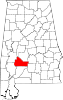 | |
| Towns | ||
| CDPs | ||
|
Unincorporated communities | ||
| Ghost towns | ||
|
| This Wilcox County, Alabama state location article is a stub. You can help Wikipedia by expanding it. |
Arlington, Alabama | |
|---|---|
|
Downtown Arlington, Alabama | |
Arlington, Alabama Location within the state of Alabama Arlington, Alabama Arlington, Alabama (the United States) | |
| Coordinates: 32°3′25.53″N 87°35′19.01″W / 32.0570917°N 87.5886139°W | |
| Country | United States |
| State | Alabama |
| County | Wilcox |
| Elevation | 194 ft (59 m) |
| Time zone | UTC-6 ( Central (CST)) |
| • Summer ( DST) | UTC-5 (CDT) |
| ZIP code | 36722 |
| Area code | 334 |
Arlington, originally known as Dumas Store, is an unincorporated community in Wilcox County, Alabama, United States. [1]
Geography
Arlington is located at 32°03′26″N 87°35′19″W / 32.05709°N 87.5886°W and has an elevation of 194 feet (59 m). [1]
Demographics
According to the returns from 1850 [2]-2010 [3] for Alabama, it has never reported a population figure separately on the U.S. Census. [4]
References
- ^ a b U.S. Geological Survey Geographic Names Information System: Arlington, Alabama
- ^ 1850 Census (places)[ permanent dead link]
- ^ 2010 AL Census
-
^
"Archived copy". Archived from
the original on March 11, 2014. Retrieved November 7, 2019.
{{
cite web}}
: CS1 maint: archived copy as title ( link)
Municipalities and communities of
Wilcox County, Alabama, United States | ||
|---|---|---|
| City | | |
| Towns | ||
| CDPs | ||
|
Unincorporated communities | ||
| Ghost towns | ||
|
| This Wilcox County, Alabama state location article is a stub. You can help Wikipedia by expanding it. |