Arkana, Louisiana | |
|---|---|
 Arkana, Louisiana  Arkana, Louisiana | |
| Coordinates: 33°01′06″N 93°40′29″W / 33.01833°N 93.67472°W | |
| Country | United States |
| State | Louisiana |
| Parish | Bossier |
| Elevation | 244 ft (74 m) |
| Time zone | UTC-6 ( Central (CST)) |
| • Summer ( DST) | UTC-5 (CDT) |
| Area code | 318 |
| GNIS feature ID | 541047 [1] |
Arkana was a former town that crossed the state lines between Louisiana and Arkansas in the United States, although mostly lying in the latter state. [2]
In the 1890s, Arkana was described as a new railroad town, and was later the site of a rail station, lumber mill, church, post office, and school. The community was also the site of the Arkana and Eastern Railroad Company, a rail line which operated between Arkana and Springhill in the early 20th century.
Arkana was named "ark-" plus "-ana" from "Louisiana" and "Arkansas". [3] [2]
The community was at altitude 244 feet (74 m) and in the 1940s had a population of 50 people. [2]

One of the early settlers of Arkana was Jackson Clark Byram, who established a homestead in 1848. [4] He was the veteran of three wars and had a large family. [5]
Arkana was originally a rail station on the Cotton Belt Route (the St. Louis Southwestern Railway), [6] a major railroad connecting the US states of Missouri, Arkansas, Tennessee, Louisiana, and Texas. [7] A sawmill owned by the Arkana Lumber Company operated in Arkana until 1899, when it burned, at a loss of $45,000. [8] This was one of several sawmill fires in Arkana; an earlier fire had occurred in 1892. [9]
By the 1890s, a history of northwestern Louisiana called Arkana "a new railroad town", [10] and in 1912, the Bossier City Banner described Arkana as a "place and community". [11] The population of Arkana was 12 in 1900. [12]
A tract of 4,000 acres was platted for the Arkana townsite in 1915, with plans for small parcels to be sold to settlers. [13] Arkana was soon home to several stores, a church and a post office. [14] The Arkana townsite was developed by the Cotton Belt Land and Development Company, headquartered in Indianapolis, Indiana. [15]

Arkana was also the site of the Arkana and Eastern Railroad Company, a short rail line which operated between the communities of Arkana and Springhill in the late 19th and early 20th century. [16] [17]
The Burton Lumber Company operated a lumber mill in Arkana during the 1920s and 1930s. [18] [19] Portions of the Burton Mill caught fire on five occasions in 1922. [20]
Circa 1920, the community of Arkana was the site of the Arkana School. [21] The population of Arkana in 1920 was 63. [22]
In April 1936, Louisiana Highway 10 (now Louisiana Highway 3) between Arkana and Plain Dealing was completed. It was reported that "Arkana will have a good road leading both north and south." [23]
Arkana's population in 1940 was 63. [24] In 1952, The Plain Dealing Progress reported that the hard surface road between Hope, Arkansas, and Arkana had been extended. [25]
In 1980, it was reported that the Crystal Oil and Land Company was pumping over 2 million cubic feet of gas per day from a site 0.5 miles (0.80 km) southwest of what had become known as "the old Arkana townsite." [26] [27]
- ^ "Geographic Names Information System". edits.nationalmap.gov. Archived from the original on December 12, 2023. Retrieved November 29, 2023.
- ^ a b c FWP 1941, p. 635.
- ^ Leeper 2012, p. 20.
- ^ "Byram Family Holds Biennial Reunion Near Ida". The Madison Journal. August 5, 1966. Retrieved November 29, 2023 – via Newspapers.com.
- ^ "125 Descendants Of Pioneer Local Family Stage Reunion". Bossier Tribune. July 20, 1966. Archived from the original on December 11, 2023. Retrieved November 29, 2023 – via Newspapers.com.
-
^
The Official Guide of the Railways and Steam Navigation Lines of the United States, Porto Rico, Canada, Mexico and Cuba. National Railway Publication Company. 1910.
Archived from the original on December 12, 2023. Retrieved November 29, 2023.
{{
cite book}}
: CS1 maint: date and year ( link) - ^ "The Cotton Belt Route Story". arkansasrailroadmuseum.org. Archived from the original on December 12, 2023. Retrieved December 1, 2023.
-
^
Fire and Water. New York, NY: F. W. Shepperd. 1899. pp. 197–198.
Archived from the original on December 15, 2023. Retrieved November 29, 2023.
{{
cite book}}
: CS1 maint: date and year ( link) - ^ "Untitled". Bossier Banner-Progress. Benton, LA. February 4, 1892. p. 2. Archived from the original on December 12, 2023. Retrieved November 29, 2023.
-
^
Biographical and Historical Memoirs of Northwest Louisiana: Comprising a Large Fund of Biography of Actual Residents, and an Interesting Historical Sketch of Thirteen Counties. Chicago, IL: Southern Publishing Company. 1890. p. 122.
Archived from the original on December 15, 2023. Retrieved November 29, 2023.
{{
cite book}}
: CS1 maint: date and year ( link) - ^ "Arkana". The Bossier Banner. Bellevue, LA. August 1, 1912. Retrieved November 28, 2023.
- ^ "Image 280 of Dun and Bradstreet Reference Book: March, 1901; Vol. 132, part 1". Library of Congress, Washington, D.C. 20540 USA. Archived from the original on December 29, 2023. Retrieved November 29, 2023.
-
^
The Lumber Trade Journal. 1915. p. 36.
Archived from the original on December 29, 2023. Retrieved December 1, 2023.
{{
cite book}}
: CS1 maint: date and year ( link) - ^ "The Towns in Bossier Parish Were Named By Early Settlers" (PDF). Ark-La-Tex Genealogical Association. 1990. Archived (PDF) from the original on December 15, 2023. Retrieved November 29, 2023.
- ^ "Visit of Indiana Party to This City Will be of Value, Says Mr. Bolinger". The Times. Shreveport, LA. June 6, 1915. p. 6. Archived from the original on December 29, 2023. Retrieved December 1, 2023.
- ^ Bruner, E.O. (1912). A Hand-book of Louisiana: Giving General and Agricultural Features, together with Crops that can be Grown. Description of each Parish, Climate, Health, Education, Industries, Railroads, Water-Courses, Forestry, Etc (PDF). Baton Rouge, LA: Louisiana State Board of Agriculture and Immigration. p. 33. Archived (PDF) from the original on December 15, 2023. Retrieved November 29, 2023.
- ^ "Arkana & Eastern Railroad Company (La.), Map Showing Route in 1907". ttarchive.com. Archived from the original on October 4, 2022. Retrieved November 29, 2023.
- ^ Southern Lumberman Directory of Southern Saw Mills (PDF). 1934. p. 189. Archived (PDF) from the original on December 11, 2023. Retrieved November 29, 2023.
- ^ The Lumber Manufacturer and Dealer. Kriechbaum Publishing Company. 1925. p. 30c. Archived from the original on December 12, 2023. Retrieved November 29, 2023.
- ^ "Around Arkana". The Bossier Banner. Bellevue, LA. October 25, 1922. p. 1. Archived from the original on December 29, 2023. Retrieved November 29, 2023.
- ^ "Arkana". The Bossier Banner. April 1, 1920. p. 3. Archived from the original on December 29, 2023. Retrieved November 29, 2023.
- ^ Premier Atlas of the World. New York: Rand McNally and Company. 1925. p. 198.
- ^ "Arkana News". Bossier Banner-Progress. April 19, 1936. p. 2. Archived from the original on December 29, 2023. Retrieved November 29, 2023.
- ^ The Attorneys List. United States Fidelity and Guaranty Company, Attorney List Department. 1940. p. 85. Archived from the original on November 3, 2022. Retrieved November 29, 2023.
- ^ Phillips, F. G. (March 27, 1952). "Mid-Century Plain Dealing". The Plain Dealing Progress. Archived from the original on December 15, 2023. Retrieved November 29, 2023 – via Newspapers.com.
- ^ "Completions". The Times. Shreveport, LA. May 4, 1980. p. 62. Archived from the original on December 29, 2023. Retrieved November 29, 2023.
- ^ "New pay indicated in Bossier". The Times. Shreveport, LA. January 27, 1980. p. 56. Archived from the original on December 29, 2023. Retrieved November 29, 2023.
- Federal Writers' Project (1941). Louisiana: A Guide to the State. Baton Rouge: Hastings.
- Leeper, Clare D'Artois (October 19, 2012). Louisiana Place Names: Popular, Unusual, and Forgotten Stories of Towns, Cities, Plantations, Bayous, and Even Some Cemeteries. LSU Press. ISBN 978-0-8071-4740-5.
Municipalities and communities of
Bossier Parish, Louisiana, United States | ||
|---|---|---|
| Cities | 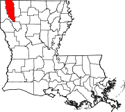 | |
| Towns | ||
| CDPs | ||
|
Other communities |
| |
| Footnotes | ‡This populated place also has portions in an adjacent parish or parishes | |
Arkana, Louisiana | |
|---|---|
Arkana, Louisiana Arkana, Louisiana | |
| Coordinates: 33°01′06″N 93°40′29″W / 33.01833°N 93.67472°W | |
| Country | United States |
| State | Louisiana |
| Parish | Bossier |
| Elevation | 244 ft (74 m) |
| Time zone | UTC-6 ( Central (CST)) |
| • Summer ( DST) | UTC-5 (CDT) |
| Area code | 318 |
| GNIS feature ID | 541047 [1] |
Arkana was a former town that crossed the state lines between Louisiana and Arkansas in the United States, although mostly lying in the latter state. [2]
In the 1890s, Arkana was described as a new railroad town, and was later the site of a rail station, lumber mill, church, post office, and school. The community was also the site of the Arkana and Eastern Railroad Company, a rail line which operated between Arkana and Springhill in the early 20th century.
Arkana was named "ark-" plus "-ana" from "Louisiana" and "Arkansas". [3] [2]
The community was at altitude 244 feet (74 m) and in the 1940s had a population of 50 people. [2]
One of the early settlers of Arkana was Jackson Clark Byram, who established a homestead in 1848. [4] He was the veteran of three wars and had a large family. [5]
Arkana was originally a rail station on the Cotton Belt Route (the St. Louis Southwestern Railway), [6] a major railroad connecting the US states of Missouri, Arkansas, Tennessee, Louisiana, and Texas. [7] A sawmill owned by the Arkana Lumber Company operated in Arkana until 1899, when it burned, at a loss of $45,000. [8] This was one of several sawmill fires in Arkana; an earlier fire had occurred in 1892. [9]
By the 1890s, a history of northwestern Louisiana called Arkana "a new railroad town", [10] and in 1912, the Bossier City Banner described Arkana as a "place and community". [11] The population of Arkana was 12 in 1900. [12]
A tract of 4,000 acres was platted for the Arkana townsite in 1915, with plans for small parcels to be sold to settlers. [13] Arkana was soon home to several stores, a church and a post office. [14] The Arkana townsite was developed by the Cotton Belt Land and Development Company, headquartered in Indianapolis, Indiana. [15]
Arkana was also the site of the Arkana and Eastern Railroad Company, a short rail line which operated between the communities of Arkana and Springhill in the late 19th and early 20th century. [16] [17]
The Burton Lumber Company operated a lumber mill in Arkana during the 1920s and 1930s. [18] [19] Portions of the Burton Mill caught fire on five occasions in 1922. [20]
Circa 1920, the community of Arkana was the site of the Arkana School. [21] The population of Arkana in 1920 was 63. [22]
In April 1936, Louisiana Highway 10 (now Louisiana Highway 3) between Arkana and Plain Dealing was completed. It was reported that "Arkana will have a good road leading both north and south." [23]
Arkana's population in 1940 was 63. [24] In 1952, The Plain Dealing Progress reported that the hard surface road between Hope, Arkansas, and Arkana had been extended. [25]
In 1980, it was reported that the Crystal Oil and Land Company was pumping over 2 million cubic feet of gas per day from a site 0.5 miles (0.80 km) southwest of what had become known as "the old Arkana townsite." [26] [27]
- ^ "Geographic Names Information System". edits.nationalmap.gov. Archived from the original on December 12, 2023. Retrieved November 29, 2023.
- ^ a b c FWP 1941, p. 635.
- ^ Leeper 2012, p. 20.
- ^ "Byram Family Holds Biennial Reunion Near Ida". The Madison Journal. August 5, 1966. Retrieved November 29, 2023 – via Newspapers.com.
- ^ "125 Descendants Of Pioneer Local Family Stage Reunion". Bossier Tribune. July 20, 1966. Archived from the original on December 11, 2023. Retrieved November 29, 2023 – via Newspapers.com.
-
^
The Official Guide of the Railways and Steam Navigation Lines of the United States, Porto Rico, Canada, Mexico and Cuba. National Railway Publication Company. 1910.
Archived from the original on December 12, 2023. Retrieved November 29, 2023.
{{
cite book}}
: CS1 maint: date and year ( link) - ^ "The Cotton Belt Route Story". arkansasrailroadmuseum.org. Archived from the original on December 12, 2023. Retrieved December 1, 2023.
-
^
Fire and Water. New York, NY: F. W. Shepperd. 1899. pp. 197–198.
Archived from the original on December 15, 2023. Retrieved November 29, 2023.
{{
cite book}}
: CS1 maint: date and year ( link) - ^ "Untitled". Bossier Banner-Progress. Benton, LA. February 4, 1892. p. 2. Archived from the original on December 12, 2023. Retrieved November 29, 2023.
-
^
Biographical and Historical Memoirs of Northwest Louisiana: Comprising a Large Fund of Biography of Actual Residents, and an Interesting Historical Sketch of Thirteen Counties. Chicago, IL: Southern Publishing Company. 1890. p. 122.
Archived from the original on December 15, 2023. Retrieved November 29, 2023.
{{
cite book}}
: CS1 maint: date and year ( link) - ^ "Arkana". The Bossier Banner. Bellevue, LA. August 1, 1912. Retrieved November 28, 2023.
- ^ "Image 280 of Dun and Bradstreet Reference Book: March, 1901; Vol. 132, part 1". Library of Congress, Washington, D.C. 20540 USA. Archived from the original on December 29, 2023. Retrieved November 29, 2023.
-
^
The Lumber Trade Journal. 1915. p. 36.
Archived from the original on December 29, 2023. Retrieved December 1, 2023.
{{
cite book}}
: CS1 maint: date and year ( link) - ^ "The Towns in Bossier Parish Were Named By Early Settlers" (PDF). Ark-La-Tex Genealogical Association. 1990. Archived (PDF) from the original on December 15, 2023. Retrieved November 29, 2023.
- ^ "Visit of Indiana Party to This City Will be of Value, Says Mr. Bolinger". The Times. Shreveport, LA. June 6, 1915. p. 6. Archived from the original on December 29, 2023. Retrieved December 1, 2023.
- ^ Bruner, E.O. (1912). A Hand-book of Louisiana: Giving General and Agricultural Features, together with Crops that can be Grown. Description of each Parish, Climate, Health, Education, Industries, Railroads, Water-Courses, Forestry, Etc (PDF). Baton Rouge, LA: Louisiana State Board of Agriculture and Immigration. p. 33. Archived (PDF) from the original on December 15, 2023. Retrieved November 29, 2023.
- ^ "Arkana & Eastern Railroad Company (La.), Map Showing Route in 1907". ttarchive.com. Archived from the original on October 4, 2022. Retrieved November 29, 2023.
- ^ Southern Lumberman Directory of Southern Saw Mills (PDF). 1934. p. 189. Archived (PDF) from the original on December 11, 2023. Retrieved November 29, 2023.
- ^ The Lumber Manufacturer and Dealer. Kriechbaum Publishing Company. 1925. p. 30c. Archived from the original on December 12, 2023. Retrieved November 29, 2023.
- ^ "Around Arkana". The Bossier Banner. Bellevue, LA. October 25, 1922. p. 1. Archived from the original on December 29, 2023. Retrieved November 29, 2023.
- ^ "Arkana". The Bossier Banner. April 1, 1920. p. 3. Archived from the original on December 29, 2023. Retrieved November 29, 2023.
- ^ Premier Atlas of the World. New York: Rand McNally and Company. 1925. p. 198.
- ^ "Arkana News". Bossier Banner-Progress. April 19, 1936. p. 2. Archived from the original on December 29, 2023. Retrieved November 29, 2023.
- ^ The Attorneys List. United States Fidelity and Guaranty Company, Attorney List Department. 1940. p. 85. Archived from the original on November 3, 2022. Retrieved November 29, 2023.
- ^ Phillips, F. G. (March 27, 1952). "Mid-Century Plain Dealing". The Plain Dealing Progress. Archived from the original on December 15, 2023. Retrieved November 29, 2023 – via Newspapers.com.
- ^ "Completions". The Times. Shreveport, LA. May 4, 1980. p. 62. Archived from the original on December 29, 2023. Retrieved November 29, 2023.
- ^ "New pay indicated in Bossier". The Times. Shreveport, LA. January 27, 1980. p. 56. Archived from the original on December 29, 2023. Retrieved November 29, 2023.
- Federal Writers' Project (1941). Louisiana: A Guide to the State. Baton Rouge: Hastings.
- Leeper, Clare D'Artois (October 19, 2012). Louisiana Place Names: Popular, Unusual, and Forgotten Stories of Towns, Cities, Plantations, Bayous, and Even Some Cemeteries. LSU Press. ISBN 978-0-8071-4740-5.
Municipalities and communities of
Bossier Parish, Louisiana, United States | ||
|---|---|---|
| Cities | | |
| Towns | ||
| CDPs | ||
|
Other communities |
| |
| Footnotes | ‡This populated place also has portions in an adjacent parish or parishes | |