Antunovac | |
|---|---|
| Općina Antunovac Municipality of Antunovac | |
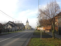
 Old church in Antunovac | |
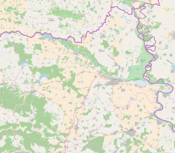
| Coordinates: 45°29′13″N 18°40′19″E / 45.487°N 18.672°E | |
| Country | |
| County |
|
| Government | |
| • Mayor | Ivan Anušić |
| Area | |
| • Municipality | 56.8 km2 (21.9 sq mi) |
| • Urban | 37.7 km2 (14.6 sq mi) |
| Population (2021)
[2] | |
| • Municipality | 3,411 |
| • Density | 60/km2 (160/sq mi) |
| • Urban | 2,036 |
| • Urban density | 54/km2 (140/sq mi) |
| Time zone | UTC+1 ( Central European Time) |
| Website |
opcina-antunovac |
Antunovac ( Hungarian: Antalfalu; German: Antonsfeld [3]) is a municipality in Osijek-Baranja County, Croatia. At the 2011 census, there were 3,703 inhabitants, 96% of them Croats. [4] The municipality consists of two villages: Antunovac (2,181 inhabitants) and Ivanovac (1,522 inhabitants). [5] Antunovac is an underdeveloped municipality which is statistically classified as part of the First Category Area of Special State Concern by the Government of Croatia. [6]
References
- ^ Register of spatial units of the State Geodetic Administration of the Republic of Croatia. Wikidata Q119585703.
- ^ "Population by Age and Sex, by Settlements, 2021 Census". Census of Population, Households and Dwellings in 2021. Zagreb: Croatian Bureau of Statistics. 2022.
- ^ Banja Luka 1941 map maps.mapywig.org
- ^ "Population by Ethnicity, by Towns/Municipalities, 2011 Census: County of Osijek-Baranja". Census of Population, Households and Dwellings 2011. Zagreb: Croatian Bureau of Statistics. December 2012.
- ^ "Population by Age and Sex, by Settlements, 2011 Census: Antunovac". Census of Population, Households and Dwellings 2011. Zagreb: Croatian Bureau of Statistics. December 2012.
- ^ Lovrinčević, Željko; Davor, Mikulić; Budak, Jelena (June 2004). "AREAS OF SPECIAL STATE CONCERN IN CROATIA- REGIONAL DEVELOPMENT DIFFERENCES AND THE DEMOGRAPHIC AND EDUCATIONAL CHARACTERISTICS". Ekonomski pregled, Vol.55 No.5-6. Archived from the original on 18 August 2018. Retrieved 25 August 2018.
External links
Antunovac | |
|---|---|
| Općina Antunovac Municipality of Antunovac | |
 Old church in Antunovac | |
| Coordinates: 45°29′13″N 18°40′19″E / 45.487°N 18.672°E | |
| Country | |
| County |
|
| Government | |
| • Mayor | Ivan Anušić |
| Area | |
| • Municipality | 56.8 km2 (21.9 sq mi) |
| • Urban | 37.7 km2 (14.6 sq mi) |
| Population (2021)
[2] | |
| • Municipality | 3,411 |
| • Density | 60/km2 (160/sq mi) |
| • Urban | 2,036 |
| • Urban density | 54/km2 (140/sq mi) |
| Time zone | UTC+1 ( Central European Time) |
| Website |
opcina-antunovac |
Antunovac ( Hungarian: Antalfalu; German: Antonsfeld [3]) is a municipality in Osijek-Baranja County, Croatia. At the 2011 census, there were 3,703 inhabitants, 96% of them Croats. [4] The municipality consists of two villages: Antunovac (2,181 inhabitants) and Ivanovac (1,522 inhabitants). [5] Antunovac is an underdeveloped municipality which is statistically classified as part of the First Category Area of Special State Concern by the Government of Croatia. [6]
References
- ^ Register of spatial units of the State Geodetic Administration of the Republic of Croatia. Wikidata Q119585703.
- ^ "Population by Age and Sex, by Settlements, 2021 Census". Census of Population, Households and Dwellings in 2021. Zagreb: Croatian Bureau of Statistics. 2022.
- ^ Banja Luka 1941 map maps.mapywig.org
- ^ "Population by Ethnicity, by Towns/Municipalities, 2011 Census: County of Osijek-Baranja". Census of Population, Households and Dwellings 2011. Zagreb: Croatian Bureau of Statistics. December 2012.
- ^ "Population by Age and Sex, by Settlements, 2011 Census: Antunovac". Census of Population, Households and Dwellings 2011. Zagreb: Croatian Bureau of Statistics. December 2012.
- ^ Lovrinčević, Željko; Davor, Mikulić; Budak, Jelena (June 2004). "AREAS OF SPECIAL STATE CONCERN IN CROATIA- REGIONAL DEVELOPMENT DIFFERENCES AND THE DEMOGRAPHIC AND EDUCATIONAL CHARACTERISTICS". Ekonomski pregled, Vol.55 No.5-6. Archived from the original on 18 August 2018. Retrieved 25 August 2018.
External links


