| Ambrose Queensland | |||||||||||||||
|---|---|---|---|---|---|---|---|---|---|---|---|---|---|---|---|
 Ambrose State School, 2014 | |||||||||||||||
 Ambrose | |||||||||||||||
| Coordinates | 23°46′59″S 150°55′35″E / 23.7830°S 150.9263°E | ||||||||||||||
| Population | 218 ( 2016 census) [1] | ||||||||||||||
| • Density | 3.455/km2 (8.948/sq mi) | ||||||||||||||
| Postcode(s) | 4695 | ||||||||||||||
| Area | 63.1 km2 (24.4 sq mi) | ||||||||||||||
| Time zone | AEST ( UTC+10:00) | ||||||||||||||
| Location |
| ||||||||||||||
| LGA(s) | Gladstone Region | ||||||||||||||
| State electorate(s) | Gladstone | ||||||||||||||
| Federal division(s) | Flynn | ||||||||||||||
| |||||||||||||||
Ambrose is a rural town and locality in the Gladstone Region, Queensland, Australia. [2] [3] In the 2016 census, the locality of Ambrose had a population of 218 people. [1]
Geography

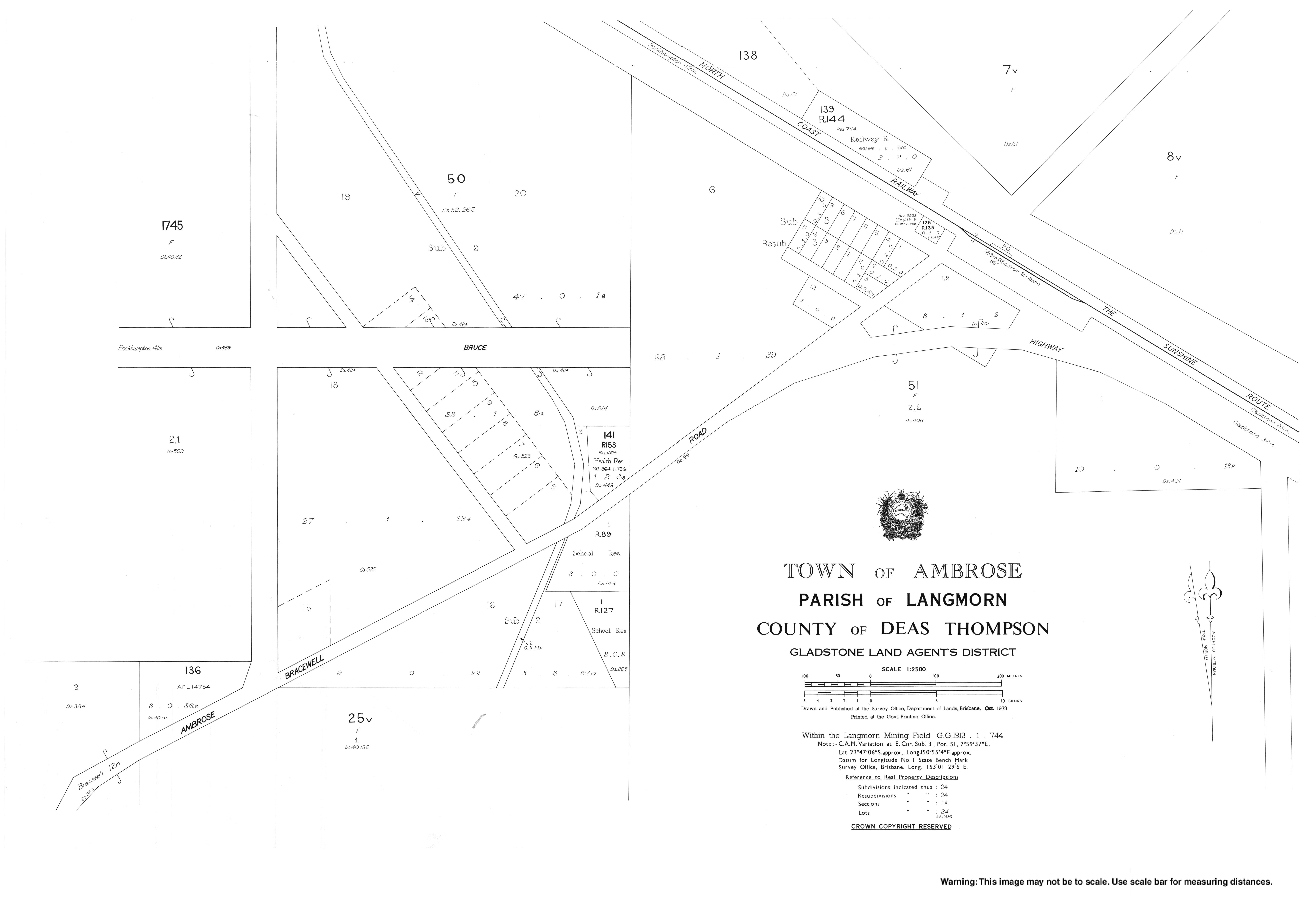
The Bruce Highway and North Coast railway pass through the northern part of the locality; the town centre is close to both. Most of the land is in the locality is used for grazing cattle.
History
The town is named after Henry Gilbert Ambrose (1876–1950), an early settler in the area. [4]
Ambrose Provisional School opened in December 1913 with 12 students. On 1 December 1914, it became Ambrose State School. [5] It celebrated its centenary in 2014. [6]
Langmorn Creek Crossing Provisional School opened on 20 October 1915 but closed circa 31 January 1916. It reopened as Langmorn Provisional School circa January 1926. On 1 January 1931, it became Langmorn State School. It closed on 26 October 1941, but reopened on 26 October 1944. It closed finally on 11 May 1962. [7] It was at 187 Langmorn School Road ( 23°49′07″S 150°52′56″E / 23.8185°S 150.8823°E). [8] [9] [10]
Ambrose Post Office opened on 1 November 1915 (a receiving office had been open since 1910) and closed in 1977. [11]
Hut Creek State School opened on 17 November 1921 and closed on 28 February 1945. [12] It was on Hut Creek Road (approx 23°50′52″S 150°53′55″E / 23.8477°S 150.8985°E). [13] [14] [10]
In the 2011 census, the locality of Ambrose had a population of 545 people. [15]
In the 2016 census, the locality of Ambrose had a population of 218 people. [1]
Education

Ambrose State School is a government primary (Prep-6) school for boys and girls at 39 Gentle Annie Road ( 23°47′11″S 150°55′18″E / 23.7864°S 150.9218°E). [16] [17] In 2017, the school had an enrolment of 84 students with 6 teachers (5 full-time equivalent) and 7 non-teaching staff (4 full-time equivalent). [18] In 2018, the school had an enrolment of 75 students with 6 teachers (5 full-time equivalent) and 7 non-teaching staff (4 full-time equivalent). [19]
There are no secondary schools in Ambrose. The nearest government secondary school is Mount Larcom State School (to Year 10) in neighbouring Mount Larcom to the east. For secondary schooling to Year 12, the nearest government secondary school in Gladstone State High School in West Gladstone to the south-east. [10]
Community groups

The Ambrose branch of the Queensland Country Women's Association meets at the QCWA Hall at 36 Gentle Annie Road ( 23°47′09″S 150°55′21″E / 23.7859°S 150.9224°E). [20]
Notable people
Notable people from or having lived in Ambrose include:
- Clifford Harry Thompson, geomorphologist and CSIRO principal research scientist
See also
References
- ^ a b c Australian Bureau of Statistics (27 June 2017). "Ambrose (SSC)". 2016 Census QuickStats. Retrieved 20 October 2018.
- ^ "Ambrose – town in Gladstone Region (entry 516)". Queensland Place Names. Queensland Government. Retrieved 7 March 2022.
- ^ "Ambrose – locality in Gladstone Region (entry 46586)". Queensland Place Names. Queensland Government. Retrieved 7 March 2022.
- ^ "OBITUARY". The Central Queensland Herald. Rockhampton, Qld. 24 August 1950. p. 29. Archived from the original on 9 April 2022. Retrieved 20 April 2014 – via National Library of Australia.
- ^ "Agency ID 8597, Ambrose State School". Queensland State Archives. Retrieved 20 April 2014.
- ^ "Centenary". Ambrose State School. Archived from the original on 21 April 2014. Retrieved 20 April 2014.
- ^ Queensland Family History Society (2010), Queensland schools past and present (Version 1.01 ed.), Queensland Family History Society, ISBN 978-1-921171-26-0
- ^ "Langmorn" (Map). Queensland Government. 1943. Archived from the original on 13 March 2020. Retrieved 3 May 2021.
- ^ "Queensland Two Mile series sheet 2m201" (Map). Queensland Government. 1954. Archived from the original on 3 May 2021. Retrieved 3 May 2021.
- ^ a b c "Queensland Globe". State of Queensland. Retrieved 9 April 2022.
- ^ Phoenix Auctions History. "Post Office List". Phoenix Auctions. Archived from the original on 9 April 2022. Retrieved 14 February 2021.
- ^ Queensland Family History Society (2010), Queensland schools past and present (Version 1.01 ed.), Queensland Family History Society, ISBN 978-1-921171-26-0
- ^ "Langmore" (Map). Queensland Government. 1943. Archived from the original on 13 March 2020. Retrieved 9 April 2022.
- ^ "Queensland Two Mile series sheet 2m201" (Map). Queensland Government. 1937. Archived from the original on 9 April 2022. Retrieved 9 April 2022.
- ^ Australian Bureau of Statistics (31 October 2012). "Ambrose (SSC)". 2011 Census QuickStats. Retrieved 20 April 2014.
- ^ "State and non-state school details". Queensland Government. 9 July 2018. Archived from the original on 21 November 2018. Retrieved 21 November 2018.
- ^ "Ambrose State School". Archived from the original on 1 April 2020. Retrieved 21 November 2018.
- ^ "ACARA School Profile 2017". Archived from the original on 22 November 2018. Retrieved 22 November 2018.
- ^ "ACARA School Profile 2018". Australian Curriculum, Assessment and Reporting Authority. Archived from the original on 27 August 2020. Retrieved 28 January 2020.
- ^ "Branch Locations". Queensland Country Women's Association. Archived from the original on 26 December 2018. Retrieved 26 December 2018.
Further reading
- Kingston, Shirley; Australia Post (1988), Ambrose, Australia Post, retrieved 20 April 2014
- Ambrose State School (1989), Ambrose State School 75th Jubilee : 26th August, 1989 : opened 1914, Ambrose State School, ISBN 978-0-7316-8509-7
- Ambrose State School Centenary Committee (2014), Ambrose State School : celebrating 100 years 1914-2014, The Centenary Committee — also includes closed schools: Bracewell State School, Raglan State School, Cedar Vale State School, East End State School, Hourigan Creek School, Hut Creek School, Langmorn School, Langmorn Creek Crossing School, Machine Creek State School
External links
| Authority control databases: National |
|---|
| Ambrose Queensland | |||||||||||||||
|---|---|---|---|---|---|---|---|---|---|---|---|---|---|---|---|
|
Ambrose State School, 2014 | |||||||||||||||
Ambrose | |||||||||||||||
| Coordinates | 23°46′59″S 150°55′35″E / 23.7830°S 150.9263°E | ||||||||||||||
| Population | 218 ( 2016 census) [1] | ||||||||||||||
| • Density | 3.455/km2 (8.948/sq mi) | ||||||||||||||
| Postcode(s) | 4695 | ||||||||||||||
| Area | 63.1 km2 (24.4 sq mi) | ||||||||||||||
| Time zone | AEST ( UTC+10:00) | ||||||||||||||
| Location |
| ||||||||||||||
| LGA(s) | Gladstone Region | ||||||||||||||
| State electorate(s) | Gladstone | ||||||||||||||
| Federal division(s) | Flynn | ||||||||||||||
| |||||||||||||||
Ambrose is a rural town and locality in the Gladstone Region, Queensland, Australia. [2] [3] In the 2016 census, the locality of Ambrose had a population of 218 people. [1]
Geography
The Bruce Highway and North Coast railway pass through the northern part of the locality; the town centre is close to both. Most of the land is in the locality is used for grazing cattle.
History
The town is named after Henry Gilbert Ambrose (1876–1950), an early settler in the area. [4]
Ambrose Provisional School opened in December 1913 with 12 students. On 1 December 1914, it became Ambrose State School. [5] It celebrated its centenary in 2014. [6]
Langmorn Creek Crossing Provisional School opened on 20 October 1915 but closed circa 31 January 1916. It reopened as Langmorn Provisional School circa January 1926. On 1 January 1931, it became Langmorn State School. It closed on 26 October 1941, but reopened on 26 October 1944. It closed finally on 11 May 1962. [7] It was at 187 Langmorn School Road ( 23°49′07″S 150°52′56″E / 23.8185°S 150.8823°E). [8] [9] [10]
Ambrose Post Office opened on 1 November 1915 (a receiving office had been open since 1910) and closed in 1977. [11]
Hut Creek State School opened on 17 November 1921 and closed on 28 February 1945. [12] It was on Hut Creek Road (approx 23°50′52″S 150°53′55″E / 23.8477°S 150.8985°E). [13] [14] [10]
In the 2011 census, the locality of Ambrose had a population of 545 people. [15]
In the 2016 census, the locality of Ambrose had a population of 218 people. [1]
Education
Ambrose State School is a government primary (Prep-6) school for boys and girls at 39 Gentle Annie Road ( 23°47′11″S 150°55′18″E / 23.7864°S 150.9218°E). [16] [17] In 2017, the school had an enrolment of 84 students with 6 teachers (5 full-time equivalent) and 7 non-teaching staff (4 full-time equivalent). [18] In 2018, the school had an enrolment of 75 students with 6 teachers (5 full-time equivalent) and 7 non-teaching staff (4 full-time equivalent). [19]
There are no secondary schools in Ambrose. The nearest government secondary school is Mount Larcom State School (to Year 10) in neighbouring Mount Larcom to the east. For secondary schooling to Year 12, the nearest government secondary school in Gladstone State High School in West Gladstone to the south-east. [10]
Community groups
The Ambrose branch of the Queensland Country Women's Association meets at the QCWA Hall at 36 Gentle Annie Road ( 23°47′09″S 150°55′21″E / 23.7859°S 150.9224°E). [20]
Notable people
Notable people from or having lived in Ambrose include:
- Clifford Harry Thompson, geomorphologist and CSIRO principal research scientist
See also
References
- ^ a b c Australian Bureau of Statistics (27 June 2017). "Ambrose (SSC)". 2016 Census QuickStats. Retrieved 20 October 2018.
- ^ "Ambrose – town in Gladstone Region (entry 516)". Queensland Place Names. Queensland Government. Retrieved 7 March 2022.
- ^ "Ambrose – locality in Gladstone Region (entry 46586)". Queensland Place Names. Queensland Government. Retrieved 7 March 2022.
- ^ "OBITUARY". The Central Queensland Herald. Rockhampton, Qld. 24 August 1950. p. 29. Archived from the original on 9 April 2022. Retrieved 20 April 2014 – via National Library of Australia.
- ^ "Agency ID 8597, Ambrose State School". Queensland State Archives. Retrieved 20 April 2014.
- ^ "Centenary". Ambrose State School. Archived from the original on 21 April 2014. Retrieved 20 April 2014.
- ^ Queensland Family History Society (2010), Queensland schools past and present (Version 1.01 ed.), Queensland Family History Society, ISBN 978-1-921171-26-0
- ^ "Langmorn" (Map). Queensland Government. 1943. Archived from the original on 13 March 2020. Retrieved 3 May 2021.
- ^ "Queensland Two Mile series sheet 2m201" (Map). Queensland Government. 1954. Archived from the original on 3 May 2021. Retrieved 3 May 2021.
- ^ a b c "Queensland Globe". State of Queensland. Retrieved 9 April 2022.
- ^ Phoenix Auctions History. "Post Office List". Phoenix Auctions. Archived from the original on 9 April 2022. Retrieved 14 February 2021.
- ^ Queensland Family History Society (2010), Queensland schools past and present (Version 1.01 ed.), Queensland Family History Society, ISBN 978-1-921171-26-0
- ^ "Langmore" (Map). Queensland Government. 1943. Archived from the original on 13 March 2020. Retrieved 9 April 2022.
- ^ "Queensland Two Mile series sheet 2m201" (Map). Queensland Government. 1937. Archived from the original on 9 April 2022. Retrieved 9 April 2022.
- ^ Australian Bureau of Statistics (31 October 2012). "Ambrose (SSC)". 2011 Census QuickStats. Retrieved 20 April 2014.
- ^ "State and non-state school details". Queensland Government. 9 July 2018. Archived from the original on 21 November 2018. Retrieved 21 November 2018.
- ^ "Ambrose State School". Archived from the original on 1 April 2020. Retrieved 21 November 2018.
- ^ "ACARA School Profile 2017". Archived from the original on 22 November 2018. Retrieved 22 November 2018.
- ^ "ACARA School Profile 2018". Australian Curriculum, Assessment and Reporting Authority. Archived from the original on 27 August 2020. Retrieved 28 January 2020.
- ^ "Branch Locations". Queensland Country Women's Association. Archived from the original on 26 December 2018. Retrieved 26 December 2018.
Further reading
- Kingston, Shirley; Australia Post (1988), Ambrose, Australia Post, retrieved 20 April 2014
- Ambrose State School (1989), Ambrose State School 75th Jubilee : 26th August, 1989 : opened 1914, Ambrose State School, ISBN 978-0-7316-8509-7
- Ambrose State School Centenary Committee (2014), Ambrose State School : celebrating 100 years 1914-2014, The Centenary Committee — also includes closed schools: Bracewell State School, Raglan State School, Cedar Vale State School, East End State School, Hourigan Creek School, Hut Creek School, Langmorn School, Langmorn Creek Crossing School, Machine Creek State School
External links
| Authority control databases: National |
|---|