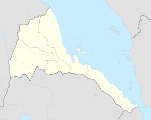
Photos • Location
Algheden
الغدن | |
|---|---|
Village | |
| Coordinates: 15°28′N 37°7′E / 15.467°N 37.117°E | |
| Country |
|
| Region | Gash-Barka |
| District | Forto |
| Elevation | 861 m (2,825 ft) |
Algheden ( Arabic: الغدن) is a village in western Eritrea. It is located in Forto District.
Nearby towns and villages include Bitama (32.6 km or 17.6 nmi), Hawashayt (30.4 km or 16.4 nmi), Adal (5.7 km or 3.1 nmi), Ad Casub (19.3 km or 10.4 nmi), Elit (28.7 km or 15.5 nmi) and Antalla (24.6 km or 13.3 nmi).
External links
