| Albert New South Wales | |
|---|---|
 Albert Anglican Church | |
 Albert | |
| Coordinates | 32°21′S 147°30′E / 32.350°S 147.500°E |
| Population | 81 ( 2016 census) [1] |
| Postcode(s) | 2873 |
| Location | |
| LGA(s) | Lachlan Shire |
| State electorate(s) | Barwon |
| Federal division(s) | Parkes |
Albert is a town in the Central West region of New South Wales, Australia. The town is in the Lachlan Shire local government area, 481 kilometres (299 mi) west north west of the state capital, Sydney. At the 2016 census, Albert had a population of 81, [1] though Albert once had a population of 900.
Copper had been discovered in the area by 1900. [2] In the early 20th century, there were several copper mines nearby, the most significant of which was the Iron Duke Mine, which operated from around 1909 until the early 1920s. [3] [4] Around the time that mining commenced, the area was known as 'Albert Water Holes'. [3] [5] Its post office was originally called 'The Alberts' but became Albert in 1916; it closed in 1982. [6]
A school—known as 'Albertia', until it was renamed Albert in January 1920—opened there in January 1899 and closed in June 1972. [7] The date of the opening of the school, the name of one of its streets, Federation Street, and the timing of the discovery of copper suggests that the village itself dates from around the time of Federation.
Albert is on the Bogan Gate–Tottenham railway line. [8] There was a station at Albert [9] and a short branch from Albert to the nearby Iron Duke Mine. [10] The branch line was known officially as the Albert Siding to Iron Duke Mine Railway. [11] The branch line to the mine closed in June 1926. [12]
Gallery
 | The image captions in this gallery
require cleanup to comply with
Wikipedia guidelines for
trivial wording. (January 2018) |
-
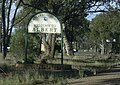 Edge of Albert village.
 -
 Rabbit Trap Hotel opposite Albert railway station.


See also
- Lake Albert, New South Wales
- Albert Parish (Delialah County), New South Wales
- Albert Parish ( Yantara County) New South Wales
- Albert, (Drake County) New South Wales
- Albert, (Kennedy County) New South Wales
- Albert, (Macquarie County) New South Wales
- Albert, (Sandon County) New South Wales
- Albert, ( St Vincent County) New South Wales
References
- ^ a b Australian Bureau of Statistics (27 June 2017). "Albert (State Suburb)". 2016 Census QuickStats. Retrieved 1 February 2018.
- ^ "Mining in New South Wales". Sydney Morning Herald. 6 February 1900.
- ^ a b "MINES AT ALBERT WATER HOLES". Sydney Morning Herald (NSW : 1842 - 1954). 4 March 1909. p. 9. Retrieved 6 October 2020.
- ^ "ALBERT". Western Champion (Parkes, NSW : 1898 - 1934). 16 June 1921. p. 18. Retrieved 6 October 2020.
- ^ "District Lines". Western Champion (Parkes, NSW : 1898 - 1934). 3 February 1911. p. 18. Retrieved 6 October 2020.
- ^ "Postmarks of Closed, or Changed Name Australian Post Offices - Page 9 - Postage Stamp Chat Board & Stamp Forum". www.stampboards.com. Retrieved 13 December 2020.
- ^ "Albert". nswgovschoolhistory.cese.nsw.gov.au. Retrieved 19 December 2020.
- ^ "Tottenham Branch". www.nswrail.net. Retrieved 6 October 2020.
- ^ "Albert Station". www.nswrail.net. Retrieved 6 October 2020.
- ^ "Iron Duke Mine". www.nswrail.net. Retrieved 6 October 2020.
- ^ "GOVERNMENT RAILWAYS.- Albert Siding to Iron Duke Mine Railway". Government Gazette of the State of New South Wales (Sydney, NSW : 1901 - 2001). 7 October 1921. p. 5775. Retrieved 6 October 2020.
- ^ "NSW Railway 30 Shortest Lived Sections". nswrail.net. Retrieved 6 October 2020.
|
| This Central West geography article is a stub. You can help Wikipedia by expanding it. |
| Albert New South Wales | |
|---|---|
|
Albert Anglican Church | |
Albert | |
| Coordinates | 32°21′S 147°30′E / 32.350°S 147.500°E |
| Population | 81 ( 2016 census) [1] |
| Postcode(s) | 2873 |
| Location | |
| LGA(s) | Lachlan Shire |
| State electorate(s) | Barwon |
| Federal division(s) | Parkes |
Albert is a town in the Central West region of New South Wales, Australia. The town is in the Lachlan Shire local government area, 481 kilometres (299 mi) west north west of the state capital, Sydney. At the 2016 census, Albert had a population of 81, [1] though Albert once had a population of 900.
Copper had been discovered in the area by 1900. [2] In the early 20th century, there were several copper mines nearby, the most significant of which was the Iron Duke Mine, which operated from around 1909 until the early 1920s. [3] [4] Around the time that mining commenced, the area was known as 'Albert Water Holes'. [3] [5] Its post office was originally called 'The Alberts' but became Albert in 1916; it closed in 1982. [6]
A school—known as 'Albertia', until it was renamed Albert in January 1920—opened there in January 1899 and closed in June 1972. [7] The date of the opening of the school, the name of one of its streets, Federation Street, and the timing of the discovery of copper suggests that the village itself dates from around the time of Federation.
Albert is on the Bogan Gate–Tottenham railway line. [8] There was a station at Albert [9] and a short branch from Albert to the nearby Iron Duke Mine. [10] The branch line was known officially as the Albert Siding to Iron Duke Mine Railway. [11] The branch line to the mine closed in June 1926. [12]
Gallery
| The image captions in this gallery
require cleanup to comply with
Wikipedia guidelines for
trivial wording. (January 2018) |
-
Edge of Albert village.
-
Rabbit Trap Hotel opposite Albert railway station.
See also
- Lake Albert, New South Wales
- Albert Parish (Delialah County), New South Wales
- Albert Parish ( Yantara County) New South Wales
- Albert, (Drake County) New South Wales
- Albert, (Kennedy County) New South Wales
- Albert, (Macquarie County) New South Wales
- Albert, (Sandon County) New South Wales
- Albert, ( St Vincent County) New South Wales
References
- ^ a b Australian Bureau of Statistics (27 June 2017). "Albert (State Suburb)". 2016 Census QuickStats. Retrieved 1 February 2018.
- ^ "Mining in New South Wales". Sydney Morning Herald. 6 February 1900.
- ^ a b "MINES AT ALBERT WATER HOLES". Sydney Morning Herald (NSW : 1842 - 1954). 4 March 1909. p. 9. Retrieved 6 October 2020.
- ^ "ALBERT". Western Champion (Parkes, NSW : 1898 - 1934). 16 June 1921. p. 18. Retrieved 6 October 2020.
- ^ "District Lines". Western Champion (Parkes, NSW : 1898 - 1934). 3 February 1911. p. 18. Retrieved 6 October 2020.
- ^ "Postmarks of Closed, or Changed Name Australian Post Offices - Page 9 - Postage Stamp Chat Board & Stamp Forum". www.stampboards.com. Retrieved 13 December 2020.
- ^ "Albert". nswgovschoolhistory.cese.nsw.gov.au. Retrieved 19 December 2020.
- ^ "Tottenham Branch". www.nswrail.net. Retrieved 6 October 2020.
- ^ "Albert Station". www.nswrail.net. Retrieved 6 October 2020.
- ^ "Iron Duke Mine". www.nswrail.net. Retrieved 6 October 2020.
- ^ "GOVERNMENT RAILWAYS.- Albert Siding to Iron Duke Mine Railway". Government Gazette of the State of New South Wales (Sydney, NSW : 1901 - 2001). 7 October 1921. p. 5775. Retrieved 6 October 2020.
- ^ "NSW Railway 30 Shortest Lived Sections". nswrail.net. Retrieved 6 October 2020.
|
| This Central West geography article is a stub. You can help Wikipedia by expanding it. |