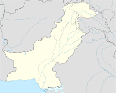
Ahla | |
|---|---|
Village and
Union council | |
| Coordinates: 32°36′N 73°24′E / 32.600°N 73.400°E [1] | |
| Country | Pakistan |
| Province | Punjab |
| District | Mandi Bahauddin |
| Time zone | UTC+5 ( PST) |
Ahla is a village and Union council of Mandi Bahauddin District in the Punjab province of Pakistan. [2] Ahla is situated on the southern bank of Lower Jhelum canal, about 9 km from Mandi Bahauddin city. It is located at an altitude of 202 metres (666 ft) from the sea level. [3] Ahla is headquarters of Union council Ahla. It has a railway station by its name, located almost 3 km from the village.
References

