Agate, Colorado | |
|---|---|
 Agate, Colorado | |
 Agate Location within the state of Colorado | |
| Coordinates: 39°27′43″N 103°56′31″W / 39.46194°N 103.94194°W | |
| Country | |
| State | |
| County | Elbert County [1] |
| Settled | about 1876 [2] |
| Elevation | 5,446 ft (1,660 m) |
| Time zone | UTC-7 ( MST) |
| • Summer ( DST) | UTC-6 ( MDT) |
| ZIP code | 80101
[3] |
| GNIS feature ID | 0204818 |
Agate is an unincorporated community and U.S. Post Office in Elbert County, Colorado, United States. The ZIP Code of the Agate Post Office is 80101. [3]
History
The town of Gebhard was established by the Union Pacific Railroad about 1876. [2] The Gebhard Post Office opened on April 8, 1881. [4] The name of the town was changed to Agate on April 24, 1882. [4] Although "Gebhard" was established by the UPRR, the town of Agate existed, by that name, as a locality used by local ranchers prior to the construction of the railroad. The town's name most probably comes from an "A-gate" – a wooden gate with an A-shaped cross-brace, but is sometimes claimed to be named for agate found in the area. The northeasternmost community in Elbert County, Agate is a ranching community and the home of Agate School District 300, one of the smallest school districts in Colorado.
Geography
Agate is located at 39°27′43″N 103°56′31″W / 39.46194°N 103.94194°W (39.461909,-103.941822). Agate is located on one of the four segments of old US 40/ US 287 (now State Highway 40) just off Interstate 70 at exit 340, and along the Union Pacific Railroad line between Limon and Aurora. It is located approximately 12 miles SSE of Deer Trail. The town is located on a NNW-SSE ridge bounded by an unnamed ravine separating it from the ridge on which I-70 is constructed, and by the Agate Creek valley to the west, and is divided by the railroad tracks. The school, post office, and a number of businesses and homes are located east of the tracks, and a grain elevator and a few houses to the west of the tracks. In recent years, several small subdivisions have been platted and homes constructed in the general area.
Cemeteries
- River Bend Cemetery: Take Exit 354 off I-70 5 miles west of Limon, CO. Follow frontage road north of the interstate through cattle gate and turn left up the hill approx. 1/2 mile
- Norton Cemetery
- Gair Cemetery
Emergency Services
Agate Fire Department [5]
Community Websites
Community Website for Elbert County, Colorado [6]
See also
References
- ^ a b "US Board on Geographic Names". United States Geological Survey. October 25, 2007. Retrieved January 31, 2008.
- ^ a b Eichler, Geo. R. (1977). Colorado Place Names. Johnson Publishing Company. LCCN 77-089726.
- ^ a b "ZIP Code Lookup". United States Postal Service. Archived from the original ( JavaScript/ HTML) on September 3, 2007. Retrieved September 2, 2007.
- ^ a b Bauer, William H.; James L. Ozment; John H. Willard (1990). Colorado Post Offices 1859–1989. The Colorado Railroad Museum. ISBN 0-918654-42-4. LCCN 90-34759.
- ^ "Home". agatefire.org.
- ^ http://www.elbertcountycolorado.net Archived January 24, 2016, at the Wayback Machine
External links
 Media from Commons
 News from Wikinews
 Quotations from Wikiquote
 Travel information from Wikivoyage
Municipalities and communities of
Elbert County, Colorado, United States | ||
|---|---|---|
| Towns | 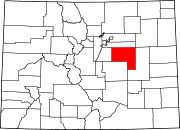 | |
| CDP | ||
|
Unincorporated communities | ||
Agate, Colorado | |
|---|---|
|
Agate, Colorado | |
Agate Location within the state of Colorado | |
| Coordinates: 39°27′43″N 103°56′31″W / 39.46194°N 103.94194°W | |
| Country | |
| State | |
| County | Elbert County [1] |
| Settled | about 1876 [2] |
| Elevation | 5,446 ft (1,660 m) |
| Time zone | UTC-7 ( MST) |
| • Summer ( DST) | UTC-6 ( MDT) |
| ZIP code | 80101
[3] |
| GNIS feature ID | 0204818 |
Agate is an unincorporated community and U.S. Post Office in Elbert County, Colorado, United States. The ZIP Code of the Agate Post Office is 80101. [3]
History
The town of Gebhard was established by the Union Pacific Railroad about 1876. [2] The Gebhard Post Office opened on April 8, 1881. [4] The name of the town was changed to Agate on April 24, 1882. [4] Although "Gebhard" was established by the UPRR, the town of Agate existed, by that name, as a locality used by local ranchers prior to the construction of the railroad. The town's name most probably comes from an "A-gate" – a wooden gate with an A-shaped cross-brace, but is sometimes claimed to be named for agate found in the area. The northeasternmost community in Elbert County, Agate is a ranching community and the home of Agate School District 300, one of the smallest school districts in Colorado.
Geography
Agate is located at 39°27′43″N 103°56′31″W / 39.46194°N 103.94194°W (39.461909,-103.941822). Agate is located on one of the four segments of old US 40/ US 287 (now State Highway 40) just off Interstate 70 at exit 340, and along the Union Pacific Railroad line between Limon and Aurora. It is located approximately 12 miles SSE of Deer Trail. The town is located on a NNW-SSE ridge bounded by an unnamed ravine separating it from the ridge on which I-70 is constructed, and by the Agate Creek valley to the west, and is divided by the railroad tracks. The school, post office, and a number of businesses and homes are located east of the tracks, and a grain elevator and a few houses to the west of the tracks. In recent years, several small subdivisions have been platted and homes constructed in the general area.
Cemeteries
- River Bend Cemetery: Take Exit 354 off I-70 5 miles west of Limon, CO. Follow frontage road north of the interstate through cattle gate and turn left up the hill approx. 1/2 mile
- Norton Cemetery
- Gair Cemetery
Emergency Services
Agate Fire Department [5]
Community Websites
Community Website for Elbert County, Colorado [6]
See also
References
- ^ a b "US Board on Geographic Names". United States Geological Survey. October 25, 2007. Retrieved January 31, 2008.
- ^ a b Eichler, Geo. R. (1977). Colorado Place Names. Johnson Publishing Company. LCCN 77-089726.
- ^ a b "ZIP Code Lookup". United States Postal Service. Archived from the original ( JavaScript/ HTML) on September 3, 2007. Retrieved September 2, 2007.
- ^ a b Bauer, William H.; James L. Ozment; John H. Willard (1990). Colorado Post Offices 1859–1989. The Colorado Railroad Museum. ISBN 0-918654-42-4. LCCN 90-34759.
- ^ "Home". agatefire.org.
- ^ http://www.elbertcountycolorado.net Archived January 24, 2016, at the Wayback Machine
External links
-
Media from Commons
-
News from Wikinews
-
Quotations from Wikiquote
-
Travel information from Wikivoyage
Municipalities and communities of
Elbert County, Colorado, United States | ||
|---|---|---|
| Towns | | |
| CDP | ||
|
Unincorporated communities | ||