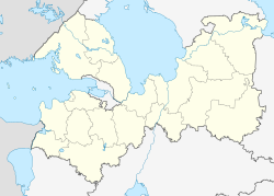
Photos • Location
Agalatovo
Агалатово | |
|---|---|
| Coordinates: 60°13′13″N 30°17′55″E / 60.2203°N 30.2987°E | |
| Country | Russia |
| Federal subject | Leningrad Oblast |
| Administrative district | Vsevolozhsk District |
| Rural settlement | Agalatovskogo Rural Settlement |
| Elevation | 84 m (276 ft) |
| • Capital of | Agalatovskogo Rural Settlement |
| Time zone |
UTC+3 (
MSK
|
| Postal code(s) [2] | 188653 |
| Dialing code(s) | +7 81370 |
| OKTMO ID | 41612408101 |
Agalatovo ( Russian: Агала́тово; Finnish: Ohalatva) is a rural locality (a selo) in Vsevolozhsk District of Leningrad Oblast, Russia. It is the garrison of the 6th Combined Arms Army.
Demographics
Population
As of 2014, the population of Agalatovo was 5,155. [3]
Ethnicity
According to the 2002 census, the ethnic composition of Agalatovo was:
- Russians - 4,034 (79.8%);
- Ukrainians - 403 (8.0%);
- Belarusians - 141 (2.8%);
- Tatars - 68 (1.4%);
- Other - 407 (8.1%).
References
- ^ "Об исчислении времени". Официальный интернет-портал правовой информации (in Russian). 3 June 2011. Retrieved 19 January 2019.
- ^ Почта России. Информационно-вычислительный центр ОАСУ РПО. (Russian Post). Поиск объектов почтовой связи (Postal Objects Search) (in Russian)
- ^ Администрация МО "Агалатовское сельское поселение" | http://agalatovo.org/index.php/statistic/chislennost-naseleniya/1934-chislennost-naseleniya-i-kolichestvo-khozyajstv-administratsii-mo-agalatovskoe-selskoe-poselenie-na-01-01-2014 Archived 2016-03-04 at the Wayback Machine

