Adams, Oklahoma | |
|---|---|
 Adams, Oklahoma Location within the state of Oklahoma  Adams, Oklahoma Adams, Oklahoma (the United States) | |
| Coordinates: 36°45′23″N 101°4′38″W / 36.75639°N 101.07722°W [1] | |
| Country | United States |
| State | Oklahoma |
| County | Texas |
| Area | |
| • Total | 0.51 sq mi (1.31 km2) |
| • Land | 0.51 sq mi (1.31 km2) |
| • Water | 0.00 sq mi (0.00 km2) |
| Elevation | 2,841 ft (866 m) |
| Population (
2020) | |
| • Total | 148 |
| • Density | 293.07/sq mi (113.26/km2) |
| Time zone | UTC-6 ( Central (CST)) |
| • Summer ( DST) | UTC-5 (CDT) |
| ZIP codes | 73901 |
| Area code | 580 |
| FIPS code | 40-00300 |
Adams is an unincorporated community in eastern Texas County, Oklahoma, United States. [1] The population was 148 at the time of the 2020 census. [3] It is approximately 20 miles (32 km) east-northeast of the county seat, Guymon. [4] The community is six miles north-northeast of Optima Lake. [5]
History
The post office opened June 14, 1930. The community was named for Jesse L. Adams, an engineer for the Rock Island Railroad. [6]
Adams was the site of the Adams Woodframe Grain Elevator, which was listed on the National Register of Historic Places (NRHP). The community and its elevator were both established in 1926. The elevator was unusable from the 1980s, and was condemned because of the danger of its collapse. [4] It was then burned down in 2018. [7]
Demographics
| Census | Pop. | Note | %± |
|---|---|---|---|
| 2020 | 148 | — | |
| U.S. Decennial Census [8] | |||
References
- ^ a b c U.S. Geological Survey Geographic Names Information System: Adams, Oklahoma
- ^ "ArcGIS REST Services Directory". United States Census Bureau. Retrieved September 20, 2022.
- ^ "Adams (CDP), Oklahoma". US Census Bureau. Retrieved October 15, 2023.
- ^ a b Culver, Galen. "Oklahoma’s Leaning Tower: The old Adams grain elevator is in a gravity defying, slow-motion fall." News4. August 18, 2017. Accessed December 10, 2017.
- ^ Oklahoma Atlas & Gazeteer, DeLorme, 1st ed., 1998, p. 16 ISBN 0899332838
- ^ Shirk, George H., Oklahoma Place Names, Norman: University of Oklahoma Press, 1987, p. 4 ISBN 0-8061-2028-2
- ^ "Iconic leaning elevator in Oklahoma panhandle is demolished". K. Querry, KFOR-TV, August 22, 2018. Retrieved January 5, 2021.
- ^ "Census of Population and Housing". Census.gov. Retrieved June 4, 2016.
Municipalities and communities of
Texas County, Oklahoma, United States | ||
|---|---|---|
| Cities | 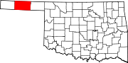 | |
| Towns | ||
| CDPs | ||
|
Other communities | ||
|
| This Oklahoma state location article is a stub. You can help Wikipedia by expanding it. |
Adams, Oklahoma | |
|---|---|
Adams, Oklahoma Location within the state of Oklahoma Adams, Oklahoma Adams, Oklahoma (the United States) | |
| Coordinates: 36°45′23″N 101°4′38″W / 36.75639°N 101.07722°W [1] | |
| Country | United States |
| State | Oklahoma |
| County | Texas |
| Area | |
| • Total | 0.51 sq mi (1.31 km2) |
| • Land | 0.51 sq mi (1.31 km2) |
| • Water | 0.00 sq mi (0.00 km2) |
| Elevation | 2,841 ft (866 m) |
| Population (
2020) | |
| • Total | 148 |
| • Density | 293.07/sq mi (113.26/km2) |
| Time zone | UTC-6 ( Central (CST)) |
| • Summer ( DST) | UTC-5 (CDT) |
| ZIP codes | 73901 |
| Area code | 580 |
| FIPS code | 40-00300 |
Adams is an unincorporated community in eastern Texas County, Oklahoma, United States. [1] The population was 148 at the time of the 2020 census. [3] It is approximately 20 miles (32 km) east-northeast of the county seat, Guymon. [4] The community is six miles north-northeast of Optima Lake. [5]
History
The post office opened June 14, 1930. The community was named for Jesse L. Adams, an engineer for the Rock Island Railroad. [6]
Adams was the site of the Adams Woodframe Grain Elevator, which was listed on the National Register of Historic Places (NRHP). The community and its elevator were both established in 1926. The elevator was unusable from the 1980s, and was condemned because of the danger of its collapse. [4] It was then burned down in 2018. [7]
Demographics
| Census | Pop. | Note | %± |
|---|---|---|---|
| 2020 | 148 | — | |
| U.S. Decennial Census [8] | |||
References
- ^ a b c U.S. Geological Survey Geographic Names Information System: Adams, Oklahoma
- ^ "ArcGIS REST Services Directory". United States Census Bureau. Retrieved September 20, 2022.
- ^ "Adams (CDP), Oklahoma". US Census Bureau. Retrieved October 15, 2023.
- ^ a b Culver, Galen. "Oklahoma’s Leaning Tower: The old Adams grain elevator is in a gravity defying, slow-motion fall." News4. August 18, 2017. Accessed December 10, 2017.
- ^ Oklahoma Atlas & Gazeteer, DeLorme, 1st ed., 1998, p. 16 ISBN 0899332838
- ^ Shirk, George H., Oklahoma Place Names, Norman: University of Oklahoma Press, 1987, p. 4 ISBN 0-8061-2028-2
- ^ "Iconic leaning elevator in Oklahoma panhandle is demolished". K. Querry, KFOR-TV, August 22, 2018. Retrieved January 5, 2021.
- ^ "Census of Population and Housing". Census.gov. Retrieved June 4, 2016.
Municipalities and communities of
Texas County, Oklahoma, United States | ||
|---|---|---|
| Cities | | |
| Towns | ||
| CDPs | ||
|
Other communities | ||
|
| This Oklahoma state location article is a stub. You can help Wikipedia by expanding it. |