Aït Hamadouche | |
|---|---|
| Nickname(s): Beni Hamadouche, Ait Hamadouche. Bouhamadouche ,Bouhmadouche, Hamadouche ,Hamdouche | |
| Motto(s): آيت حمادوش,بني حمادوش ،حماادوش , بوحمادوش | |
| Coordinates: 36°40′41″N 3°34′03″E / 36.6781511°N 3.5674283°E | |
| Commune | Souk El-Had |
| District | Thénia District |
| Province | Boumerdès Province |
| Region | Kabylie |
| Country | |
| Area | |
| • Total | 3 km2 (1 sq mi) |
| Dimensions | |
| • Length | 1.5 km (0.9 mi) |
| • Width | 2 km (1 mi) |
| Elevation | 480 m (1,570 ft) |
| Time zone | UTC+01:00 |
| Area code | 35020 |
Aït Hamadouche or Beni Hamadouche is a village in the Boumerdès Province in Kabylie, Algeria. [1] [2]
Location
The village is surrounded by Isser River and Meraldene River and the towns of Souk El-Had, Thénia / Tizi-Nait-Aicha and Beni Amrane in the Khachna mountain range. [3] [4] [5]
Notable people
Gallery
-
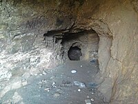 Caves of Grotte Aït HamadoucheBni hamadouche

References
- ^ "Le Soir du Centre". Djazairess.
- ^ "مركز التعذيب «غوتيي»..شاهد على فظاعة الاستعمار". جزايرس.
- ^ "Archives des sciences physiques et naturelles / par MM. de La Rive, Marignac et J. Pictet". Gallica. February 1, 1898.
- ^ texte, Algérie (Période coloniale) Conseil supérieur de gouvernement Auteur du; texte, Algérie (Période coloniale) Auteur du (February 1, 1902). "Procès-verbaux des délibérations : session... / Conseil supérieur de gouvernement". Gallica.
- ^ "Annuaire des mines et minerais métalliques de France et d'Algérie / par Auguste Pawlowski". Gallica. February 1, 1919.
| A | |
|---|---|
| B | |
| C | |
| D | |
| E | |
| F | |
| G | |
| H | |
| L | |
| M | |
| O | |
| S | |
| T | |
| Z | |
|
| This article about a location in Boumerdès Province is a stub. You can help Wikipedia by expanding it. |
Aït Hamadouche | |
|---|---|
| Nickname(s): Beni Hamadouche, Ait Hamadouche. Bouhamadouche ,Bouhmadouche, Hamadouche ,Hamdouche | |
| Motto(s): آيت حمادوش,بني حمادوش ،حماادوش , بوحمادوش | |
| Coordinates: 36°40′41″N 3°34′03″E / 36.6781511°N 3.5674283°E | |
| Commune | Souk El-Had |
| District | Thénia District |
| Province | Boumerdès Province |
| Region | Kabylie |
| Country | |
| Area | |
| • Total | 3 km2 (1 sq mi) |
| Dimensions | |
| • Length | 1.5 km (0.9 mi) |
| • Width | 2 km (1 mi) |
| Elevation | 480 m (1,570 ft) |
| Time zone | UTC+01:00 |
| Area code | 35020 |
Aït Hamadouche or Beni Hamadouche is a village in the Boumerdès Province in Kabylie, Algeria. [1] [2]
Location
The village is surrounded by Isser River and Meraldene River and the towns of Souk El-Had, Thénia / Tizi-Nait-Aicha and Beni Amrane in the Khachna mountain range. [3] [4] [5]
Notable people
Gallery
-
Caves of Grotte Aït HamadoucheBni hamadouche
References
- ^ "Le Soir du Centre". Djazairess.
- ^ "مركز التعذيب «غوتيي»..شاهد على فظاعة الاستعمار". جزايرس.
- ^ "Archives des sciences physiques et naturelles / par MM. de La Rive, Marignac et J. Pictet". Gallica. February 1, 1898.
- ^ texte, Algérie (Période coloniale) Conseil supérieur de gouvernement Auteur du; texte, Algérie (Période coloniale) Auteur du (February 1, 1902). "Procès-verbaux des délibérations : session... / Conseil supérieur de gouvernement". Gallica.
- ^ "Annuaire des mines et minerais métalliques de France et d'Algérie / par Auguste Pawlowski". Gallica. February 1, 1919.
| A | |
|---|---|
| B | |
| C | |
| D | |
| E | |
| F | |
| G | |
| H | |
| L | |
| M | |
| O | |
| S | |
| T | |
| Z | |
|
| This article about a location in Boumerdès Province is a stub. You can help Wikipedia by expanding it. |