Žulová | |
|---|---|
_-_okres_Jesen%C3%ADk_(5).jpg) View of Žulová from Boží hora | |
 Flag  Coat of arms | |
 Žulová Location in the Czech Republic | |
| Coordinates: 50°18′34″N 17°5′56″E / 50.30944°N 17.09889°E | |
| Country | |
| Region | Olomouc |
| District | Jeseník |
| First mentioned | 1266 |
| Area | |
| • Total | 14.76 km2 (5.70 sq mi) |
| Elevation | 357 m (1,171 ft) |
| Population (2023-01-01)
[1] | |
| • Total | 1,162 |
| • Density | 79/km2 (200/sq mi) |
| Time zone | UTC+1 ( CET) |
| • Summer ( DST) | UTC+2 ( CEST) |
| Postal code | 790 65 |
| Website |
www |
Žulová (until 1948 Frýdberk; German: Friedeberg) is a town in Jeseník District in the Olomouc Region of the Czech Republic. It has about 1,200 inhabitants.
Administrative parts
The village of Tomíkovice is an administrative part of Žulová.
Etymology
The name is derived from the Czech word for granite (žula), which was mined here. [2]
Geography
Žulová is located about 11 kilometres (7 mi) north-west of Jeseník and 80 km (50 mi) north of Olomouc. It lies in the Žulová Hilly Land. The highest point is the hill Boží hora at 527 m (1,729 ft) above sea level. The Vidnavka stream flows through the town.
Velký Pond, located in the eastern part of the municipal territory, is a fish pond with an area of 11 ha (27 acres). It is the largest pond in the area. [3]
History
The first written mention of Frýdberk is from the 13th century, when the Frýdberk Castle was built. The settlement was first referred to as a town in 1358. It was part of the Duchy of Nysa under Bohemian suzerainty. In the 15th century, silver was mined here and two glassworks were in operation. The castle was renaissance reconstructed in 1594. [4]
The development of the town ended with the Thirty Years' War. In 1639, the castle was conquered and demolished by the Swedish and Polish troops. The town was looted in 1642 and destroyed by a fire in 1657. In the second half of the 17th century, Frýdberk recovered and began to expand. In 1793, the town privileges were restored. [4]
Following the duchy's dissolution in 1850, it was incorporated directly into Bohemia. In the 19th century, the town of became a centre of stone mining and processing, especially granite. [4]
From 1938 to 1945, the town was occupied by Nazi Germany and administered as a part of Reichsgau Sudetenland. During World War II, the Germans operated a forced labour subcamp of the Stalag VIII-B/344 prisoner-of-war camp at a quarry in Frýdberk, and a subcamp of Stalag VIII-B/344 at a quarry in Tomíkovice. [5]
In 1948, the municipality was renamed to its current name. [6]
Demographics
|
|
| ||||||||||||||||||||||||||||||||||||||||||||||||||||||
| Source: Censuses [7] [8] | ||||||||||||||||||||||||||||||||||||||||||||||||||||||||
Transport
Žulová is located on a railway line of local importance from Javorník to Lipová-lázně. [9]
Sights
_-_kostel_sv._Josefa_s_poz%C5%AFstatkem_hradu_Fr%C3%BDdberka.jpg)
A bergfried survived from the ruins of the castle. It is up to 4 m (13 ft) thick and has survived to the present day up to the height of the original 4th floor. The bergfried and the core of the castle ruins were used to build a unique church. The Church of Saint Joseph was built in the Neoclassical style in 1809–1810. [10] The stone bridge leading to the church was built in 1846 and is also a cultural monument. [11]
The Church of Our Lady of Sorrows is situated on the Boží hora Hill. A wooden church, which was built there in 1712–1713, was replaced by the current neo-Gothic building built in 1878–1880. It was designed by Friedrich von Schmidt. An atypical double construction system was used during construction due to the local extreme weather conditions. Stations of the Cross line the way up the hill to the church. [12]
Gallery
-
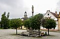 Mariánské Square
 -
 Town hall
 -
 Church of Our Lady of Sorrows
.jpg)

_-_okres_Jesen%C3%ADk_(11).jpg)
References
- ^ "Population of Municipalities – 1 January 2023". Czech Statistical Office. 2023-05-23.
- ^ "Toulavá kamera: Žulová" (in Czech). Czech Television. 2023-10-15. Retrieved 2024-01-26.
- ^ "Velký rybník u Žulové na Jesenicku" (in Czech). CzechTourism. Retrieved 2022-05-07.
- ^ a b c "Územní plán Žulová: Odůvodnění územního plánu" (in Czech). Město Žulová. May 2017. p. 64 (68). Retrieved 2022-01-26.
- ^ "Working Parties". Lamsdorf.com. Archived from the original on 29 October 2020. Retrieved 13 November 2021.
- ^ "Vyhláška č. 22/1949 Sb". Zákony pro lidi (in Czech). Retrieved 2024-01-26.
- ^ "Historický lexikon obcí České republiky 1869–2011 – Okres Jeseník" (in Czech). Czech Statistical Office. 2015-12-21. pp. 7–8.
- ^ "Population Census 2021: Population by sex". Public Database. Czech Statistical Office. 2021-03-27.
- ^ "Detail stanice Žulová" (in Czech). České dráhy. Retrieved 2024-01-26.
- ^ "Hrad a kostel Žulová" (in Czech). CzechTourism. Retrieved 2023-05-19.
- ^ "Kostel sv. Josefa s mostem" (in Czech). National Heritage Institute. Retrieved 2023-05-19.
- ^ "Kostel Panny Marie Bolestné" (in Czech). National Heritage Institute. Retrieved 2023-05-19.
External links
| International | |
|---|---|
| National | |
Žulová | |
|---|---|
|
View of Žulová from Boží hora | |
|
Flag Coat of arms | |
Žulová Location in the Czech Republic | |
| Coordinates: 50°18′34″N 17°5′56″E / 50.30944°N 17.09889°E | |
| Country | |
| Region | Olomouc |
| District | Jeseník |
| First mentioned | 1266 |
| Area | |
| • Total | 14.76 km2 (5.70 sq mi) |
| Elevation | 357 m (1,171 ft) |
| Population (2023-01-01)
[1] | |
| • Total | 1,162 |
| • Density | 79/km2 (200/sq mi) |
| Time zone | UTC+1 ( CET) |
| • Summer ( DST) | UTC+2 ( CEST) |
| Postal code | 790 65 |
| Website |
www |
Žulová (until 1948 Frýdberk; German: Friedeberg) is a town in Jeseník District in the Olomouc Region of the Czech Republic. It has about 1,200 inhabitants.
Administrative parts
The village of Tomíkovice is an administrative part of Žulová.
Etymology
The name is derived from the Czech word for granite (žula), which was mined here. [2]
Geography
Žulová is located about 11 kilometres (7 mi) north-west of Jeseník and 80 km (50 mi) north of Olomouc. It lies in the Žulová Hilly Land. The highest point is the hill Boží hora at 527 m (1,729 ft) above sea level. The Vidnavka stream flows through the town.
Velký Pond, located in the eastern part of the municipal territory, is a fish pond with an area of 11 ha (27 acres). It is the largest pond in the area. [3]
History
The first written mention of Frýdberk is from the 13th century, when the Frýdberk Castle was built. The settlement was first referred to as a town in 1358. It was part of the Duchy of Nysa under Bohemian suzerainty. In the 15th century, silver was mined here and two glassworks were in operation. The castle was renaissance reconstructed in 1594. [4]
The development of the town ended with the Thirty Years' War. In 1639, the castle was conquered and demolished by the Swedish and Polish troops. The town was looted in 1642 and destroyed by a fire in 1657. In the second half of the 17th century, Frýdberk recovered and began to expand. In 1793, the town privileges were restored. [4]
Following the duchy's dissolution in 1850, it was incorporated directly into Bohemia. In the 19th century, the town of became a centre of stone mining and processing, especially granite. [4]
From 1938 to 1945, the town was occupied by Nazi Germany and administered as a part of Reichsgau Sudetenland. During World War II, the Germans operated a forced labour subcamp of the Stalag VIII-B/344 prisoner-of-war camp at a quarry in Frýdberk, and a subcamp of Stalag VIII-B/344 at a quarry in Tomíkovice. [5]
In 1948, the municipality was renamed to its current name. [6]
Demographics
|
|
| ||||||||||||||||||||||||||||||||||||||||||||||||||||||
| Source: Censuses [7] [8] | ||||||||||||||||||||||||||||||||||||||||||||||||||||||||
Transport
Žulová is located on a railway line of local importance from Javorník to Lipová-lázně. [9]
Sights
A bergfried survived from the ruins of the castle. It is up to 4 m (13 ft) thick and has survived to the present day up to the height of the original 4th floor. The bergfried and the core of the castle ruins were used to build a unique church. The Church of Saint Joseph was built in the Neoclassical style in 1809–1810. [10] The stone bridge leading to the church was built in 1846 and is also a cultural monument. [11]
The Church of Our Lady of Sorrows is situated on the Boží hora Hill. A wooden church, which was built there in 1712–1713, was replaced by the current neo-Gothic building built in 1878–1880. It was designed by Friedrich von Schmidt. An atypical double construction system was used during construction due to the local extreme weather conditions. Stations of the Cross line the way up the hill to the church. [12]
Gallery
-
Mariánské Square
-
Town hall
-
Church of Our Lady of Sorrows
References
- ^ "Population of Municipalities – 1 January 2023". Czech Statistical Office. 2023-05-23.
- ^ "Toulavá kamera: Žulová" (in Czech). Czech Television. 2023-10-15. Retrieved 2024-01-26.
- ^ "Velký rybník u Žulové na Jesenicku" (in Czech). CzechTourism. Retrieved 2022-05-07.
- ^ a b c "Územní plán Žulová: Odůvodnění územního plánu" (in Czech). Město Žulová. May 2017. p. 64 (68). Retrieved 2022-01-26.
- ^ "Working Parties". Lamsdorf.com. Archived from the original on 29 October 2020. Retrieved 13 November 2021.
- ^ "Vyhláška č. 22/1949 Sb". Zákony pro lidi (in Czech). Retrieved 2024-01-26.
- ^ "Historický lexikon obcí České republiky 1869–2011 – Okres Jeseník" (in Czech). Czech Statistical Office. 2015-12-21. pp. 7–8.
- ^ "Population Census 2021: Population by sex". Public Database. Czech Statistical Office. 2021-03-27.
- ^ "Detail stanice Žulová" (in Czech). České dráhy. Retrieved 2024-01-26.
- ^ "Hrad a kostel Žulová" (in Czech). CzechTourism. Retrieved 2023-05-19.
- ^ "Kostel sv. Josefa s mostem" (in Czech). National Heritage Institute. Retrieved 2023-05-19.
- ^ "Kostel Panny Marie Bolestné" (in Czech). National Heritage Institute. Retrieved 2023-05-19.
External links
| International | |
|---|---|
| National | |