Žostautai | |
|---|---|
Village | |
 | |
 Žostautai Location in Lithuania  Žostautai Žostautai (Lithuania) | |
| Coordinates: 55°18′12″N 23°38′49″E / 55.30333°N 23.64694°E | |
| Country | |
| County |
|
| Municipality | Kėdainiai district municipality |
| Eldership | Pernarava Eldership |
| Population (2011) | |
| • Total | 53 |
| Time zone | UTC+2 ( EET) |
| • Summer ( DST) | UTC+3 ( EEST) |
Žostautai or Zaštautai (formerly Russian: Заштовты, Polish: Zasztowty) [1] is a village in Kėdainiai district municipality, in Kaunas County, in central Lithuania. According to the 2011 census, the village had a population of 53 people. [2] It is located 4 kilometres (2.5 mi) from Pernarava, between the Lapkalnys-Paliepiai Forest and the Šušvė river. There is a farm.
History
Žostautai has been known since 1596. There was Žostautai village and folwark at the end of the 19th century. During the Soviet era it was a subsidiary kolkhoz settlement. [3]
Demography
|
| |||||||||||||||||||||||||||||||||
| Source: 1902, 1923, 1959 & 1970, 1979, 1989, 2001, 2011 | ||||||||||||||||||||||||||||||||||
Images
-
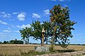
 Žostautai from the west
 -
 Žostautai roofed pole (Žostautų stogastulpis)
 -
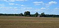 Western part of Žostautai nearby forest
.JPG)


References
- ^ " Zasztowty". Geographical Dictionary of the Kingdom of Poland (in Polish). 14. Warszawa: Kasa im. Józefa Mianowskiego. 1895. p. 456.
- ^ "2011 census". Statistikos Departamentas (Lithuania). Retrieved August 21, 2017.
- ^ "Žostautai". Tarybų Lietuvos enciklopedija (in Lithuanian). Vol. 4. Vilnius: Vyriausioji enciklopedijų redakcija. 1988. p. 687.

Žostautai | |
|---|---|
Village | |
|
| |
Žostautai Location in Lithuania Žostautai Žostautai (Lithuania) | |
| Coordinates: 55°18′12″N 23°38′49″E / 55.30333°N 23.64694°E | |
| Country | |
| County |
|
| Municipality | Kėdainiai district municipality |
| Eldership | Pernarava Eldership |
| Population (2011) | |
| • Total | 53 |
| Time zone | UTC+2 ( EET) |
| • Summer ( DST) | UTC+3 ( EEST) |
Žostautai or Zaštautai (formerly Russian: Заштовты, Polish: Zasztowty) [1] is a village in Kėdainiai district municipality, in Kaunas County, in central Lithuania. According to the 2011 census, the village had a population of 53 people. [2] It is located 4 kilometres (2.5 mi) from Pernarava, between the Lapkalnys-Paliepiai Forest and the Šušvė river. There is a farm.
History
Žostautai has been known since 1596. There was Žostautai village and folwark at the end of the 19th century. During the Soviet era it was a subsidiary kolkhoz settlement. [3]
Demography
|
| |||||||||||||||||||||||||||||||||
| Source: 1902, 1923, 1959 & 1970, 1979, 1989, 2001, 2011 | ||||||||||||||||||||||||||||||||||
Images
-
Žostautai from the west
-
Žostautai roofed pole (Žostautų stogastulpis)
-
Western part of Žostautai nearby forest
References
- ^ " Zasztowty". Geographical Dictionary of the Kingdom of Poland (in Polish). 14. Warszawa: Kasa im. Józefa Mianowskiego. 1895. p. 456.
- ^ "2011 census". Statistikos Departamentas (Lithuania). Retrieved August 21, 2017.
- ^ "Žostautai". Tarybų Lietuvos enciklopedija (in Lithuanian). Vol. 4. Vilnius: Vyriausioji enciklopedijų redakcija. 1988. p. 687.