Photos • Location

Ąžuolytė | |
|---|---|
Village | |
 | |
 Ąžuolytė Location in Lithuania  Ąžuolytė Ąžuolytė (Lithuania) | |
| Coordinates: 55°23′10″N 23°42′11″E / 55.38611°N 23.70306°E | |
| Country | |
| County |
|
| Municipality | Kėdainiai district municipality |
| Eldership | Krakės Eldership |
| Population (2011) | |
| • Total | 8 |
| Time zone | UTC+2 ( EET) |
| • Summer ( DST) | UTC+3 ( EEST) |
Ąžuolytė ('a little place of oaks', formerly Russian: Ажолита, Ожолита) is a village in Kėdainiai district municipality, in Kaunas County, in central Lithuania. According to the 2011 census, the village had a population of 8 people. [1] It is located 1 kilometre (0.62 mi) from Meironiškiai, on a ridge between the Dangaučius river and a little grove.
Demography
|
| ||||||||||||||||||||||||||||||
| Source: 1902, 1923, 1959 & 1970, 1979, 1989, 2001, 2011 | |||||||||||||||||||||||||||||||
Images
-
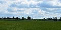 Ąžuolytė landscapes

References
- ^ "2011 census". Statistikos Departamentas (Lithuania). Retrieved August 21, 2017.

Ąžuolytė | |
|---|---|
Village | |
|
| |
Ąžuolytė Location in Lithuania Ąžuolytė Ąžuolytė (Lithuania) | |
| Coordinates: 55°23′10″N 23°42′11″E / 55.38611°N 23.70306°E | |
| Country | |
| County |
|
| Municipality | Kėdainiai district municipality |
| Eldership | Krakės Eldership |
| Population (2011) | |
| • Total | 8 |
| Time zone | UTC+2 ( EET) |
| • Summer ( DST) | UTC+3 ( EEST) |
Ąžuolytė ('a little place of oaks', formerly Russian: Ажолита, Ожолита) is a village in Kėdainiai district municipality, in Kaunas County, in central Lithuania. According to the 2011 census, the village had a population of 8 people. [1] It is located 1 kilometre (0.62 mi) from Meironiškiai, on a ridge between the Dangaučius river and a little grove.
Demography
|
| ||||||||||||||||||||||||||||||
| Source: 1902, 1923, 1959 & 1970, 1979, 1989, 2001, 2011 | |||||||||||||||||||||||||||||||
Images
-
Ąžuolytė landscapes
References
- ^ "2011 census". Statistikos Departamentas (Lithuania). Retrieved August 21, 2017.