Photos • Location
Location of
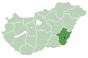
Békés County in
Hungary

This article needs additional citations for
verification. (December 2023) |
Örménykút
Irminčok | |
|---|---|
 Coat of arms | |
| Country | |
| County | Békés |
| Area | |
| • Total | 54.56 km2 (21.07 sq mi) |
| Population (2002) | |
| • Total | 549 |
| • Density | 10/km2 (30/sq mi) |
| Time zone | UTC+1 ( CET) |
| • Summer ( DST) | UTC+2 ( CEST) |
| Postal code | 5556 |
| Area code | 66 |

Örménykút ( Slovak: Irminčok) [1] is a village in Békés County, in the Southern Great Plain region of south-east Hungary.
Geography
It covers an area of 54.56 km² and has a population of 549 people (2002).
References
- ^ "Magyarország helységnévtára". www.ksh.hu. Retrieved 2023-12-05.
| City with county rights |
|   |
|---|---|---|
| Towns | ||
| Large villages | ||
| Villages |
| |
| Other topics | ||
46°51′N 20°47′E / 46.850°N 20.783°E
|
| This Békés County location article is a stub. You can help Wikipedia by expanding it. |
This article needs additional citations for
verification. (December 2023) |
Örménykút
Irminčok | |
|---|---|
|
Coat of arms | |
| Country | |
| County | Békés |
| Area | |
| • Total | 54.56 km2 (21.07 sq mi) |
| Population (2002) | |
| • Total | 549 |
| • Density | 10/km2 (30/sq mi) |
| Time zone | UTC+1 ( CET) |
| • Summer ( DST) | UTC+2 ( CEST) |
| Postal code | 5556 |
| Area code | 66 |
Örménykút ( Slovak: Irminčok) [1] is a village in Békés County, in the Southern Great Plain region of south-east Hungary.
Geography
It covers an area of 54.56 km² and has a population of 549 people (2002).
References
- ^ "Magyarország helységnévtára". www.ksh.hu. Retrieved 2023-12-05.
| City with county rights |
| |
|---|---|---|
| Towns | ||
| Large villages | ||
| Villages |
| |
| Other topics | ||
46°51′N 20°47′E / 46.850°N 20.783°E
|
| This Békés County location article is a stub. You can help Wikipedia by expanding it. |