Photos • Location
Station platform


Åmarken | |||||||||||
|---|---|---|---|---|---|---|---|---|---|---|---|
| S-train station | |||||||||||
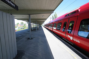
 Åmarken station in 2007 | |||||||||||
| General information | |||||||||||
| Coordinates | 55°38′24″N 12°30′00″E / 55.640°N 12.500°E | ||||||||||
| Owned by | DSB | ||||||||||
| Platforms | Island platform | ||||||||||
| Tracks | 2 | ||||||||||
| History | |||||||||||
| Opened | 1972 | ||||||||||
| Services | |||||||||||
| |||||||||||
Åmarken station is a commuter rail railway station serving the southern part of the suburb of Hvidovre west of Copenhagen, Denmark. It is located on the Køge radial of Copenhagen's S-train network. [1]

- ^ "Åmarken Station". DSB. Retrieved January 8, 2023.
Wikimedia Commons has media related to
Åmarken Station.
- (in Danish) Banedanmark – government agency responsible for maintenance and traffic control of most of the Danish railway network
- (in Danish) DSB – the Danish national train operating company
- (in Danish) Danske Jernbaner – website with information on railway history in Denmark
This article about a Danish railway station is a stub. You can help Wikipedia by expanding it. |
Åmarken | |||||||||||
|---|---|---|---|---|---|---|---|---|---|---|---|
| S-train station | |||||||||||
|
Åmarken station in 2007 | |||||||||||
| General information | |||||||||||
| Coordinates | 55°38′24″N 12°30′00″E / 55.640°N 12.500°E | ||||||||||
| Owned by | DSB | ||||||||||
| Platforms | Island platform | ||||||||||
| Tracks | 2 | ||||||||||
| History | |||||||||||
| Opened | 1972 | ||||||||||
| Services | |||||||||||
| |||||||||||
Åmarken station is a commuter rail railway station serving the southern part of the suburb of Hvidovre west of Copenhagen, Denmark. It is located on the Køge radial of Copenhagen's S-train network. [1]
- ^ "Åmarken Station". DSB. Retrieved January 8, 2023.
Wikimedia Commons has media related to
Åmarken Station.
- (in Danish) Banedanmark – government agency responsible for maintenance and traffic control of most of the Danish railway network
- (in Danish) DSB – the Danish national train operating company
- (in Danish) Danske Jernbaner – website with information on railway history in Denmark
This article about a Danish railway station is a stub. You can help Wikipedia by expanding it. |