World map showing the Tropic of CapricornRelationship of Earth's axial tilt (ε) to the tropical and polar circles
The Tropic of Capricorn (or the Southern Tropic) is the
circle of latitude that contains the
subsolar point at the December (or southern)
solstice. It is thus the southernmost latitude where the Sun can be seen directly overhead. It also reaches 90 degrees below the horizon at solar midnight on the
June Solstice. Its northern equivalent is the
Tropic of Cancer.
The Tropic of Capricorn is one of the five major circles of latitude marked on maps of
Earth. Its latitude is currently 23°26′10.1″ (or 23.43613°)[1] south of the
Equator, but it is very gradually moving northward, currently at the rate of 0.47
arcseconds, or 15 metres, per year.
The Tropic of Capricorn's position is not fixed, but constantly changes because of a slight wobble in the Earth's longitudinal alignment relative to its orbit around the Sun. Earth's
axial tilt varies over a 41,000 year period from about 22.1 to 24.5 degrees and currently resides at about 23.4 degrees. This wobble means that the Tropic of Capricorn is currently drifting northward at a rate of almost half an arcsecond (0.468″) of latitude, or 15 metres, per year (it was at exactly 23° 27′S in 1917 and will be at 23° 26'S in 2045). Therefore, the distance between
Arctic Circle and the Tropic of Capricorn is essentially constant moving in tandem. See under
circles of latitude for information.
There are approximately 10 hours, 41 minutes of daylight during the June solstice (Southern Hemisphere winter). During the December solstice (Southern Hemisphere summer), there are 13 hours, 35 minutes of daylight. The length of the Tropic of Capricorn at 23°26′11.7″S is 36,788 km (22,859 mi).[2]
Africa
In most of this belt of
southern Africa, a minimum of seasonal rainfall is reliable and farming is possible, though yields struggle to compete with for example the
Mississippi basin, even against like-to-like soil
fertilisers. Rivers have been successfully dammed particularly flowing from
relief precipitation areas (high eminences) and those from the edge of the
Great Rift Valley, such as the
Zambezi, well within the Tropics. This, with alluvial or enriched soil, enables substantial yield grain farming in areas with good soil. Across this large region pasture farming is widespread, where intensive, brief and rotational it helps to fertilise and stabilise the soil, preventing run-off and
desertification.[3] This approach is traditional to many tribes and promoted by government advisors such as
Allan Savory, a Zimbabwean-born biologist, farmer, game rancher, politician and international consultant and co-founder of the
Savory Institute. According to the
United Nations University Our World dissemination he is credited with developing "holistic management" in the 1960s and has led anti-desertification efforts in Africa for decades using a counterintuitive approach to most developed economies of increasing the number of livestock on grasslands rather than fencing them off for conservation. Such practices in this area have seen success and won generous awards; he gave the keynote speech at UNCCD's Land Day in 2018, and later that year a
TED (conference) address, widely re-broadcast.[3]
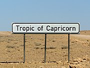
A sign marking the Tropic of Capricorn as it passes through
Namibia
A monument marking the Tropic of Capricorn as it passes through
Botswana
In
Australia, areas around the Tropic have some of the world's most variable
rainfall.[4] In the east advanced plants such as flowering shrubs and
eucalyptus and in most bioregions grasses have adapted to cope with means such as deep roots and little
transpiration. Wetter areas, seasonally watered, are widely pasture farmed. As to animals, birds and
marsupials are well-adapted. Naturally difficult
arable agriculture specialises in dry fruits, nuts and modest water consumption produce. Other types are possible given reliable irrigation sources and, ideally, water-retentive enriched or
alluvial soils, especially wheat; shallow irrigation sources very widely dry up in and after
drought years. The multi-ridge
Great Dividing Range brings
relief precipitation enough to make hundreds of kilometres either side cultivable, and its rivers are widely dammed to store necessary water; this benefits the settled areas of
New South Wales and
Queensland.
Behind the end of the green hills, away from the
Pacific, which is subject to warm, negative phases of the
El Niño–Southern Oscillation (colloquially this is an "El Niño year/season") is a white, red and yellow landscape of 2,800 to 3,300 kilometres of
rain shadow heading west in turn feature normally arid cattle lands of the
Channel Country, the white
Kati Thanda-Lake Eyre National Park, the mainly red
Mamungari Conservation Park, then the
Gibson Desert, after others the dry landscape settlement of
Kalbarri on the west coast and its rest, northward. The
Channel Country features an arid landscape with a series of ancient
flood plains from rivers which only flow intermittently. The principal rivers are
Georgina River,
Cooper Creek and the
Diamantina River. In most years, their waters are absorbed into the earth or evaporate, but when there is sufficient rainfall in their catchment area, these rivers flow into
Lake Eyre, South Australia. One of the most significant rainfall events occurred in 2010 when a monsoonal low from ex-
Cyclone Olga created a period of exceptional rainfall.[5]
El Niño adverse phases cause a shift in atmospheric circulation; rainfall becomes reduced over Indonesia and Australia, rainfall and tropical cyclone formation increases over the tropical Pacific.[6] The low-level surface
trade winds, which normally blow from east to west along the equator, either weaken or start blowing from the other direction.[6]
Spire marking Tropic of Capricorn in
Rockhampton,
Queensland (4 km north of the actual Tropic of Capricorn)
Monument marking Tropic of Capricorn near Civic Centre,
Longreach, at mid-day of
Summer solstice 2019. The monument is few arc seconds South of Tropic of Capricorn(notice shadow directly below the sign)
South America
In
South America, whilst in the continental
cratons soils are almost as old as in Australia and Southern Africa, the presence of the geologically young and evolving
Andes means that this region is on the western side of the subtropical
anticyclones and thus receives warm and humid air from the
Atlantic Ocean. As a result, areas in
Brazil adjacent to the Tropic are impressively productive agricultural regions, producing large quantities of crops such as
sugarcane, and the natural
rainforest vegetation has been almost entirely cleared, except for a few remaining patches of
Atlantic Forest. Further south in
Argentina, the temperate grasslands of the
Pampas region is equally influential in
wheat,
soybeans,
maize, and
beef, making the country one of the largest worldwide agricultural exporters, similar to the role played by the
Prairies region in
Canada.
List of countries entirely south of the Tropic of Capricorn
As most of Earth's land is in the
Northern Hemisphere only four countries are wholly south of the Tropic of Capricorn (which contrasts with 73, about one third of the current total, wholly north of the
Tropic of Cancer):
World map showing the Tropic of CapricornRelationship of Earth's axial tilt (ε) to the tropical and polar circles
The Tropic of Capricorn (or the Southern Tropic) is the
circle of latitude that contains the
subsolar point at the December (or southern)
solstice. It is thus the southernmost latitude where the Sun can be seen directly overhead. It also reaches 90 degrees below the horizon at solar midnight on the
June Solstice. Its northern equivalent is the
Tropic of Cancer.
The Tropic of Capricorn is one of the five major circles of latitude marked on maps of
Earth. Its latitude is currently 23°26′10.1″ (or 23.43613°)[1] south of the
Equator, but it is very gradually moving northward, currently at the rate of 0.47
arcseconds, or 15 metres, per year.
The Tropic of Capricorn's position is not fixed, but constantly changes because of a slight wobble in the Earth's longitudinal alignment relative to its orbit around the Sun. Earth's
axial tilt varies over a 41,000 year period from about 22.1 to 24.5 degrees and currently resides at about 23.4 degrees. This wobble means that the Tropic of Capricorn is currently drifting northward at a rate of almost half an arcsecond (0.468″) of latitude, or 15 metres, per year (it was at exactly 23° 27′S in 1917 and will be at 23° 26'S in 2045). Therefore, the distance between
Arctic Circle and the Tropic of Capricorn is essentially constant moving in tandem. See under
circles of latitude for information.
There are approximately 10 hours, 41 minutes of daylight during the June solstice (Southern Hemisphere winter). During the December solstice (Southern Hemisphere summer), there are 13 hours, 35 minutes of daylight. The length of the Tropic of Capricorn at 23°26′11.7″S is 36,788 km (22,859 mi).[2]
Africa
In most of this belt of
southern Africa, a minimum of seasonal rainfall is reliable and farming is possible, though yields struggle to compete with for example the
Mississippi basin, even against like-to-like soil
fertilisers. Rivers have been successfully dammed particularly flowing from
relief precipitation areas (high eminences) and those from the edge of the
Great Rift Valley, such as the
Zambezi, well within the Tropics. This, with alluvial or enriched soil, enables substantial yield grain farming in areas with good soil. Across this large region pasture farming is widespread, where intensive, brief and rotational it helps to fertilise and stabilise the soil, preventing run-off and
desertification.[3] This approach is traditional to many tribes and promoted by government advisors such as
Allan Savory, a Zimbabwean-born biologist, farmer, game rancher, politician and international consultant and co-founder of the
Savory Institute. According to the
United Nations University Our World dissemination he is credited with developing "holistic management" in the 1960s and has led anti-desertification efforts in Africa for decades using a counterintuitive approach to most developed economies of increasing the number of livestock on grasslands rather than fencing them off for conservation. Such practices in this area have seen success and won generous awards; he gave the keynote speech at UNCCD's Land Day in 2018, and later that year a
TED (conference) address, widely re-broadcast.[3]
A sign marking the Tropic of Capricorn as it passes through
Namibia
A monument marking the Tropic of Capricorn as it passes through
Botswana
In
Australia, areas around the Tropic have some of the world's most variable
rainfall.[4] In the east advanced plants such as flowering shrubs and
eucalyptus and in most bioregions grasses have adapted to cope with means such as deep roots and little
transpiration. Wetter areas, seasonally watered, are widely pasture farmed. As to animals, birds and
marsupials are well-adapted. Naturally difficult
arable agriculture specialises in dry fruits, nuts and modest water consumption produce. Other types are possible given reliable irrigation sources and, ideally, water-retentive enriched or
alluvial soils, especially wheat; shallow irrigation sources very widely dry up in and after
drought years. The multi-ridge
Great Dividing Range brings
relief precipitation enough to make hundreds of kilometres either side cultivable, and its rivers are widely dammed to store necessary water; this benefits the settled areas of
New South Wales and
Queensland.
Behind the end of the green hills, away from the
Pacific, which is subject to warm, negative phases of the
El Niño–Southern Oscillation (colloquially this is an "El Niño year/season") is a white, red and yellow landscape of 2,800 to 3,300 kilometres of
rain shadow heading west in turn feature normally arid cattle lands of the
Channel Country, the white
Kati Thanda-Lake Eyre National Park, the mainly red
Mamungari Conservation Park, then the
Gibson Desert, after others the dry landscape settlement of
Kalbarri on the west coast and its rest, northward. The
Channel Country features an arid landscape with a series of ancient
flood plains from rivers which only flow intermittently. The principal rivers are
Georgina River,
Cooper Creek and the
Diamantina River. In most years, their waters are absorbed into the earth or evaporate, but when there is sufficient rainfall in their catchment area, these rivers flow into
Lake Eyre, South Australia. One of the most significant rainfall events occurred in 2010 when a monsoonal low from ex-
Cyclone Olga created a period of exceptional rainfall.[5]
El Niño adverse phases cause a shift in atmospheric circulation; rainfall becomes reduced over Indonesia and Australia, rainfall and tropical cyclone formation increases over the tropical Pacific.[6] The low-level surface
trade winds, which normally blow from east to west along the equator, either weaken or start blowing from the other direction.[6]
Spire marking Tropic of Capricorn in
Rockhampton,
Queensland (4 km north of the actual Tropic of Capricorn)
Monument marking Tropic of Capricorn near Civic Centre,
Longreach, at mid-day of
Summer solstice 2019. The monument is few arc seconds South of Tropic of Capricorn(notice shadow directly below the sign)
South America
In
South America, whilst in the continental
cratons soils are almost as old as in Australia and Southern Africa, the presence of the geologically young and evolving
Andes means that this region is on the western side of the subtropical
anticyclones and thus receives warm and humid air from the
Atlantic Ocean. As a result, areas in
Brazil adjacent to the Tropic are impressively productive agricultural regions, producing large quantities of crops such as
sugarcane, and the natural
rainforest vegetation has been almost entirely cleared, except for a few remaining patches of
Atlantic Forest. Further south in
Argentina, the temperate grasslands of the
Pampas region is equally influential in
wheat,
soybeans,
maize, and
beef, making the country one of the largest worldwide agricultural exporters, similar to the role played by the
Prairies region in
Canada.
List of countries entirely south of the Tropic of Capricorn
As most of Earth's land is in the
Northern Hemisphere only four countries are wholly south of the Tropic of Capricorn (which contrasts with 73, about one third of the current total, wholly north of the
Tropic of Cancer):
 A sign marking the Tropic of Capricorn as it passes through Namibia
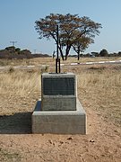 A monument marking the Tropic of Capricorn as it passes through Botswana
 A monument in Kruger National Park, South Africa
 A sign marking the Tropic of Capricorn in Atsimo-Andrefana Region, Madagascar


.jpg)


 Tropic of Capricorn as it runs through Australia in the 1794 Dunn Map of the World
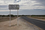 Road sign marking Tropic of Capricorn in Western Australia
 Monument marking the Tropic of Capricorn just north of Alice Springs, Northern Territory
 Spire marking Tropic of Capricorn in Rockhampton, Queensland (4 km north of the actual Tropic of Capricorn)
 Monument marking Tropic of Capricorn near Civic Centre, Longreach, at mid-day of Summer solstice 2019. The monument is few arc seconds South of Tropic of Capricorn(notice shadow directly below the sign)


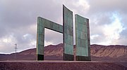 Monument marking the Tropic of Capricorn just north of Antofagasta, Chile
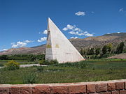


.jpg)


