| William Mitchell State Park | |
|---|---|
.jpg)
Clam Lake Canal with campground on the right | |
 Location in Michigan  Mitchell State Park (the United States) | |
| Location | Cadillac, Wexford County, Michigan, United States |
| Coordinates | 44°14′17″N 85°27′08″W / 44.23806°N 85.45222°W [2] |
| Area | 334 acres (135 ha) |
| Elevation | 1,289 feet (393 m) [2] |
| Designation | Michigan state park |
| Established | 1920 [3] |
| Named for | William W. Mitchell |
| Visitors | 155,633 (in 1996) |
| Administrator | Michigan Department of Natural Resources |
| Website | William Mitchell State Park |
William Mitchell State Park is a public recreation area covering 334 acres (135 ha) within the city limits of Cadillac in northern lower Michigan. The state park is located between Lake Mitchell and Lake Cadillac. The historic Clam Lake Canal, approximately one-third of a mile in length, connects the two lakes and runs directly through the park. [4] Dug in 1873 at the direction of city father George A. Mitchell, the canal allowed felled trees to be floated from Lake Mitchell to lumber mills on Lake Cadillac. [5]
History
The park bears the name of William W. Mitchell, who during the 1890s operated sawmills in the area as co-owner of the Cobbs and Mitchell Mill No. 1, [6] and who was a nephew of city founder George Mitchell. [7] Under the name Cadillac State Park, it was among 13 parks established in 1920 following the creation of the Michigan State Parks Commission a year earlier. [8] [9] The park's "prime real estate" was donated by Mitchell's widow, Ellen, who requested the park be named in her late husband's honor. [6]
Features
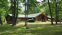
The park is home to Carl T. Johnson Hunting and Fishing Center which documents the history of hunting and fishing, offers seminars, workshops and audio-visual presentations, and includes an exhibit hall which displays local wildlife species. [10]
Activities and amenities
The park offers a campground with 221 sites, cabins, two boat launches, playground, beach, picnicking facilities, and fishing for perch, walleye, panfish, and bass. The 2.5-mile (4.0 km) Heritage Nature Trail runs through a woodland and marsh environment. The trail, mostly a woodchip path with a series of bridges and boardwalks, provides a study area supporting a variety of plants and wildlife. Winter activities include snowmobiling, ice fishing, snowshoeing, and cross-country skiing. [4]
Images
-
 Johnson Hunting and Fishing Center
 -
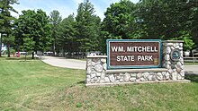 Main entrance park signage
 -
 Clam Lake Canal and campground
 -
 Beachfront along Lake Mitchell

.jpg)
.jpg)
.jpg)
References
- ^ "Mitchell State Park". IUCN. Retrieved May 10, 2020.
- ^ a b "William Mitchell State Park". Geographic Names Information System. United States Geological Survey, United States Department of the Interior.
- ^ "When were Michigan state parks and recreation areas established?" (PDF). Michigan Department of Natural Resources. Retrieved May 10, 2020.
- ^ a b "Mitchell State Park". Michigan Department of Natural Resources. Retrieved March 7, 2018.
- ^ "Lake Mitchell Facts & History". Lake Mitchell Improvement Board. Retrieved March 7, 2018.
- ^ a b "Who's who behind Michigan's named state parks". Michigan History Magazine. Historical Society of Michigan. March 1, 2016.
- ^ Walter Romig (1986). Michigan Place Names. Detroit, Mich.: Wayne State University Press. p. 604. ISBN 081431838X. Retrieved March 7, 2018.
- ^ "Michigan DNR celebrates 100 years of state parks" (PDF). Michigan Department of Natural Resources. pp. 10–11. Retrieved May 10, 2020.
- ^ Albert Stoll, Jr. (ed.). "Biennial Report of the Department of Conservation of the State of Michigan 1921–1922". p. 228. Retrieved May 10, 2020.
- ^ "Carl T. Johnson Hunting and Fishing Center". Michigan Department of Natural Resources. Retrieved March 7, 2018.
External links
- Mitchell State Park Michigan Department of Natural Resources
- Mitchell State Park Map Michigan Michigan Department of Natural Resources
| Authority control databases: National |
|---|
| William Mitchell State Park | |
|---|---|
|
Clam Lake Canal with campground on the right | |
Location in Michigan Mitchell State Park (the United States) | |
| Location | Cadillac, Wexford County, Michigan, United States |
| Coordinates | 44°14′17″N 85°27′08″W / 44.23806°N 85.45222°W [2] |
| Area | 334 acres (135 ha) |
| Elevation | 1,289 feet (393 m) [2] |
| Designation | Michigan state park |
| Established | 1920 [3] |
| Named for | William W. Mitchell |
| Visitors | 155,633 (in 1996) |
| Administrator | Michigan Department of Natural Resources |
| Website | William Mitchell State Park |
William Mitchell State Park is a public recreation area covering 334 acres (135 ha) within the city limits of Cadillac in northern lower Michigan. The state park is located between Lake Mitchell and Lake Cadillac. The historic Clam Lake Canal, approximately one-third of a mile in length, connects the two lakes and runs directly through the park. [4] Dug in 1873 at the direction of city father George A. Mitchell, the canal allowed felled trees to be floated from Lake Mitchell to lumber mills on Lake Cadillac. [5]
History
The park bears the name of William W. Mitchell, who during the 1890s operated sawmills in the area as co-owner of the Cobbs and Mitchell Mill No. 1, [6] and who was a nephew of city founder George Mitchell. [7] Under the name Cadillac State Park, it was among 13 parks established in 1920 following the creation of the Michigan State Parks Commission a year earlier. [8] [9] The park's "prime real estate" was donated by Mitchell's widow, Ellen, who requested the park be named in her late husband's honor. [6]
Features
The park is home to Carl T. Johnson Hunting and Fishing Center which documents the history of hunting and fishing, offers seminars, workshops and audio-visual presentations, and includes an exhibit hall which displays local wildlife species. [10]
Activities and amenities
The park offers a campground with 221 sites, cabins, two boat launches, playground, beach, picnicking facilities, and fishing for perch, walleye, panfish, and bass. The 2.5-mile (4.0 km) Heritage Nature Trail runs through a woodland and marsh environment. The trail, mostly a woodchip path with a series of bridges and boardwalks, provides a study area supporting a variety of plants and wildlife. Winter activities include snowmobiling, ice fishing, snowshoeing, and cross-country skiing. [4]
Images
-
Johnson Hunting and Fishing Center
-
Main entrance park signage
-
Clam Lake Canal and campground
-
Beachfront along Lake Mitchell
References
- ^ "Mitchell State Park". IUCN. Retrieved May 10, 2020.
- ^ a b "William Mitchell State Park". Geographic Names Information System. United States Geological Survey, United States Department of the Interior.
- ^ "When were Michigan state parks and recreation areas established?" (PDF). Michigan Department of Natural Resources. Retrieved May 10, 2020.
- ^ a b "Mitchell State Park". Michigan Department of Natural Resources. Retrieved March 7, 2018.
- ^ "Lake Mitchell Facts & History". Lake Mitchell Improvement Board. Retrieved March 7, 2018.
- ^ a b "Who's who behind Michigan's named state parks". Michigan History Magazine. Historical Society of Michigan. March 1, 2016.
- ^ Walter Romig (1986). Michigan Place Names. Detroit, Mich.: Wayne State University Press. p. 604. ISBN 081431838X. Retrieved March 7, 2018.
- ^ "Michigan DNR celebrates 100 years of state parks" (PDF). Michigan Department of Natural Resources. pp. 10–11. Retrieved May 10, 2020.
- ^ Albert Stoll, Jr. (ed.). "Biennial Report of the Department of Conservation of the State of Michigan 1921–1922". p. 228. Retrieved May 10, 2020.
- ^ "Carl T. Johnson Hunting and Fishing Center". Michigan Department of Natural Resources. Retrieved March 7, 2018.
External links
- Mitchell State Park Michigan Department of Natural Resources
- Mitchell State Park Map Michigan Michigan Department of Natural Resources
See also:
Important Bird Areas and
State game and wildlife areas | |||||||||||||||
| National |
| ||||||||||||||
| State |
| ||||||||||||||
| Authority control databases: National |
|---|