Long Island
Isla Larga Former name: Isle Brûlée | |
|---|---|
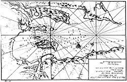
 Early mapping of Long Island (Dom Pernety, 1769) | |
| Coordinates: 51°33′00″S 58°04′00″W / 51.55°S 58.06667°W | |
| Country | Falkland Islands |
| Time zone | UTC−3 ( FKST) |
| If shown, area and population ranks are for all islands and all inhabited islands in the Falklands respectively. | |
Long Island ( French: Isle Brûlée, [1] Spanish: Isla Larga [2]) is the largest island in Berkeley Sound, Falkland Islands.
During the August 1833 events in nearby Port Louis, the surviving members of Louis Vernet's settlement, seeking refuge on the nearby Hog Island to escape the murderous gang of Antonio Rivero, regularly sent their boat to Long Island for food supplies to bring cattle, pigs, and geese. [3]
There is one listed building on the island, the Old House. [4]
References
- ^ Dom Pernety, Antoine-Joseph. Journal historique d'un voyage fait aux Iles Malouïnes en 1763 et 1764 pour les reconnoître et y former un établissement; et de deux Voyages au Détroit de Magellan, avec une Rélation sur les Patagons. Berlin: Etienne de Bourdeaux, 1769. 2 volumes, 704 pp. Online vol. 1 & vol. 2. Abridged English version.
- ^ PCGN Falkland Islands Archived 2012-10-22 at the Wayback Machine
- ^ wikisource:Thomas Helsby's Account of the Port Louis Murders.
- ^ "Falkland Islands Information Web Portal". Buildings and Structures in the Falkland Islands designated as being of Architectural or Historic Interest. Archived from the original on 28 July 2012. Retrieved 1 September 2012.
Long Island
Isla Larga Former name: Isle Brûlée | |
|---|---|
 Early mapping of Long Island (Dom Pernety, 1769) | |
| Coordinates: 51°33′00″S 58°04′00″W / 51.55°S 58.06667°W | |
| Country | Falkland Islands |
| Time zone | UTC−3 ( FKST) |
| If shown, area and population ranks are for all islands and all inhabited islands in the Falklands respectively. | |
Long Island ( French: Isle Brûlée, [1] Spanish: Isla Larga [2]) is the largest island in Berkeley Sound, Falkland Islands.
During the August 1833 events in nearby Port Louis, the surviving members of Louis Vernet's settlement, seeking refuge on the nearby Hog Island to escape the murderous gang of Antonio Rivero, regularly sent their boat to Long Island for food supplies to bring cattle, pigs, and geese. [3]
There is one listed building on the island, the Old House. [4]
References
- ^ Dom Pernety, Antoine-Joseph. Journal historique d'un voyage fait aux Iles Malouïnes en 1763 et 1764 pour les reconnoître et y former un établissement; et de deux Voyages au Détroit de Magellan, avec une Rélation sur les Patagons. Berlin: Etienne de Bourdeaux, 1769. 2 volumes, 704 pp. Online vol. 1 & vol. 2. Abridged English version.
- ^ PCGN Falkland Islands Archived 2012-10-22 at the Wayback Machine
- ^ wikisource:Thomas Helsby's Account of the Port Louis Murders.
- ^ "Falkland Islands Information Web Portal". Buildings and Structures in the Falkland Islands designated as being of Architectural or Historic Interest. Archived from the original on 28 July 2012. Retrieved 1 September 2012.