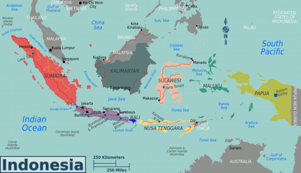
Photos • Location
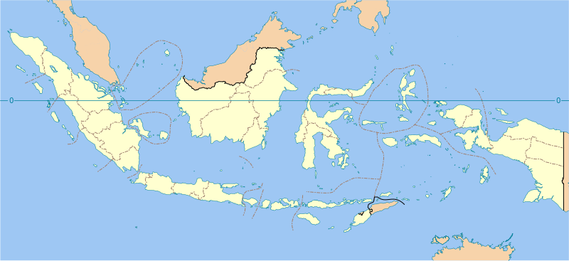
This clickable map shows province of Indonesia as of 25 October 2012. Click on a province name to go to its list of rivers. 
This is a list of rivers in Indonesia. [1]

By island
This list is arranged by island in alphabetical order, with respective tributaries indented under each larger stream's name.
Ambon
Bali
Buru
The largest primary rivers on the island of Buru [2] [3]
| River | Mouth
coordinates |
Basin size
(km²) |
Average discharge | Length
(km) | |
|---|---|---|---|---|---|
| (m3/s) | (km3) | ||||
| Ceram Sea | |||||
| Wae Nibe | 3°3′49.356″S 126°36′0.8784″E / 3.06371000°S 126.600244000°E | 438.5 | 14.14 | 0.446 | |
| Wae Bebek | 3°4′51.8376″S 126°24′18.6984″E / 3.081066000°S 126.405194000°E | 368.2 | 18.18 | 0.573 | |
| Banda Sea | |||||
| Wae Apo | 3°19′36.7284″S 127°4′19.1208″E / 3.326869000°S 127.071978000°E | 1,891.4 | 65.34 | 2.06 | 80 |
| Wae Mala | 3°42′10.7892″S 126°21′8.6652″E / 3.702997000°S 126.352407000°E | 804.7 | 47.76 | 1.506 | |
| Wae Dalan | 3°35′48.3324″S 126°10′15.6612″E / 3.596759000°S 126.171017000°E | 529 | 29.86 | 0.942 | |
| Wae Pede | 3°51′25.2072″S 126°40′47.8524″E / 3.857002000°S 126.679959000°E | 451.3 | 24.63 | 0.777 | |
| Other | 4,121.9 | 120.27 | 3.793 | ||
| Buru | 8,605 | 320.18 | 10.097 | ||
Flores
Java
- Angke River
- Asem River
- Baliung River
- Baru Barat River
- Baru Timur River
- Bodri River
- Brantas River
- Buaran River
- Buni River
- Cakung
- Ci Banten
- Ci Durian
- Ci Kaengan
- Ci Kapundung
- Ci Liwung
- Ci Manceuri
- Ci Manuk
- Ci Pinang
- Ci Sadane
- Ci Tanduy
- Ci Tarum
- Ci Ujung
- Comal River
- Grogol River
- Jatikramat River
- Kaso River (Sukabumi)
- Kaso River (Garut)
- Krukut River
- Laki River
- Liman River
- Lusi River
- Madiun River
- Mandiri River
- Mookervaart River
- Opak River
- Oyo River
- Pemali River
- Pesanggrahan River
- Progo River
- Sanen River
- Serang River
- Serayu River
- Setail River
- Solo River
- Sunter River
- Tuntang River
- Widas River
Kalimantan
- Below are the rivers in the Indonesian territory of Borneo ( Kalimantan)
Papua
- Apauwar River
- Baliem (Vriendschaps) River
- Becking River
- Bewani River
- Bian River
- Brazza River
- Bulaka River
- Digul
- Fly River
- Grime River
- Kampung River
- Kamundan River
- Kumbe River
- Lorentz (Undir) River
- Mamberamo
- Mandobo River
- Mapi River
- Maro (Merauke) River
- Mimika River
- Momats River
- Muturi River
- Nawa River
- Ok Tedi River
- Pauwasi River
- Pulau (Eilanden) River
- Seremuk River
- Tabai River
- Tami River
- Tariku River
- Taritatu River
- Tor River
- Sobger River
- Songgato River
- Sepik
- Van Daalen River
- Wamma River
- Wapoga River
- Warenai River
- Waruta River
- Wildeman River
- Wiriagar River
- Wiru River
- Wowei River
Seram
Sulawesi
Sumatra
- Aceh
- Asahan
- Banyuasin
- Barumun
- Batang Hari
- Bila
- Bohorok
- Gadis
- Indragiri
- Jamboaye
- Kampar Kanan
- Kampar
- Kluet
- Komering
- Kualu
- Kumu
- Mandau
- Merangin
- Mesuji
- Musi
- Ogan
- Ombilin
- Peureulak
- Peusangen
- Rawas
- Renun
- Rokan
- Rokan-kanan
- Rokan-kiri
- Sekampung
- Seputih
- Siak
- Silau
- Simpang-kanan
- Simpang-kiri
- Sinamar
- Tamiang
- Tembesi
- Teunom
- Toru
- Tripa
- Tulangbawang
- Tungkal
- Wampu
- Woyla
Sumba
Sumbawa
West Timor
By province
See also
Notes and references
- ^ Map of Indonesia. Peta Indonesia. Wawasan Nusantara. CV. Indo Prima Sarana. Accessed 29 Juli 2017.
- ^ "Palau & East Indonesia".
- ^ Radhika, Radhika; Firmansyah, Rendy; Hatmoko, Waluyo (November 2017). "Computation of surface water availability in Indonesia based on satellite data". Jurnal Sumber Daya Air. 13 (2): 115–130. doi: 10.32679/jsda.v13i2.206.
Sources
- Rand McNally, The New International Atlas, 1993.
- GEOnet Names Server
- Indonesia 1:250,000 Series T503, U.S. Army Map Service, (1954)
This is a list of rivers in Indonesia. [1]
By island
This list is arranged by island in alphabetical order, with respective tributaries indented under each larger stream's name.
Ambon
Bali
Buru
The largest primary rivers on the island of Buru [2] [3]
| River | Mouth
coordinates |
Basin size
(km²) |
Average discharge | Length
(km) | |
|---|---|---|---|---|---|
| (m3/s) | (km3) | ||||
| Ceram Sea | |||||
| Wae Nibe | 3°3′49.356″S 126°36′0.8784″E / 3.06371000°S 126.600244000°E | 438.5 | 14.14 | 0.446 | |
| Wae Bebek | 3°4′51.8376″S 126°24′18.6984″E / 3.081066000°S 126.405194000°E | 368.2 | 18.18 | 0.573 | |
| Banda Sea | |||||
| Wae Apo | 3°19′36.7284″S 127°4′19.1208″E / 3.326869000°S 127.071978000°E | 1,891.4 | 65.34 | 2.06 | 80 |
| Wae Mala | 3°42′10.7892″S 126°21′8.6652″E / 3.702997000°S 126.352407000°E | 804.7 | 47.76 | 1.506 | |
| Wae Dalan | 3°35′48.3324″S 126°10′15.6612″E / 3.596759000°S 126.171017000°E | 529 | 29.86 | 0.942 | |
| Wae Pede | 3°51′25.2072″S 126°40′47.8524″E / 3.857002000°S 126.679959000°E | 451.3 | 24.63 | 0.777 | |
| Other | 4,121.9 | 120.27 | 3.793 | ||
| Buru | 8,605 | 320.18 | 10.097 | ||
Flores
Java
- Angke River
- Asem River
- Baliung River
- Baru Barat River
- Baru Timur River
- Bodri River
- Brantas River
- Buaran River
- Buni River
- Cakung
- Ci Banten
- Ci Durian
- Ci Kaengan
- Ci Kapundung
- Ci Liwung
- Ci Manceuri
- Ci Manuk
- Ci Pinang
- Ci Sadane
- Ci Tanduy
- Ci Tarum
- Ci Ujung
- Comal River
- Grogol River
- Jatikramat River
- Kaso River (Sukabumi)
- Kaso River (Garut)
- Krukut River
- Laki River
- Liman River
- Lusi River
- Madiun River
- Mandiri River
- Mookervaart River
- Opak River
- Oyo River
- Pemali River
- Pesanggrahan River
- Progo River
- Sanen River
- Serang River
- Serayu River
- Setail River
- Solo River
- Sunter River
- Tuntang River
- Widas River
Kalimantan
- Below are the rivers in the Indonesian territory of Borneo ( Kalimantan)
Papua
- Apauwar River
- Baliem (Vriendschaps) River
- Becking River
- Bewani River
- Bian River
- Brazza River
- Bulaka River
- Digul
- Fly River
- Grime River
- Kampung River
- Kamundan River
- Kumbe River
- Lorentz (Undir) River
- Mamberamo
- Mandobo River
- Mapi River
- Maro (Merauke) River
- Mimika River
- Momats River
- Muturi River
- Nawa River
- Ok Tedi River
- Pauwasi River
- Pulau (Eilanden) River
- Seremuk River
- Tabai River
- Tami River
- Tariku River
- Taritatu River
- Tor River
- Sobger River
- Songgato River
- Sepik
- Van Daalen River
- Wamma River
- Wapoga River
- Warenai River
- Waruta River
- Wildeman River
- Wiriagar River
- Wiru River
- Wowei River
Seram
Sulawesi
Sumatra
- Aceh
- Asahan
- Banyuasin
- Barumun
- Batang Hari
- Bila
- Bohorok
- Gadis
- Indragiri
- Jamboaye
- Kampar Kanan
- Kampar
- Kluet
- Komering
- Kualu
- Kumu
- Mandau
- Merangin
- Mesuji
- Musi
- Ogan
- Ombilin
- Peureulak
- Peusangen
- Rawas
- Renun
- Rokan
- Rokan-kanan
- Rokan-kiri
- Sekampung
- Seputih
- Siak
- Silau
- Simpang-kanan
- Simpang-kiri
- Sinamar
- Tamiang
- Tembesi
- Teunom
- Toru
- Tripa
- Tulangbawang
- Tungkal
- Wampu
- Woyla
Sumba
Sumbawa
West Timor
By province
See also
Notes and references
- ^ Map of Indonesia. Peta Indonesia. Wawasan Nusantara. CV. Indo Prima Sarana. Accessed 29 Juli 2017.
- ^ "Palau & East Indonesia".
- ^ Radhika, Radhika; Firmansyah, Rendy; Hatmoko, Waluyo (November 2017). "Computation of surface water availability in Indonesia based on satellite data". Jurnal Sumber Daya Air. 13 (2): 115–130. doi: 10.32679/jsda.v13i2.206.
Sources
- Rand McNally, The New International Atlas, 1993.
- GEOnet Names Server
- Indonesia 1:250,000 Series T503, U.S. Army Map Service, (1954)